TopoQuest Logo
Do you find TopoQuest useful?
Help keep TopoQuest running and adding new maps/features by donating!
Bitcoin:  19c7KJd3qBynnjoSw5npx9KScwjBe4ifkT
Litecoin:  LXs6TkuXGGXo1vDsWCkWVdjQX94eUKd6ui
Home View Maps Find Maps Find Places Resources & Links


Euchre Mountain, Oregon Topographic Map

USGS Map Title: Euchre Mountain, OR
USGS Map MRC: 44123G7
DRG (GeoTIFF) Download: o44123g7.tif


Neighboring USGS Topographic Map Quads:


  Devils Lake, OR  
44123H8
 

  Stott Mountain, OR  
44123H7
 

  Warnicke Creek, OR  
44123H6
 

  Mowrey Landing, OR  
44123G8
 

  Euchre Mountain, OR  
44123G7
 

  Valsetz, OR  
44123G6
 

  Toledo North, OR  
44123F8
 

  Eddyville, OR  
44123F7
 

  Nortons, OR  
44123F6


Map MRC Location:

N45°
W124°
N45°
W123°
H8 H7 H6 H5 H4 H3 H2 H1
G8 G7 G6 G5 G4 G3 G2 G1
F8 F7 F6 F5 F4 F3 F2 F1
E8 E7 E6 E5 E4 E3 E2 E1
D8 D7 D6 D5 D4 D3 D2 D1
C8 C7 C6 C5 C4 C3 C2 C1
B8 B7 B6 B5 B4 B3 B2 B1
A8 A7 A6 A5 A4 A3 A2 A1
N44°
W124°
N44°
W123°

Euchre Mountain, OR USGS 1:24K Topographic Map Preview:
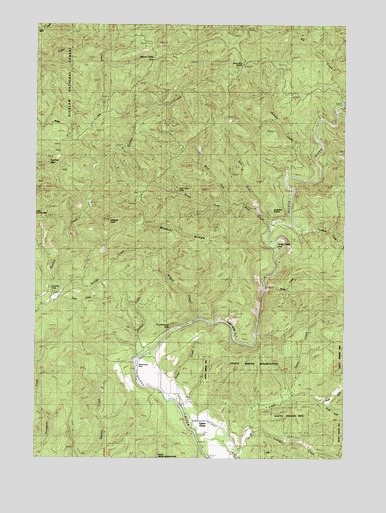
Euchre Mountain, OR USGS Topographic Map
Click on map above to begin viewing in our Map Viewer.

This topographic map contains these locations and features:
Feature Name Type Latitude Longitude GNIS ID View Map
Baker CreekStreamN44.7651°W123.8176°1153653View Map
Black Tank SaddleGapN44.8634°W123.7929°1135577View Map
Buck CreekStreamN44.8171°W123.7812°1138764View Map
Cerine CreekStreamN44.7573°W123.7871°1139547View Map
Coon CreekStreamN44.7957°W123.8662°1140069View Map
East Fork Buck CreekStreamN44.8223°W123.7862°1141538View Map
Elk CreekStreamN44.8526°W123.7523°1141747View Map
Euchre FallsFallsN44.8007°W123.8698°1153651View Map
Euchre MountainSummitN44.8351°W123.8707°1141909View Map
Gobblers KnobSummitN44.8221°W123.7793°1142789View Map
Gorge CampLocaleN44.8109°W123.7776°1142872View Map
Gunn CreekStreamN44.7679°W123.7718°1135576View Map
Holman CreekStreamN44.8301°W123.7657°1143675View Map
Lambert PointSummitN44.8176°W123.8462°1144801View Map
Little Euchre MountainSummitN44.8190°W123.8748°1145164View Map
Lower GorgeValleyN44.7859°W123.8223°1145622View Map
Moonshine County ParkParkN44.7771°W123.8348°1153652View Map
Moonshine Park Boat LaunchLocaleN44.7793°W123.8318°2668117View Map
North Fork Mill CreekStreamN44.7660°W123.7593°1146982View Map
Palmer CreekStreamN44.7787°W123.8348°1147368View Map
Peck CabinLocaleN44.8268°W123.8173°1147553View Map
Powderhouse HoleBendN44.7868°W123.8218°1135593View Map
Savage CreekStreamN44.7934°W123.8734°1149084View Map
Siletz DivisionCivilN44.7743°W123.8444°1938119View Map
South Fork Buck CreekStreamN44.8232°W123.7968°1127262View Map
South Fork Mill CreekStreamN44.7660°W123.7590°1149992View Map
Sugarloaf Post Office (historical)Post OfficeN44.8304°W123.8093°1164706View Map
Sunshine CreekStreamN44.8176°W123.7715°1150689View Map
Upper FarmLocaleN44.7604°W123.8071°1151676View Map
Werner Camp (historical)LocaleN44.8646°W123.8282°1153654View Map
West Fork Buck CreekStreamN44.8232°W123.7965°1152055View Map
Wildcat CreekStreamN44.7901°W123.8107°1152341View Map
Wildcat RidgeRidgeN44.8146°W123.8154°1135592View Map
Wolfer CreekStreamN44.7993°W123.7832°1152609View Map

Note: Coordinates in the location and feature list above are referenced to NAD83 datum.


Copyright (C) 2008-2025 Ryan Niemi / Sunset Dynamics ... All Rights Reserved