TopoQuest Logo
Do you find TopoQuest useful?
Help keep TopoQuest running and adding new maps/features by donating!
Bitcoin:  19c7KJd3qBynnjoSw5npx9KScwjBe4ifkT
Litecoin:  LXs6TkuXGGXo1vDsWCkWVdjQX94eUKd6ui
Home View Maps Find Maps Find Places Resources & Links


Eureka, Illinois Topographic Map

USGS Map Title: Eureka, IL
USGS Map MRC: 40089F3
DRG (GeoTIFF) Download: o40089f3.tif


Neighboring USGS Topographic Map Quads:


  Germantown Hills, IL  
40089G4
 

  Metamora, IL  
40089G3
 

  Roanoke, IL  
40089G2
 

  Washington, IL  
40089F4
 

  Eureka, IL  
40089F3
 

  Secor, IL  
40089F2
 

  Morton, IL  
40089E4
 

  Mackinaw, IL  
40089E3
 

  Danvers, IL  
40089E2


Map MRC Location:

N41°
W90°
N41°
W89°
H8 H7 H6 H5 H4 H3 H2 H1
G8 G7 G6 G5 G4 G3 G2 G1
F8 F7 F6 F5 F4 F3 F2 F1
E8 E7 E6 E5 E4 E3 E2 E1
D8 D7 D6 D5 D4 D3 D2 D1
C8 C7 C6 C5 C4 C3 C2 C1
B8 B7 B6 B5 B4 B3 B2 B1
A8 A7 A6 A5 A4 A3 A2 A1
N40°
W90°
N40°
W89°

Eureka, IL USGS 1:24K Topographic Map Preview:
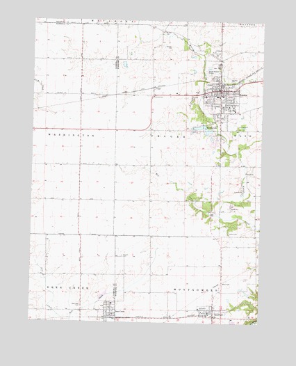
Eureka, IL USGS Topographic Map
Click on map above to begin viewing in our Map Viewer.

This topographic map contains these locations and features:
Feature Name Type Latitude Longitude GNIS ID View Map
Advocate Eureka HospitalHospitalN40.7211°W89.2712°2662372View Map
Allison CemeteryCemeteryN40.6624°W89.2666°403443View Map
City of EurekaCivilN40.7148°W89.2774°2394706View Map
Cottonwood School (historical)SchoolN40.7195°W89.3593°1747452View Map
CrugerPopulated PlaceN40.7220°W89.3101°422592View Map
Danforth School (historical)SchoolN40.6436°W89.3656°1747454View Map
Davenport Elementary SchoolSchoolN40.7192°W89.2720°1824263View Map
Dee-Mack Middle SchoolSchoolN40.6328°W89.3301°1811106View Map
Deer CreekPopulated PlaceN40.6300°W89.3326°407058View Map
Deer CreekStreamN40.6259°W89.3526°407067View Map
Deer Creek Fire Protection DistrictBuildingN40.6274°W89.3273°2640524View Map
Deer Creek Post OfficePost OfficeN40.6274°W89.3319°2788425View Map
Enchanted Gardens Mobile Home ParkPopulated PlaceN40.7103°W89.2656°2628265View Map
EurekaPopulated PlaceN40.7214°W89.2729°408082View Map
Eureka - Goodfield Fire Protection District Eureka StationBuildingN40.7228°W89.2725°2640491View Map
Eureka - Goodfield Fire Protection District Goodfield StationBuildingN40.6293°W89.2764°2640768View Map
Eureka CemeteryCemeteryN40.7103°W89.2698°1953790View Map
Eureka CollegeSchoolN40.7139°W89.2690°408085View Map
Eureka High SchoolSchoolN40.7189°W89.2745°1824271View Map
Eureka LakeReservoirN40.7053°W89.2815°408086View Map
Eureka Lake DamDamN40.7050°W89.2770°1691369View Map
Eureka Middle SchoolSchoolN40.7006°W89.2709°1824272View Map
Eureka Police DepartmentBuildingN40.7228°W89.2731°2756824View Map
Eureka Post OfficePost OfficeN40.7201°W89.2736°2788551View Map
Galey School (historical)SchoolN40.6489°W89.2704°1801988View Map
GoodfieldPopulated PlaceN40.6298°W89.2748°409149View Map
Goodfield Post OfficePost OfficeN40.6279°W89.2759°2788670View Map
Greenridge School (historical)SchoolN40.6756°W89.3579°1747466View Map
Hartman CemeteryCemeteryN40.7250°W89.2673°409888View Map
Liberty Bible ChurchChurchN40.7348°W89.2718°2041415View Map
Mill CreekStreamN40.6695°W89.2726°413540View Map
Mount Zion CemeteryCemeteryN40.6525°W89.3250°414114View Map
Mount Zion CemeteryCemeteryN40.7454°W89.3049°414115View Map
Olio School (historical)SchoolN40.6753°W89.3006°1802014View Map
Olio Township CemeteryCemeteryN40.7113°W89.2720°1953801View Map
Our Redeemer ChurchChurchN40.7114°W89.2634°2041418View Map
Pleasant View School (historical)SchoolN40.7045°W89.3587°1747506View Map
Pleasantland FarmLocaleN40.7208°W89.3561°2559589View Map
Presbyterian CemeteryCemeteryN40.6320°W89.3473°407071View Map
Ray School (historical)SchoolN40.7050°W89.3009°1802024View Map
Reed School (historical)SchoolN40.6442°W89.3237°1802025View Map
Rich LakeReservoirN40.7317°W89.3256°1691374View Map
Rich Lake DamDamN40.7317°W89.3268°1691373View Map
Stormer School (historical)SchoolN40.7334°W89.3587°1747521View Map
Township of CrugerCivilN40.7036°W89.3028°428862View Map
Village of Deer CreekCivilN40.6291°W89.3314°2398702View Map
Village of GoodfieldCivilN40.6340°W89.2563°2398176View Map
WCRI-FM (Eureka)TowerN40.7389°W89.2704°428489View Map
Woodford County CourthouseBuildingN40.7217°W89.2720°2041416View Map
Woodford County Sheriff's OfficeBuildingN40.7226°W89.2720°2756839View Map
Woosley CemeteryCemeteryN40.7392°W89.3006°421500View Map

Note: Coordinates in the location and feature list above are referenced to NAD83 datum.


Copyright (C) 2008-2025 Ryan Niemi / Sunset Dynamics ... All Rights Reserved