TopoQuest Logo
Do you find TopoQuest useful?
Help keep TopoQuest running and adding new maps/features by donating!
Bitcoin:  19c7KJd3qBynnjoSw5npx9KScwjBe4ifkT
Litecoin:  LXs6TkuXGGXo1vDsWCkWVdjQX94eUKd6ui
Home View Maps Find Maps Find Places Resources & Links


Metamora, Illinois Topographic Map

USGS Map Title: Metamora, IL
USGS Map MRC: 40089G3
DRG (GeoTIFF) Download: o40089g3.tif


Neighboring USGS Topographic Map Quads:


  Chillicothe, IL  
40089H4
 

  Washburn, IL  
40089H3
 

  La Rose, IL  
40089H2
 

  Germantown Hills, IL  
40089G4
 

  Metamora, IL  
40089G3
 

  Roanoke, IL  
40089G2
 

  Washington, IL  
40089F4
 

  Eureka, IL  
40089F3
 

  Secor, IL  
40089F2


Map MRC Location:

N41°
W90°
N41°
W89°
H8 H7 H6 H5 H4 H3 H2 H1
G8 G7 G6 G5 G4 G3 G2 G1
F8 F7 F6 F5 F4 F3 F2 F1
E8 E7 E6 E5 E4 E3 E2 E1
D8 D7 D6 D5 D4 D3 D2 D1
C8 C7 C6 C5 C4 C3 C2 C1
B8 B7 B6 B5 B4 B3 B2 B1
A8 A7 A6 A5 A4 A3 A2 A1
N40°
W90°
N40°
W89°

Metamora, IL USGS 1:24K Topographic Map Preview:
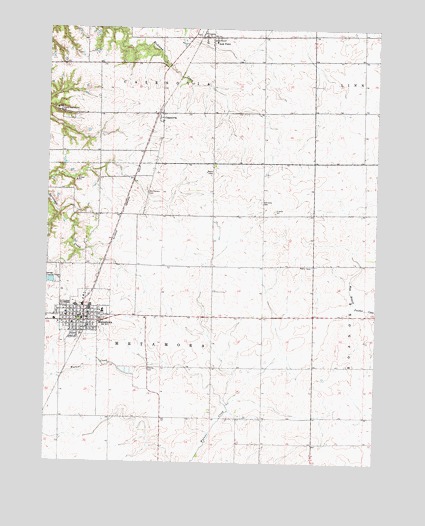
Metamora, IL USGS Topographic Map
Click on map above to begin viewing in our Map Viewer.

This topographic map contains these locations and features:
Feature Name Type Latitude Longitude GNIS ID View Map
Camp ManitoumiLocaleN40.8514°W89.3709°405484View Map
CazenoviaPopulated PlaceN40.8503°W89.3320°405725View Map
Cazenovia Post OfficePost OfficeN40.8506°W89.3326°1824256View Map
County CemeteryCemeteryN40.7771°W89.3363°1801985View Map
Emergency 116 Ambulance ServiceBuildingN40.7899°W89.3617°2673864View Map
Fairview School (historical)SchoolN40.8514°W89.2931°1801987View Map
First Baptist ChurchChurchN40.7898°W89.3648°1824277View Map
Happy Hour School (historical)SchoolN40.7625°W89.3306°1801994View Map
Harmony CemeteryCemeteryN40.8252°W89.2936°409801View Map
Harmony School (historical)SchoolN40.8217°W89.2540°1801995View Map
Hazel Dell School (historical)SchoolN40.8214°W89.3631°1801997View Map
Jay Schertz Farm AirportAirportN40.8409°W89.2758°427479View Map
Lincoln School (historical)SchoolN40.8514°W89.2548°1802002View Map
Lone Willow FarmLocaleN40.8206°W89.2764°2585289View Map
Low PointPopulated PlaceN40.8725°W89.3134°424444View Map
Lowell School (historical)SchoolN40.7923°W89.3309°1802004View Map
Lowpoint Post OfficePost OfficeN40.8729°W89.3156°1824283View Map
Maple Grove School (historical)SchoolN40.7639°W89.3693°1802005View Map
Maple Lawn School (historical)SchoolN40.7636°W89.2584°1802006View Map
MetamoraPopulated PlaceN40.7906°W89.3606°413453View Map
Metamora City HallBuildingN40.7906°W89.3615°2041413View Map
Metamora CourthouseBuildingN40.7917°W89.3620°2041412View Map
Metamora Grade SchoolSchoolN40.7936°W89.3537°1824285View Map
Metamora High SchoolSchoolN40.7950°W89.3637°1824286View Map
Metamora Post OfficePost OfficeN40.7917°W89.3621°2788672View Map
Metamora Township Police DepartmentBuildingN40.7907°W89.3616°2756993View Map
Metamora Volunteer Fire DepartmentBuildingN40.7901°W89.3616°2041414View Map
Michael Pfister AirportAirportN40.7793°W89.2611°2679084View Map
Morristown CemeteryCemeteryN40.8278°W89.3372°413854View Map
Morristown School (historical)SchoolN40.8214°W89.3318°1802008View Map
Mount Pleasant School (historical)SchoolN40.7923°W89.2931°1802009View Map
Oak Dell School (historical)SchoolN40.8581°W89.3556°1802011View Map
Pleasant Valley School (historical)SchoolN40.7925°W89.2537°1802020View Map
Saint Marys FriaryChurchN40.7931°W89.3673°1824292View Map
Saint Marys SchoolSchoolN40.7917°W89.3673°2041411View Map
Tom School (historical)SchoolN40.7625°W89.2923°1802037View Map
Township of MetamoraCivilN40.7921°W89.3310°429358View Map
Village of MetamoraCivilN40.7957°W89.3688°2399325View Map
Woodford County HomeBuildingN40.7709°W89.3398°1802046View Map

Note: Coordinates in the location and feature list above are referenced to NAD83 datum.


Copyright (C) 2008-2025 Ryan Niemi / Sunset Dynamics ... All Rights Reserved