TopoQuest Logo
Do you find TopoQuest useful?
Help keep TopoQuest running and adding new maps/features by donating!
Bitcoin:  19c7KJd3qBynnjoSw5npx9KScwjBe4ifkT
Litecoin:  LXs6TkuXGGXo1vDsWCkWVdjQX94eUKd6ui
Home View Maps Find Maps Find Places Resources & Links


Saint Joe, Arkansas Topographic Map

USGS Map Title: Saint Joe, AR
USGS Map MRC: 36092A7
DRG (GeoTIFF) Download: o36092a7.tif


Neighboring USGS Topographic Map Quads:


  Everton, AR  
36092B8
 

  Bruno, AR  
36092B7
 

  Yellville, AR  
36092B6
 

  Western Grove, AR  
36092A8
 

  Saint Joe, AR  
36092A7
 

  Maumee, AR  
36092A6
 

  Eula, AR  
35092H8
 

  Snowball, AR  
35092H7
 

  Marshall, AR  
35092H6


Map MRC Location:

N37°
W93°
N37°
W92°
H8 H7 H6 H5 H4 H3 H2 H1
G8 G7 G6 G5 G4 G3 G2 G1
F8 F7 F6 F5 F4 F3 F2 F1
E8 E7 E6 E5 E4 E3 E2 E1
D8 D7 D6 D5 D4 D3 D2 D1
C8 C7 C6 C5 C4 C3 C2 C1
B8 B7 B6 B5 B4 B3 B2 B1
A8 A7 A6 A5 A4 A3 A2 A1
N36°
W93°
N36°
W92°

Saint Joe, AR USGS 1:24K Topographic Map Preview:
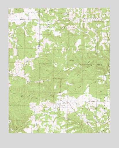
Saint Joe, AR USGS Topographic Map
Click on map above to begin viewing in our Map Viewer.

This topographic map contains these locations and features:
Feature Name Type Latitude Longitude GNIS ID View Map
Anderson FlatFlatN36.1073°W92.8296°45866View Map
Anderson Flat CemeteryCemeteryN36.1023°W92.8232°61019View Map
Anderson Flat ChurchChurchN36.1023°W92.8249°45867View Map
Anderson Flat School (historical)SchoolN36.1023°W92.8238°81916View Map
Beckham CemeteryCemeteryN36.1187°W92.8696°61018View Map
Beckham ChurchChurchN36.1192°W92.8702°46284View Map
Davy Crockett MountainSummitN36.0640°W92.7802°57628View Map
DuffPopulated PlaceN36.0006°W92.7627°62145View Map
Dugger (historical)Populated PlaceN36.1148°W92.8596°69957View Map
Dugget CreekStreamN36.0951°W92.8718°48693View Map
Excelsor MineMineN36.0406°W92.8241°69959View Map
Ham FlatFlatN36.1170°W92.8557°49795View Map
Henley CemeteryCemeteryN36.0381°W92.7860°50016View Map
North Fork Tomahawk CreekStreamN36.0754°W92.7593°52827View Map
Pilot MountainSummitN36.0415°W92.7632°58371View Map
Pilot Mountain ChurchChurchN36.0317°W92.7693°53399View Map
Pindall Gilbert and Saint Joe Volunteer Fire DepartmentBuildingN36.0257°W92.7967°2116959View Map
PushPopulated PlaceN36.0104°W92.7793°69972View Map
Round MountainSummitN36.0734°W92.7977°54242View Map
Saint JoePopulated PlaceN36.0301°W92.8046°78237View Map
Saint Joe Elementary SchoolSchoolN36.0290°W92.7989°69975View Map
Saint Joe High SchoolSchoolN36.0279°W92.7983°69976View Map
Saint Joe MountainSummitN36.0440°W92.7904°58571View Map
Saint Joe Post OfficePost OfficeN36.0276°W92.7991°84512View Map
Town of PindallCivilN36.0638°W92.8618°2407113View Map
Town of Saint JoeCivilN36.0293°W92.8080°2407269View Map
Township of Hampton (historical)CivilN36.1237°W92.7543°69635View Map
Township of Independence (historical)CivilN36.1140°W92.8279°69636View Map
VeronaPopulated PlaceN36.1092°W92.8274°58801View Map

Note: Coordinates in the location and feature list above are referenced to NAD83 datum.


Copyright (C) 2008-2025 Ryan Niemi / Sunset Dynamics ... All Rights Reserved