TopoQuest Logo
Do you find TopoQuest useful?
Help keep TopoQuest running and adding new maps/features by donating!
Bitcoin:  19c7KJd3qBynnjoSw5npx9KScwjBe4ifkT
Litecoin:  LXs6TkuXGGXo1vDsWCkWVdjQX94eUKd6ui
Home View Maps Find Maps Find Places Resources & Links


Farber, Missouri Topographic Map

USGS Map Title: Farber, MO
USGS Map MRC: 39091C5
DRG (GeoTIFF) Download: o39091c5.tif


Neighboring USGS Topographic Map Quads:


  Perry, MO  
39091D6
 

  Perry NE, MO  
39091D5
 

  Spencerburg, MO  
39091D4
 

  Hutchison, MO  
39091C6
 

  Farber, MO  
39091C5
 

  Vandalia, MO  
39091C4
 

  Laddonia, MO  
39091B6
 

  Vandalia Lake, MO  
39091B5
 

  Middletown, MO  
39091B4


Map MRC Location:

N40°
W92°
N40°
W91°
H8 H7 H6 H5 H4 H3 H2 H1
G8 G7 G6 G5 G4 G3 G2 G1
F8 F7 F6 F5 F4 F3 F2 F1
E8 E7 E6 E5 E4 E3 E2 E1
D8 D7 D6 D5 D4 D3 D2 D1
C8 C7 C6 C5 C4 C3 C2 C1
B8 B7 B6 B5 B4 B3 B2 B1
A8 A7 A6 A5 A4 A3 A2 A1
N39°
W92°
N39°
W91°

Farber, MO USGS 1:24K Topographic Map Preview:
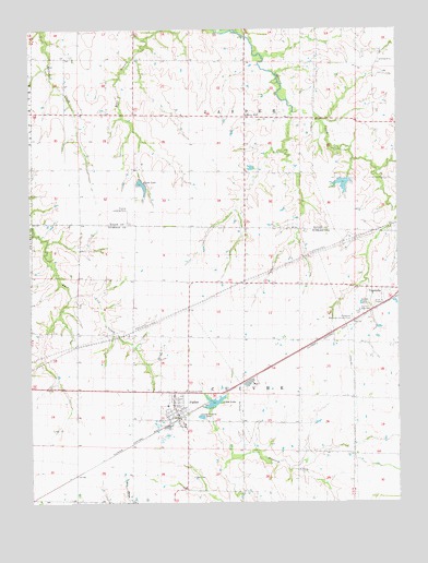
Farber, MO USGS Topographic Map
Click on map above to begin viewing in our Map Viewer.

This topographic map contains these locations and features:
Feature Name Type Latitude Longitude GNIS ID View Map
Alton LakeReservoirN39.2764°W91.5627°758243View Map
Alton Lake DamDamN39.2750°W91.5635°761386View Map
Auwarter LakeReservoirN39.3367°W91.5935°760302View Map
Bear Branch School (historical)SchoolN39.3386°W91.5933°743933View Map
Buell Airport (historical)AirportN39.3625°W91.6085°758857View Map
Carl Moore Lake DamDamN39.3334°W91.5035°761810View Map
Carlson Lake DamDamN39.2984°W91.5985°762045View Map
City of FarberCivilN39.2746°W91.5762°2394741View Map
Eisele LakeLakeN39.3339°W91.5868°717427View Map
Eisele Lake DamDamN39.3367°W91.5935°760301View Map
Evergreen Memorial Gardens CemeteryCemeteryN39.2984°W91.5157°717693View Map
FarberPopulated PlaceN39.2725°W91.5746°717845View Map
Farber CemeteryCemeteryN39.2564°W91.5718°717846View Map
Farber Post OfficePost OfficeN39.2730°W91.5753°2783212View Map
Farber Volunteer Fire DepartmentBuildingN39.2789°W91.5752°2620896View Map
Gibson DamDamN39.3717°W91.5635°761809View Map
Liberty HallLocaleN39.3520°W91.5515°720981View Map
Nadine (historical)LocaleN39.3442°W91.5515°743934View Map
Nadine School (historical)SchoolN39.3444°W91.5520°744097View Map
Number 572 DamDamN39.3517°W91.6102°761492View Map
Robinson Lake DamDamN39.3167°W91.6068°762044View Map
Van-Far Elementary SchoolSchoolN39.3053°W91.5137°2649799View Map
Van-Far High SchoolSchoolN39.3003°W91.5135°728127View Map
Verna Moore DamDamN39.3350°W91.5168°762043View Map

Note: Coordinates in the location and feature list above are referenced to NAD83 datum.


Copyright (C) 2008-2025 Ryan Niemi / Sunset Dynamics ... All Rights Reserved