TopoQuest Logo
Do you find TopoQuest useful?
Help keep TopoQuest running and adding new maps/features by donating!
Bitcoin:  19c7KJd3qBynnjoSw5npx9KScwjBe4ifkT
Litecoin:  LXs6TkuXGGXo1vDsWCkWVdjQX94eUKd6ui
Home View Maps Find Maps Find Places Resources & Links


Vandalia Lake, Missouri Topographic Map

USGS Map Title: Vandalia Lake, MO
USGS Map MRC: 39091B5
DRG (GeoTIFF) Download: o39091b5.tif


Neighboring USGS Topographic Map Quads:


  Hutchison, MO  
39091C6
 

  Farber, MO  
39091C5
 

  Vandalia, MO  
39091C4
 

  Laddonia, MO  
39091B6
 

  Vandalia Lake, MO  
39091B5
 

  Middletown, MO  
39091B4
 

  Martinsburg, MO  
39091A6
 

  Wellsville, MO  
39091A5
 

  Buell, MO  
39091A4


Map MRC Location:

N40°
W92°
N40°
W91°
H8 H7 H6 H5 H4 H3 H2 H1
G8 G7 G6 G5 G4 G3 G2 G1
F8 F7 F6 F5 F4 F3 F2 F1
E8 E7 E6 E5 E4 E3 E2 E1
D8 D7 D6 D5 D4 D3 D2 D1
C8 C7 C6 C5 C4 C3 C2 C1
B8 B7 B6 B5 B4 B3 B2 B1
A8 A7 A6 A5 A4 A3 A2 A1
N39°
W92°
N39°
W91°

Vandalia Lake, MO USGS 1:24K Topographic Map Preview:
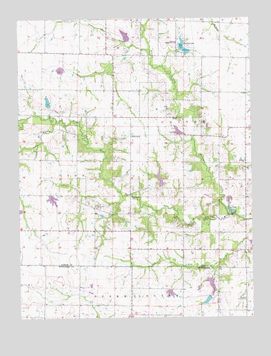
Vandalia Lake, MO USGS Topographic Map
Click on map above to begin viewing in our Map Viewer.

This topographic map contains these locations and features:
Feature Name Type Latitude Longitude GNIS ID View Map
Barneyville Post Office (historical)Post OfficeN39.1690°W91.5015°759494View Map
Bear SloughStreamN39.2348°W91.5532°713823View Map
Becker Lake DamDamN39.1700°W91.6235°762048View Map
Beshears Lake DamDamN39.1800°W91.5485°762049View Map
Black School (historical)SchoolN39.2106°W91.6113°744420View Map
Cornett School (historical)SchoolN39.1766°W91.5992°744419View Map
CuliverPopulated PlaceN39.1692°W91.5665°740611View Map
Deichman Lake Dam - NorthDamN39.1417°W91.5218°762046View Map
Deichman Lake Dam - SouthDamN39.1334°W91.5235°760443View Map
Deichman Lake Dam - WestDamN39.1367°W91.5452°762047View Map
Edwards CemeteryCemeteryN39.1717°W91.5252°717414View Map
Elmer Foree LakeReservoirN39.2152°W91.6093°761038View Map
Fike CemeteryCemeteryN39.1636°W91.5318°717909View Map
Foree Lake DamDamN39.2134°W91.6102°761037View Map
Fred Wenzel LakeReservoirN39.1323°W91.5245°760444View Map
Hall School (historical)SchoolN39.1625°W91.5471°744418View Map
Hammett Lake DamDamN39.2417°W91.5668°762053View Map
Hickory CreekStreamN39.1681°W91.5118°729513View Map
Hickory Creek (historical)Populated PlaceN39.1690°W91.5015°738786View Map
Hickory Grove School (historical)SchoolN39.2102°W91.5452°744417View Map
Johns BranchStreamN39.2078°W91.6077°720347View Map
Mount Olivet ChurchChurchN39.1903°W91.5035°729564View Map
New Providence CemeteryCemeteryN39.1756°W91.5649°723292View Map
Pleasant Plains School (historical)SchoolN39.2295°W91.5027°744416View Map
Rices CornerPopulated PlaceN39.2014°W91.5649°741195View Map
Robertson DamDamN39.2284°W91.6018°762050View Map
Swope School (historical)SchoolN39.1359°W91.5035°744421View Map
Township of CuivreCivilN39.2395°W91.5134°766241View Map
Vandalia Community LakeParkN39.2400°W91.5377°743178View Map
Vandalia Community Lake DamDamN39.2367°W91.5385°760677View Map
Vandalia LakeReservoirN39.2361°W91.5354°728135View Map
West Cuivre Baptist ChurchChurchN39.1709°W91.5835°729688View Map

Note: Coordinates in the location and feature list above are referenced to NAD83 datum.


Copyright (C) 2008-2025 Ryan Niemi / Sunset Dynamics ... All Rights Reserved