TopoQuest Logo
Do you find TopoQuest useful?
Help keep TopoQuest running and adding new maps/features by donating!
Bitcoin:  19c7KJd3qBynnjoSw5npx9KScwjBe4ifkT
Litecoin:  LXs6TkuXGGXo1vDsWCkWVdjQX94eUKd6ui
Home View Maps Find Maps Find Places Resources & Links


Fillmore, Illinois Topographic Map

USGS Map Title: Fillmore, IL
USGS Map MRC: 39089A3
DRG (GeoTIFF) Download: o39089a3.tif


Neighboring USGS Topographic Map Quads:


  Hillsboro, IL  
39089B4
 

  Bald Knob, IL  
39089B3
 

  Ramsey Lake, IL  
39089B2
 

  Coffeen, IL  
39089A4
 

  Fillmore, IL  
39089A3
 

  Bingham, IL  
39089A2
 

  Greenville, IL  
38089H4
 

  Mulberry Grove, IL  
38089H3
 

  Hagarstown, IL  
38089H2


Map MRC Location:

N40°
W90°
N40°
W89°
H8 H7 H6 H5 H4 H3 H2 H1
G8 G7 G6 G5 G4 G3 G2 G1
F8 F7 F6 F5 F4 F3 F2 F1
E8 E7 E6 E5 E4 E3 E2 E1
D8 D7 D6 D5 D4 D3 D2 D1
C8 C7 C6 C5 C4 C3 C2 C1
B8 B7 B6 B5 B4 B3 B2 B1
A8 A7 A6 A5 A4 A3 A2 A1
N39°
W90°
N39°
W89°

Fillmore, IL USGS 1:24K Topographic Map Preview:
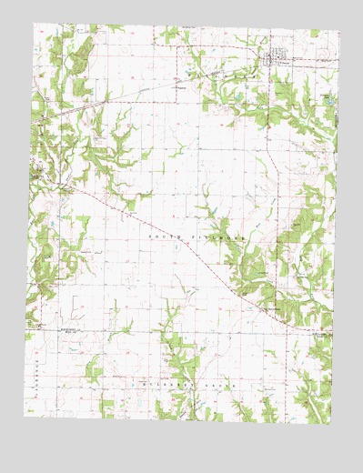
Fillmore, IL USGS Topographic Map
Click on map above to begin viewing in our Map Viewer.

This topographic map contains these locations and features:
Feature Name Type Latitude Longitude GNIS ID View Map
Alexander School (historical)SchoolN39.0720°W89.2790°1772057View Map
Brown CemeteryCemeteryN39.1003°W89.3676°404942View Map
ChapmanPopulated PlaceN39.1056°W89.3170°405968View Map
Crab Apple School (historical)SchoolN39.0128°W89.3429°1725154View Map
Cress CemeteryCemeteryN39.0886°W89.3487°406775View Map
Durr CemeteryCemeteryN39.0134°W89.3201°407530View Map
East Fork ChurchChurchN39.0645°W89.3337°407635View Map
East Fork School (historical)SchoolN39.0675°W89.3431°1772076View Map
Egypt School (historical)SchoolN39.1003°W89.3345°1772078View Map
FillmorePopulated PlaceN39.1153°W89.2790°408366View Map
Fillmore Baptist ChurchChurchN39.1173°W89.2762°1986075View Map
Fillmore Community Fire Protection DistrictBuildingN39.1168°W89.2790°2640497View Map
Fillmore LakeReservoirN39.1027°W89.2538°408367View Map
Fillmore Lake DamDamN39.1017°W89.2534°1692358View Map
Fillmore Post OfficePost OfficeN39.1153°W89.2788°1986078View Map
Forsee VineyardsBuildingN39.0581°W89.3542°2681048View Map
Gilham School (historical)SchoolN39.0112°W89.3054°1725160View Map
Glendale CemeteryCemeteryN39.1045°W89.2781°409068View Map
Green Hill CemeteryCemeteryN39.0406°W89.2878°409383View Map
Hurricane CemeteryCemeteryN39.0636°W89.2676°1953390View Map
Hurricane ChurchChurchN39.0631°W89.2684°410711View Map
Jerusalem School (historical)SchoolN39.1189°W89.3356°1772095View Map
Lanes BranchStreamN39.1034°W89.2987°411805View Map
Liberty ChurchChurchN39.0003°W89.3062°412001View Map
Mount Moriah ChurchChurchN39.0287°W89.3695°413998View Map
Mud CreekStreamN39.0539°W89.2873°414164View Map
Neathery CemeteryCemeteryN39.0109°W89.2778°414329View Map
Neathery School (historical)SchoolN39.0123°W89.2684°1725183View Map
New Boston School (historical)SchoolN39.0412°W89.3662°1772119View Map
Piatt CreekStreamN39.0398°W89.2592°415627View Map
Renshaw CemeteryCemeteryN39.0473°W89.2656°416536View Map
Saint Matthew Lutheran ChurchChurchN39.1162°W89.2784°1986076View Map
Shiloh Church (historical)ChurchN39.0723°W89.3590°1772148View Map
Shiloh Presbyterian CemeteryCemeteryN39.0725°W89.3595°418401View Map
Snow CemeteryCemeteryN39.0123°W89.3248°418683View Map
Township of Fillmore ConsolidatedCivilN39.1007°W89.3064°2787904View Map
Township of South FillmoreCivilN39.0572°W89.3063°429764View Map
Van BurensburgPopulated PlaceN39.0362°W89.2795°420215View Map
Village of FillmoreCivilN39.1154°W89.2785°2398877View Map
Walker CemeteryCemeteryN39.0500°W89.2912°420400View Map
Williamson CemeteryCemeteryN39.1248°W89.3095°421216View Map

Note: Coordinates in the location and feature list above are referenced to NAD83 datum.


Copyright (C) 2008-2025 Ryan Niemi / Sunset Dynamics ... All Rights Reserved