TopoQuest Logo
Do you find TopoQuest useful?
Help keep TopoQuest running and adding new maps/features by donating!
Bitcoin:  19c7KJd3qBynnjoSw5npx9KScwjBe4ifkT
Litecoin:  LXs6TkuXGGXo1vDsWCkWVdjQX94eUKd6ui
Home View Maps Find Maps Find Places Resources & Links


Ramsey Lake, Illinois Topographic Map

USGS Map Title: Ramsey Lake, IL
USGS Map MRC: 39089B2
DRG (GeoTIFF) Download: o39089b2.tif


Neighboring USGS Topographic Map Quads:


  Nokomis, IL  
39089C3
 

  Ohlman, IL  
39089C2
 

  Oconee, IL  
39089C1
 

  Bald Knob, IL  
39089B3
 

  Ramsey Lake, IL  
39089B2
 

  Ramsey, IL  
39089B1
 

  Fillmore, IL  
39089A3
 

  Bingham, IL  
39089A2
 

  Vera, IL  
39089A1


Map MRC Location:

N40°
W90°
N40°
W89°
H8 H7 H6 H5 H4 H3 H2 H1
G8 G7 G6 G5 G4 G3 G2 G1
F8 F7 F6 F5 F4 F3 F2 F1
E8 E7 E6 E5 E4 E3 E2 E1
D8 D7 D6 D5 D4 D3 D2 D1
C8 C7 C6 C5 C4 C3 C2 C1
B8 B7 B6 B5 B4 B3 B2 B1
A8 A7 A6 A5 A4 A3 A2 A1
N39°
W90°
N39°
W89°

Ramsey Lake, IL USGS 1:24K Topographic Map Preview:
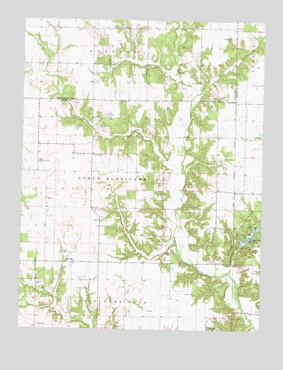
Ramsey Lake, IL USGS Topographic Map
Click on map above to begin viewing in our Map Viewer.

This topographic map contains these locations and features:
Feature Name Type Latitude Longitude GNIS ID View Map
Bailey BranchStreamN39.2323°W89.1915°403801View Map
Big Three School (historical)SchoolN39.1878°W89.1340°1736922View Map
Blackberry Fork Picnic AreaLocaleN39.1656°W89.1312°1773052View Map
Caesar CreekStreamN39.1881°W89.1659°405334View Map
Casey CemeteryCemeteryN39.1728°W89.1604°405674View Map
Cearlock CemeteryCemeteryN39.1414°W89.2156°405597View Map
Coon Ridge Picnic AreaLocaleN39.1631°W89.1345°1773058View Map
Crabapple Ridge Camping AreaLocaleN39.1673°W89.1281°1773059View Map
Craig CemeteryCemeteryN39.2033°W89.1930°406718View Map
Craigtown School (historical)SchoolN39.1881°W89.1948°1736937View Map
Donaldson CemeteryCemeteryN39.1431°W89.2417°407300View Map
Elliott CreekStreamN39.2281°W89.1706°407895View Map
Fairview Community CenterBuildingN39.1920°W89.2420°408200View Map
Fairview School (historical)SchoolN39.1920°W89.2415°1736945View Map
Fox CemeteryCemeteryN39.1326°W89.1838°408614View Map
Fox Hunt HollowValleyN39.1512°W89.1393°408623View Map
Fox Knoll Picnic AreaLocaleN39.1609°W89.1362°1773071View Map
Gamble BranchStreamN39.1337°W89.2306°408866View Map
Halford CemeteryCemeteryN39.1842°W89.2101°409647View Map
Halford ChapelChurchN39.1950°W89.2137°409648View Map
Harris CemeteryCemeteryN39.1267°W89.2415°409841View Map
Hickory CreekStreamN39.1370°W89.2309°410141View Map
Hickory Grove Camping AreaLocaleN39.1645°W89.1276°1773062View Map
Lake View Picnic AreaLocaleN39.1623°W89.1301°1773087View Map
Liberty CemeteryCemeteryN39.1251°W89.2002°411988View Map
Liberty ChurchChurchN39.1262°W89.2001°412002View Map
Little Hickory CemeteryCemeteryN39.1537°W89.2267°1802267View Map
Little Hickory ChurchChurchN39.1520°W89.2262°412351View Map
Little Hickory School (historical)SchoolN39.1514°W89.2376°1736956View Map
Mount Carmel CemeteryCemeteryN39.1553°W89.1712°1736966View Map
Mount Carmel ChurchChurchN39.1559°W89.1715°413944View Map
Mount Zion School (historical)SchoolN39.2173°W89.1862°1736969View Map
Nave CemeteryCemeteryN39.1256°W89.1509°414313View Map
New Bethel ChurchChurchN39.2173°W89.2001°414382View Map
Oak Valley ChurchChurchN39.2248°W89.1587°414865View Map
Otter BranchStreamN39.2200°W89.1604°415211View Map
Pine Bend Picnic AreaLocaleN39.1664°W89.1254°1773096View Map
Poland CemeteryCemeteryN39.1398°W89.1595°415982View Map
Prairie Mound School (historical)SchoolN39.1517°W89.1715°1736981View Map
Ramsey Hills Nature TrailTrailN39.1525°W89.1362°1773103View Map
Ramsey LakeReservoirN39.1633°W89.1311°416371View Map
Ramsey Lake DamDamN39.1600°W89.1359°1691740View Map
Ramsey Lake State ParkParkN39.1645°W89.1356°416372View Map
Shady Grove Picnic AreaLocaleN39.1600°W89.1273°1773111View Map
Sterling School (historical)SchoolN39.2317°W89.2281°1772154View Map
Stokes CemeteryCemeteryN39.1553°W89.2284°419156View Map
Success School (historical)SchoolN39.1670°W89.1509°1737003View Map
Tennessee CemeteryCemeteryN39.2431°W89.1426°419595View Map
Township of HurricaneCivilN39.1848°W89.1950°429159View Map
Virden School (historical)SchoolN39.2175°W89.1545°1737010View Map
White Oak Camping AreaLocaleN39.1589°W89.1329°1773124View Map
Whitfield LakeReservoirN39.1667°W89.1417°1692339View Map
Whitfield Lake DamDamN39.1667°W89.1417°1692338View Map
Whitten School (historical)SchoolN39.1517°W89.2095°1737014View Map

Note: Coordinates in the location and feature list above are referenced to NAD83 datum.


Copyright (C) 2008-2025 Ryan Niemi / Sunset Dynamics ... All Rights Reserved