TopoQuest Logo
Do you find TopoQuest useful?
Help keep TopoQuest running and adding new maps/features by donating!
Bitcoin:  19c7KJd3qBynnjoSw5npx9KScwjBe4ifkT
Litecoin:  LXs6TkuXGGXo1vDsWCkWVdjQX94eUKd6ui
Home View Maps Find Maps Find Places Resources & Links


Hagarstown, Illinois Topographic Map

USGS Map Title: Hagarstown, IL
USGS Map MRC: 38089H2
DRG (GeoTIFF) Download: o38089h2.tif


Neighboring USGS Topographic Map Quads:


  Fillmore, IL  
39089A3
 

  Bingham, IL  
39089A2
 

  Vera, IL  
39089A1
 

  Mulberry Grove, IL  
38089H3
 

  Hagarstown, IL  
38089H2
 

  Vandalia, IL  
38089H1
 

  Pleasant Mound, IL  
38089G3
 

  Wildcat Lake, IL  
38089G2
 

  Patoka, IL  
38089G1


Map MRC Location:

N39°
W90°
N39°
W89°
H8 H7 H6 H5 H4 H3 H2 H1
G8 G7 G6 G5 G4 G3 G2 G1
F8 F7 F6 F5 F4 F3 F2 F1
E8 E7 E6 E5 E4 E3 E2 E1
D8 D7 D6 D5 D4 D3 D2 D1
C8 C7 C6 C5 C4 C3 C2 C1
B8 B7 B6 B5 B4 B3 B2 B1
A8 A7 A6 A5 A4 A3 A2 A1
N38°
W90°
N38°
W89°

Hagarstown, IL USGS 1:24K Topographic Map Preview:
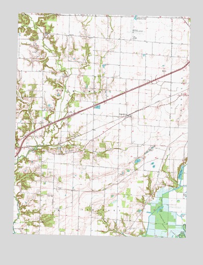
Hagarstown, IL USGS Topographic Map
Click on map above to begin viewing in our Map Viewer.

This topographic map contains these locations and features:
Feature Name Type Latitude Longitude GNIS ID View Map
Alton School (historical)SchoolN38.9670°W89.2387°1736916View Map
Bethlehem CemeteryCemeteryN38.9786°W89.2370°1802258View Map
Bethlehem ChurchChurchN38.9784°W89.2362°404342View Map
Bowles School (historical)SchoolN38.9289°W89.1934°1736926View Map
Brush LakeLakeN38.8866°W89.1282°405043View Map
Center School (historical)SchoolN38.9578°W89.1942°1736933View Map
Clover College School (historical)SchoolN38.9378°W89.2315°1736934View Map
Crown Point ChurchChurchN38.8789°W89.1665°406852View Map
Daniel CemeteryCemeteryN38.9009°W89.2153°406944View Map
Eakle CemeteryCemeteryN38.9703°W89.2298°407585View Map
Elm Grove School (historical)SchoolN38.9875°W89.2131°1736942View Map
Evans CemeteryCemeteryN38.9264°W89.1403°408097View Map
Evans School (historical)SchoolN38.9189°W89.1434°1736943View Map
Fish LakeLakeN38.8909°W89.1441°408386View Map
Fish Lake DitchCanalN38.8998°W89.1412°408392View Map
Gilham CreekStreamN38.9928°W89.2381°409015View Map
HagarstownPopulated PlaceN38.9434°W89.1684°409606View Map
Hagarstown Post OfficePost OfficeN38.9431°W89.1684°1773076View Map
Hurricane ChurchChurchN38.9875°W89.1984°410710View Map
Interchange 61CrossingN38.9700°W89.1320°1773078View Map
JimtownPopulated PlaceN38.9878°W89.2126°422848View Map
Lick CreekStreamN38.9253°W89.2340°412053View Map
Lutz Airport (historical)AirportN38.9173°W89.2256°427587View Map
Lutz SpurLocaleN38.9242°W89.2409°412751View Map
McInturff CemeteryCemeteryN38.9225°W89.2117°413282View Map
Oak Grove School (historical)SchoolN38.9006°W89.2178°1736971View Map
Owl CreekStreamN38.9184°W89.2473°415278View Map
Pond Grove School (historical)SchoolN38.9712°W89.1565°1736978View Map
Prairie Mound School (historical)SchoolN38.9873°W89.1753°1736980View Map
Raccoon CreekStreamN38.9237°W89.2337°416333View Map
Seminary School (historical)SchoolN38.8789°W89.1753°1736995View Map
Suttons PondReservoirN38.9109°W89.1300°419441View Map
Township of Bear GroveCivilN38.9568°W89.1970°428645View Map
Vandalia Municipal AirportAirportN38.9880°W89.1658°427887View Map
Wescott Church (historical)ChurchN38.9125°W89.1459°1737012View Map
Wright and Neathery CemeteryCemeteryN38.9892°W89.2290°1802279View Map

Note: Coordinates in the location and feature list above are referenced to NAD83 datum.


Copyright (C) 2008-2025 Ryan Niemi / Sunset Dynamics ... All Rights Reserved