TopoQuest Logo
Do you find TopoQuest useful?
Help keep TopoQuest running and adding new maps/features by donating!
Bitcoin:  19c7KJd3qBynnjoSw5npx9KScwjBe4ifkT
Litecoin:  LXs6TkuXGGXo1vDsWCkWVdjQX94eUKd6ui
Home View Maps Find Maps Find Places Resources & Links


Tipton, Missouri Topographic Map

USGS Map Title: Tipton, MO
USGS Map MRC: 38092F7
DRG (GeoTIFF) Download: o38092f7.tif


Neighboring USGS Topographic Map Quads:


  Pilot Grove South, MO  
38092G8
 

  Bunceton, MO  
38092G7
 

  Lone Elm, MO  
38092G6
 

  Otterville East, MO  
38092F8
 

  Tipton, MO  
38092F7
 

  Clarksburg, MO  
38092F6
 

  Florence, MO  
38092E8
 

  Fortuna, MO  
38092E7
 

  Latham, MO  
38092E6


Map MRC Location:

N39°
W93°
N39°
W92°
H8 H7 H6 H5 H4 H3 H2 H1
G8 G7 G6 G5 G4 G3 G2 G1
F8 F7 F6 F5 F4 F3 F2 F1
E8 E7 E6 E5 E4 E3 E2 E1
D8 D7 D6 D5 D4 D3 D2 D1
C8 C7 C6 C5 C4 C3 C2 C1
B8 B7 B6 B5 B4 B3 B2 B1
A8 A7 A6 A5 A4 A3 A2 A1
N38°
W93°
N38°
W92°

Tipton, MO USGS 1:24K Topographic Map Preview:
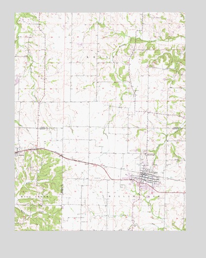
Tipton, MO USGS Topographic Map
Click on map above to begin viewing in our Map Viewer.

This topographic map contains these locations and features:
Feature Name Type Latitude Longitude GNIS ID View Map
Baxter School (historical)SchoolN38.7175°W92.7616°743855View Map
Chilton CemeteryCemeteryN38.7472°W92.7696°715789View Map
City of TiptonCivilN38.6549°W92.7803°2397030View Map
Clark School (historical)SchoolN38.6250°W92.7996°743619View Map
Donley School (historical)SchoolN38.6353°W92.7516°743620View Map
Excelsior School (historical)SchoolN38.6772°W92.7627°743623View Map
Gallagher CemeteryCemeteryN38.6553°W92.8169°718316View Map
Gilroy School (historical)SchoolN38.6995°W92.8744°743856View Map
Glendale School (historical)SchoolN38.7215°W92.8097°743854View Map
Hirst (historical)LocaleN38.7075°W92.8149°743779View Map
Hopewell CemeteryCemeteryN38.7172°W92.7624°719794View Map
Langkop Lake DamDamN38.7117°W92.8719°765392View Map
Lone Elm School (historical)SchoolN38.6811°W92.8057°743630View Map
Masonic CemeteryCemeteryN38.6622°W92.7830°721960View Map
Olive Branch School (historical)SchoolN38.6317°W92.8671°745288View Map
Smith BranchStreamN38.6281°W92.7855°729394View Map
Snorgrass CemeteryCemeteryN38.6303°W92.8269°726670View Map
SyracusePopulated PlaceN38.6700°W92.8733°729823View Map
Syracuse Post OfficePost OfficeN38.6696°W92.8740°2782582View Map
TiptonPopulated PlaceN38.6556°W92.7799°727679View Map
Tipton Correctional CenterBuildingN38.6665°W92.7794°2735662View Map
Tipton Elementary SchoolSchoolN38.6534°W92.7788°2571124View Map
Tipton Fire DepartmentBuildingN38.6530°W92.7826°2621420View Map
Tipton High SchoolSchoolN38.6522°W92.7787°2571125View Map
Tipton Police DepartmentBuildingN38.6570°W92.7796°2752545View Map
Tipton Post OfficePost OfficeN38.6558°W92.7801°2782798View Map
Township of KellyCivilN38.7443°W92.8004°766530View Map
Vermont (historical)BuildingN38.7467°W92.8127°743793View Map
Veulemans Lake DamDamN38.6717°W92.7852°763909View Map
Willow Fork School (historical)SchoolN38.6334°W92.8271°743646View Map
Woods CemeteryCemeteryN38.7053°W92.7877°729118View Map

Note: Coordinates in the location and feature list above are referenced to NAD83 datum.


Copyright (C) 2008-2025 Ryan Niemi / Sunset Dynamics ... All Rights Reserved