TopoQuest Logo
Do you find TopoQuest useful?
Help keep TopoQuest running and adding new maps/features by donating!
Bitcoin:  19c7KJd3qBynnjoSw5npx9KScwjBe4ifkT
Litecoin:  LXs6TkuXGGXo1vDsWCkWVdjQX94eUKd6ui
Home View Maps Find Maps Find Places Resources & Links


Flowers, North Carolina Topographic Map

USGS Map Title: Flowers, NC
USGS Map MRC: 35078F3
DRG (GeoTIFF) Download: o35078f3.tif


Neighboring USGS Topographic Map Quads:


  Knightdale, NC  
35078G4
 

  Zebulon, NC  
35078G3
 

  Middlesex, NC  
35078G2
 

  Clayton, NC  
35078F4
 

  Flowers, NC  
35078F3
 

  Stancils Chapel, NC  
35078F2
 

  Powhatan, NC  
35078E4
 

  Selma, NC  
35078E3
 

  Kenly West, NC  
35078E2


Map MRC Location:

N36°
W79°
N36°
W78°
H8 H7 H6 H5 H4 H3 H2 H1
G8 G7 G6 G5 G4 G3 G2 G1
F8 F7 F6 F5 F4 F3 F2 F1
E8 E7 E6 E5 E4 E3 E2 E1
D8 D7 D6 D5 D4 D3 D2 D1
C8 C7 C6 C5 C4 C3 C2 C1
B8 B7 B6 B5 B4 B3 B2 B1
A8 A7 A6 A5 A4 A3 A2 A1
N35°
W79°
N35°
W78°

Flowers, NC USGS 1:24K Topographic Map Preview:
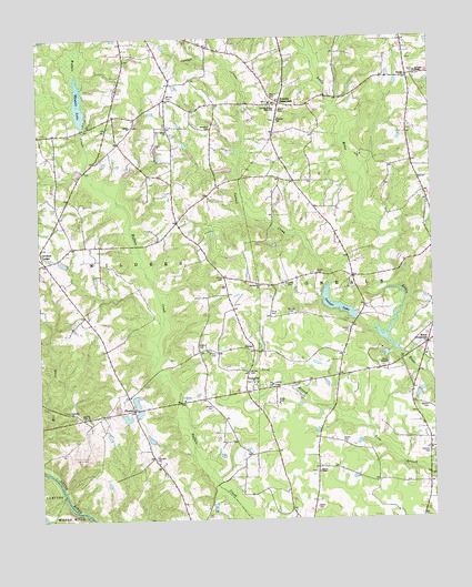
Flowers, NC USGS Topographic Map
Click on map above to begin viewing in our Map Viewer.

This topographic map contains these locations and features:
Feature Name Type Latitude Longitude GNIS ID View Map
Atkinson LakeReservoirN35.6685°W78.2631°999220View Map
Atkinson Lake DamDamN35.6685°W78.2631°999219View Map
Atkinson Mill PondReservoirN35.6685°W78.2597°999218View Map
Atkinson Mill Pond DamDamN35.6685°W78.2597°999217View Map
Batten CemeteryCemeteryN35.6538°W78.2517°980625View Map
Batten CemeteryCemeteryN35.6546°W78.3203°980626View Map
Branch ChapelChurchN35.6374°W78.2867°981822View Map
Camp AtkinsonLocaleN35.6652°W78.2639°982486View Map
Cattail CemeteryCemeteryN35.6738°W78.2764°982771View Map
Cattail CreekStreamN35.6718°W78.2653°982772View Map
Cattail LakeReservoirN35.6774°W78.2742°982775View Map
Cattail Pond DamDamN35.6774°W78.2742°999236View Map
Corinth - Holder Volunteer Fire Department Station 1BuildingN35.7326°W78.3011°2638817View Map
Corinth - Holder Volunteer Fire Department Station 2BuildingN35.7428°W78.2568°2639595View Map
Corinth ChurchChurchN35.7288°W78.2983°983561View Map
Corinth Holders High SchoolSchoolN35.7256°W78.3389°983567View Map
Eason CemeteryCemeteryN35.6282°W78.2875°984482View Map
Eason CemeteryCemeteryN35.6446°W78.2786°984483View Map
Eason CemeteryCemeteryN35.6888°W78.2867°984484View Map
EmitPopulated PlaceN35.7399°W78.2567°984765View Map
Fairview CemeteryCemeteryN35.6418°W78.2517°984909View Map
FlowersPopulated PlaceN35.6538°W78.3450°985237View Map
Flowers Pond Number OneReservoirN35.6452°W78.3397°999193View Map
Flowers Pond Number One DamDamN35.6452°W78.3397°999194View Map
Flowers Ranch Airport (historical)AirportN35.6410°W78.3653°997954View Map
Greswell CemeteryCemeteryN35.6868°W78.2956°986139View Map
Hares CrossroadsPopulated PlaceN35.6704°W78.2517°986405View Map
Hocutt CemeteryCemeteryN35.7351°W78.3003°986865View Map
Hocutts CrossroadsPopulated PlaceN35.7335°W78.2978°986867View Map
Jeffrey CemeteryCemeteryN35.6879°W78.3164°987544View Map
JordanPopulated PlaceN35.6690°W78.3069°1006264View Map
Lake Andrew AcresReservoirN35.7152°W78.3447°999291View Map
Lake Andrew Acres DamDamN35.7152°W78.3447°999292View Map
Lake Wendell DamDamN35.7268°W78.3614°999309View Map
Murphy CemeteryCemeteryN35.6699°W78.3242°990806View Map
New Bethel ChurchChurchN35.7268°W78.3342°990935View Map
O'Neal CemeteryCemeteryN35.6685°W78.3189°991340View Map
Pineville ChurchChurchN35.6535°W78.3658°992314View Map
Price CemeteryCemeteryN35.6788°W78.3011°992804View Map
Red Hill ChurchChurchN35.6410°W78.3383°993120View Map
Salem ChurchChurchN35.7271°W78.3450°994172View Map
Smith CemeteryCemeteryN35.7313°W78.2981°994949View Map
Snipes CreekStreamN35.7452°W78.2869°995058View Map
Spring Hill ChurchChurchN35.6860°W78.3044°995350View Map
Thanksgiving ChurchChurchN35.6607°W78.3069°995952View Map
Thanksgiving Fire DepartmentBuildingN35.6598°W78.3099°2639213View Map
Town of Archer LodgeCivilN35.6909°W78.3745°2612171View Map
Township of WildersCivilN35.6957°W78.3611°1026858View Map
Watkins ChapelChurchN35.7410°W78.2542°996860View Map
Wendell LakeReservoirN35.7304°W78.3609°996956View Map
Wheeler CemeteryCemeteryN35.6788°W78.2947°997107View Map
Whitley CemeteryCemeteryN35.6632°W78.3083°997263View Map
Whitley CemeteryCemeteryN35.7351°W78.3336°997264View Map
Woodard CemeteryCemeteryN35.7271°W78.3197°997572View Map

Note: Coordinates in the location and feature list above are referenced to NAD83 datum.


Copyright (C) 2008-2025 Ryan Niemi / Sunset Dynamics ... All Rights Reserved