TopoQuest Logo
Do you find TopoQuest useful?
Help keep TopoQuest running and adding new maps/features by donating!
Bitcoin:  19c7KJd3qBynnjoSw5npx9KScwjBe4ifkT
Litecoin:  LXs6TkuXGGXo1vDsWCkWVdjQX94eUKd6ui
Home View Maps Find Maps Find Places Resources & Links


Zebulon, North Carolina Topographic Map

USGS Map Title: Zebulon, NC
USGS Map MRC: 35078G3
DRG (GeoTIFF) Download: o35078g3.tif


Neighboring USGS Topographic Map Quads:


  Rolesville, NC  
35078H4
 

  Bunn West, NC  
35078H3
 

  Bunn East, NC  
35078H2
 

  Knightdale, NC  
35078G4
 

  Zebulon, NC  
35078G3
 

  Middlesex, NC  
35078G2
 

  Clayton, NC  
35078F4
 

  Flowers, NC  
35078F3
 

  Stancils Chapel, NC  
35078F2


Map MRC Location:

N36°
W79°
N36°
W78°
H8 H7 H6 H5 H4 H3 H2 H1
G8 G7 G6 G5 G4 G3 G2 G1
F8 F7 F6 F5 F4 F3 F2 F1
E8 E7 E6 E5 E4 E3 E2 E1
D8 D7 D6 D5 D4 D3 D2 D1
C8 C7 C6 C5 C4 C3 C2 C1
B8 B7 B6 B5 B4 B3 B2 B1
A8 A7 A6 A5 A4 A3 A2 A1
N35°
W79°
N35°
W78°

Zebulon, NC USGS 1:24K Topographic Map Preview:
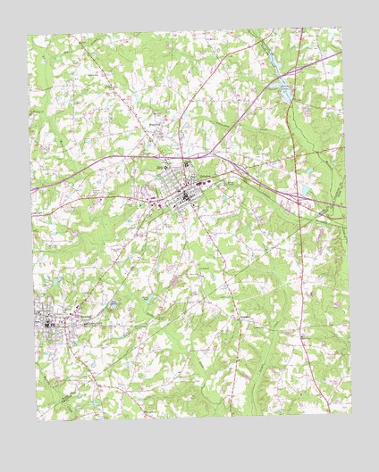
Zebulon, NC USGS Topographic Map
Click on map above to begin viewing in our Map Viewer.

This topographic map contains these locations and features:
Feature Name Type Latitude Longitude GNIS ID View Map
Ammons PondReservoirN35.8185°W78.3581°999510View Map
Ammons Pond DamDamN35.8185°W78.3581°999509View Map
AngelviewPopulated PlaceN35.7635°W78.3661°1002809View Map
Baptist Tabernacle ChurchChurchN35.7523°W78.3316°995810View Map
Barbees Mill (historical)LocaleN35.8227°W78.3517°1951356View Map
Beaverdam CreekStreamN35.8429°W78.2686°980843View Map
Big BranchStreamN35.8668°W78.3669°981364View Map
Buchanan Airport (historical)AirportN35.8071°W78.3664°997975View Map
Bunn LakeReservoirN35.8585°W78.2744°999577View Map
Bunn Lake DamDamN35.8518°W78.2697°999578View Map
Carver SchoolSchoolN35.7813°W78.3539°982711View Map
CobblestonePopulated PlaceN35.7893°W78.3539°1002810View Map
DeerfieldPopulated PlaceN35.7738°W78.3608°1002808View Map
EarpsboroPopulated PlaceN35.7815°W78.2933°984480View Map
Eastern Wake County Emergency Medical Services Station 1BuildingN35.7810°W78.3645°2720674View Map
Eastern Wake County Emergency Medical Services Station 3BuildingN35.8221°W78.3115°2720547View Map
Fall BranchStreamN35.8285°W78.3536°1951534View Map
Greshams LakeReservoirN35.8514°W78.3435°986138View Map
Hales ChapelChurchN35.7752°W78.2689°986294View Map
Hendricks DamDamN35.8535°W78.3314°999580View Map
Hendricks PondReservoirN35.8539°W78.3313°999579View Map
Hendricks Ranch Airport (historical)AirportN35.8371°W78.3300°997981View Map
Hester PondReservoirN35.7874°W78.3292°986672View Map
Hester Pond DamDamN35.7868°W78.3297°999432View Map
Hominy CreekStreamN35.8507°W78.3689°987007View Map
Lake JohnsonReservoirN35.7863°W78.3442°987693View Map
Little CreekStreamN35.8093°W78.2514°1951491View Map
Lizard LickPopulated PlaceN35.8165°W78.3750°1021251View Map
Lu-Tom Acres LakeReservoirN35.7968°W78.3631°999453View Map
Lu-Tom Acres Lake DamDamN35.7968°W78.3631°999454View Map
Merry Grove ChurchChurchN35.7960°W78.3083°989748View Map
Morphus BridgeBridgeN35.7827°W78.3261°990258View Map
Moss PondReservoirN35.7935°W78.3197°999449View Map
Moss Pond DamDamN35.7935°W78.3197°999450View Map
New Zebulon Elementary SchoolSchoolN35.8415°W78.3203°1002815View Map
Philip R Bunn AirportAirportN35.8621°W78.3459°997989View Map
Pineview EstatesPopulated PlaceN35.8199°W78.3369°1002811View Map
Pleasant Grove CemeteryCemeteryN35.7801°W78.3353°992460View Map
Pleasant Grove ChurchChurchN35.7813°W78.3531°992487View Map
Privette Lake Number OneReservoirN35.8226°W78.2658°999518View Map
Privette Lake Number One DamDamN35.8218°W78.2647°999519View Map
Privette Pond Number TwoReservoirN35.8289°W78.2637°999538View Map
Privette Pond Number Two DamDamN35.8302°W78.2614°999539View Map
RivercrestPopulated PlaceN35.8193°W78.3603°1002812View Map
Rocky BranchStreamN35.8482°W78.3678°1951545View Map
Saint Marks ChurchChurchN35.7785°W78.2839°994018View Map
Saint Mathews ChurchChurchN35.8724°W78.3036°994047View Map
Saint Pauls ChurchChurchN35.7982°W78.3086°994091View Map
Shepard High SchoolSchoolN35.8318°W78.3133°994653View Map
Tarpleys PondReservoirN35.8010°W78.3417°995873View Map
Town of WendellCivilN35.7817°W78.3685°2406857View Map
Town of ZebulonCivilN35.8312°W78.3184°2406928View Map
Township of Little RiverCivilN35.8595°W78.3440°1027265View Map
Union ChapelChurchN35.8579°W78.3419°996437View Map
Wakefield CemeteryCemeteryN35.8485°W78.3219°996683View Map
Wakelon High SchoolSchoolN35.8310°W78.3206°996684View Map
WakeMed Zebulon / Wendell Outpatient and Skilled Nurse FacilityBuildingN35.8192°W78.3268°2701550View Map
WedgewoodPopulated PlaceN35.8279°W78.3444°1002813View Map
WendellPopulated PlaceN35.7810°W78.3697°1023154View Map
Wendell Elementary SchoolSchoolN35.7857°W78.3723°1002814View Map
Wendell Police DepartmentBuildingN35.7806°W78.3684°2769670View Map
ZebulonPopulated PlaceN35.8243°W78.3147°997745View Map
Zebulon Fire DepartmentBuildingN35.8220°W78.3118°2638603View Map
Zebulon Police DepartmentBuildingN35.8309°W78.3199°2769905View Map
Zebulon Post OfficePost OfficeN35.8222°W78.3112°2774097View Map

Note: Coordinates in the location and feature list above are referenced to NAD83 datum.


Copyright (C) 2008-2025 Ryan Niemi / Sunset Dynamics ... All Rights Reserved