TopoQuest Logo
Do you find TopoQuest useful?
Help keep TopoQuest running and adding new maps/features by donating!
Bitcoin:  19c7KJd3qBynnjoSw5npx9KScwjBe4ifkT
Litecoin:  LXs6TkuXGGXo1vDsWCkWVdjQX94eUKd6ui
Home View Maps Find Maps Find Places Resources & Links


Knightdale, North Carolina Topographic Map

USGS Map Title: Knightdale, NC
USGS Map MRC: 35078G4
DRG (GeoTIFF) Download: o35078g4.tif


Neighboring USGS Topographic Map Quads:


  Wake Forest, NC  
35078H5
 

  Rolesville, NC  
35078H4
 

  Bunn West, NC  
35078H3
 

  Raleigh East, NC  
35078G5
 

  Knightdale, NC  
35078G4
 

  Zebulon, NC  
35078G3
 

  Garner, NC  
35078F5
 

  Clayton, NC  
35078F4
 

  Flowers, NC  
35078F3


Map MRC Location:

N36°
W79°
N36°
W78°
H8 H7 H6 H5 H4 H3 H2 H1
G8 G7 G6 G5 G4 G3 G2 G1
F8 F7 F6 F5 F4 F3 F2 F1
E8 E7 E6 E5 E4 E3 E2 E1
D8 D7 D6 D5 D4 D3 D2 D1
C8 C7 C6 C5 C4 C3 C2 C1
B8 B7 B6 B5 B4 B3 B2 B1
A8 A7 A6 A5 A4 A3 A2 A1
N35°
W79°
N35°
W78°

Knightdale, NC USGS 1:24K Topographic Map Preview:
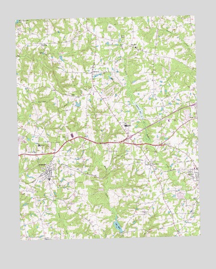
Knightdale, NC USGS Topographic Map
Click on map above to begin viewing in our Map Viewer.

This topographic map contains these locations and features:
Feature Name Type Latitude Longitude GNIS ID View Map
Bethany ChurchChurchN35.8446°W78.4464°981084View Map
Bethlehem ChurchChurchN35.7504°W78.4825°981217View Map
Buffalo Creek Cypress SwampSwampN35.8056°W78.4102°2541787View Map
C N Robertson PondReservoirN35.8264°W78.4575°999523View Map
C N Robertson Pond DamDamN35.8252°W78.4581°999522View Map
Carrington WoodsPopulated PlaceN35.7896°W78.4875°1002836View Map
Central ChurchChurchN35.7646°W78.4117°982957View Map
Eagle RockPopulated PlaceN35.7913°W78.4083°984472View Map
Eastern Wake County Emergency Medical Services Station 4BuildingN35.8446°W78.4406°2720545View Map
Eastern Wake County Emergency Medical Services Station 63BuildingN35.8022°W78.4883°2720438View Map
Eastern Wake Fire and Rescue Department Station 1BuildingN35.7526°W78.4960°2638461View Map
Eastern Wake Fire and Rescue Department Station 2BuildingN35.7886°W78.4786°2638728View Map
Hammonds PondReservoirN35.8535°W78.4681°999581View Map
Hammonds Pond DamDamN35.8535°W78.4681°999582View Map
Hephzibah ChurchChurchN35.8027°W78.3994°986635View Map
Holly LakesPopulated PlaceN35.7679°W78.3792°1002803View Map
Jones ChapelChurchN35.8315°W78.4622°987737View Map
KnightdalePopulated PlaceN35.7877°W78.4806°1021061View Map
Knightdale Elementary SchoolSchoolN35.7841°W78.4786°1002807View Map
Knightdale Fire Department Station 1BuildingN35.8021°W78.4882°2638711View Map
Knightdale Fire Department Station 2BuildingN35.7894°W78.4747°2639830View Map
Knightdale Police DepartmentBuildingN35.8022°W78.4883°2769770View Map
Knightdale Post OfficePost OfficeN35.7941°W78.4900°2455249View Map
Knightdale QuarryMineN35.8075°W78.4994°2649051View Map
Knights CrossroadsLocaleN35.7985°W78.4875°1951445View Map
Lake MirlReservoirN35.8554°W78.4808°990072View Map
Lake MyraSwampN35.7659°W78.4349°990826View Map
Lake Myra DamDamN35.7529°W78.4300°999351View Map
Lake Myra Elementary SchoolSchoolN35.7613°W78.4298°2573104View Map
Lockhart Elementary SchoolSchoolN35.8032°W78.4855°988829View Map
Malbys Crossroads ChurchChurchN35.7999°W78.4875°989253View Map
MaplewoodPopulated PlaceN35.8018°W78.4864°1002801View Map
MeadowbrookPopulated PlaceN35.7782°W78.3767°1002804View Map
Myrick PondReservoirN35.7835°W78.4847°999426View Map
Myrick Pond DamDamN35.7835°W78.4847°999425View Map
Oakwood EstatesPopulated PlaceN35.7821°W78.4850°1002835View Map
PebblebrookPopulated PlaceN35.8113°W78.4711°1002802View Map
Perry PondReservoirN35.8613°W78.4278°992056View Map
Perry Pond DamDamN35.8618°W78.4264°999597View Map
Raleigh East AirportAirportN35.7974°W78.4361°997973View Map
Riley High - Northern Wake Optional SchoolSchoolN35.8579°W78.4164°1002806View Map
Riley HillPopulated PlaceN35.8588°W78.4200°1022292View Map
Robertsons PondSwampN35.8256°W78.4178°993458View Map
Robertsons Pond DamDamN35.8174°W78.4131°999501View Map
Six Forks CrossroadsPopulated PlaceN35.8615°W78.4825°1022648View Map
Town of KnightdaleCivilN35.7918°W78.4964°2405958View Map
Township of Marks CreekCivilN35.7860°W78.4112°1027266View Map
Wake New Hope Volunteer Fire Department Station 2 HeadquartersBuildingN35.8603°W78.4816°2639492View Map
Wendell Holmes Rural Fire Department Station 1 HeadquartersBuildingN35.7904°W78.3779°2638767View Map
Wendell Holmes Rural Fire Department Station 2BuildingN35.8446°W78.4406°2639501View Map
Wendell Post OfficePost OfficeN35.7933°W78.3761°2455260View Map
WETC-AM (Wendell-Zebulon)TowerN35.8685°W78.4319°1018508View Map
Whitley High SchoolSchoolN35.8135°W78.4247°997268View Map
Whitley Middle SchoolSchoolN35.8199°W78.4314°1002805View Map

Note: Coordinates in the location and feature list above are referenced to NAD83 datum.


Copyright (C) 2008-2025 Ryan Niemi / Sunset Dynamics ... All Rights Reserved