TopoQuest Logo
Do you find TopoQuest useful?
Help keep TopoQuest running and adding new maps/features by donating!
Bitcoin:  19c7KJd3qBynnjoSw5npx9KScwjBe4ifkT
Litecoin:  LXs6TkuXGGXo1vDsWCkWVdjQX94eUKd6ui
Home View Maps Find Maps Find Places Resources & Links


Fork Mountain, West Virginia Topographic Map

USGS Map Title: Fork Mountain, WV
USGS Map MRC: 38080B4
DRG (GeoTIFF) Download: o38080b4.tif


Neighboring USGS Topographic Map Quads:


  Camden On Gauley, WV  
38080C5
 

  Webster Springs SW, WV  
38080C4
 

  Webster Springs SE, WV  
38080C3
 

  Richwood, WV  
38080B5
 

  Fork Mountain, WV  
38080B4
 

  Lobelia, WV  
38080B3
 

  Duo, WV  
38080A5
 

  Trout, WV  
38080A4
 

  Droop, WV  
38080A3


Map MRC Location:

N39°
W81°
N39°
W80°
H8 H7 H6 H5 H4 H3 H2 H1
G8 G7 G6 G5 G4 G3 G2 G1
F8 F7 F6 F5 F4 F3 F2 F1
E8 E7 E6 E5 E4 E3 E2 E1
D8 D7 D6 D5 D4 D3 D2 D1
C8 C7 C6 C5 C4 C3 C2 C1
B8 B7 B6 B5 B4 B3 B2 B1
A8 A7 A6 A5 A4 A3 A2 A1
N38°
W81°
N38°
W80°

Fork Mountain, WV USGS 1:24K Topographic Map Preview:
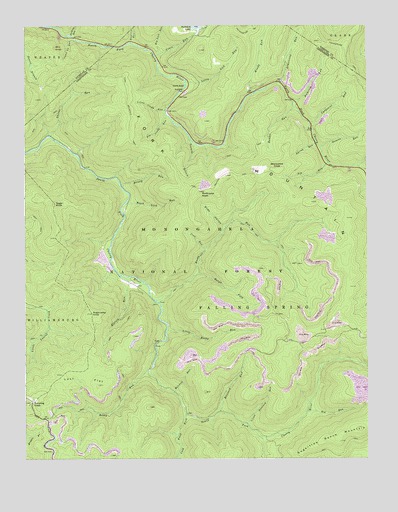
Fork Mountain, WV USGS Topographic Map
Click on map above to begin viewing in our Map Viewer.

This topographic map contains these locations and features:
Feature Name Type Latitude Longitude GNIS ID View Map
Armstrong RunStreamN38.2334°W80.4065°1550115View Map
Bearwallow KnobSummitN38.2082°W80.4073°1553825View Map
Becky RunStreamN38.1504°W80.4554°1550234View Map
Beech Lick RunStreamN38.1990°W80.4631°1550246View Map
Big Glady RunStreamN38.2243°W80.4481°1550294View Map
Big Lick RunStreamN38.2421°W80.4504°1550299View Map
Big RunStreamN38.2107°W80.3892°1550314View Map
Big RunStreamN38.1387°W80.3970°1550337View Map
Big Run TrailTrailN38.2059°W80.3965°1553662View Map
Blizzard RunStreamN38.1387°W80.4295°1550388View Map
Briery RunStreamN38.2037°W80.4645°1550467View Map
Bumblebee RunStreamN38.1260°W80.4445°1550558View Map
Camp 29 RunStreamN38.2473°W80.4843°1550593View Map
Carpenter RunStreamN38.2223°W80.3962°1550636View Map
Coats RunStreamN38.2415°W80.4520°1550747View Map
Cold Knob ForkStreamN38.1382°W80.4415°1550756View Map
Coon RunStreamN38.1859°W80.4342°1550787View Map
Deacon RunStreamN38.2151°W80.3920°1550889View Map
Elklick RunStreamN38.1768°W80.4626°1551039View Map
Epling RunStreamN38.2159°W80.3934°1551065View Map
Fallen Timber RunStreamN38.2079°W80.3754°1551091View Map
Fork MountainSummitN38.1843°W80.3837°1554488View Map
Fork Mountain TrailTrailN38.2093°W80.4454°1551159View Map
Hacking RunStreamN38.2473°W80.4826°1551317View Map
Hamrick RunStreamN38.2279°W80.4017°1551343View Map
Hunters RunStreamN38.2448°W80.4609°1551526View Map
Little Blizzard RunStreamN38.1354°W80.4195°1551838View Map
Little Glady RunStreamN38.2257°W80.4484°1551859View Map
Little Lick RunStreamN38.2337°W80.4409°1551872View Map
Little Rocky RunStreamN38.1626°W80.4481°1551888View Map
Lost FlatFlatN38.1490°W80.4787°1551941View Map
Manning KnobSummitN38.1407°W80.4990°1555038View Map
Mill KnobSummitN38.2437°W80.4890°1555123View Map
Mitchell RunStreamN38.1440°W80.4459°1552169View Map
North BendPopulated PlaceN38.2298°W80.4431°1552314View Map
North Bend Picnic AreaLocaleN38.2307°W80.4417°1553612View Map
Pocahontas TrailTrailN38.2487°W80.3926°1552518View Map
Rabbit RunStreamN38.2265°W80.4015°1552573View Map
Rockcamp KnobSummitN38.2023°W80.4362°1552703View Map
Rocky RunStreamN38.1707°W80.4526°1552719View Map
Rough ForkStreamN38.1782°W80.4373°1552736View Map
Shiras RunStreamN38.2184°W80.4904°1552873View Map
Slide HollowValleyN38.1923°W80.4279°1552930View Map
Sugar KnobSummitN38.1987°W80.4890°1555733View Map
Sugarcamp KnobSummitN38.1673°W80.4756°1553128View Map
Sugartree Bench MountainSummitN38.1337°W80.3781°1555738View Map
Summit Lake CampgroundLocaleN38.2484°W80.4448°1553613View Map
Summit Lake DamDamN38.2492°W80.4369°1558864View Map
Tenmile BranchStreamN38.2182°W80.4398°1553193View Map
Windy RunStreamN38.2307°W80.4159°1553487View Map

Note: Coordinates in the location and feature list above are referenced to NAD83 datum.


Copyright (C) 2008-2025 Ryan Niemi / Sunset Dynamics ... All Rights Reserved