TopoQuest Logo
Do you find TopoQuest useful?
Help keep TopoQuest running and adding new maps/features by donating!
Bitcoin:  19c7KJd3qBynnjoSw5npx9KScwjBe4ifkT
Litecoin:  LXs6TkuXGGXo1vDsWCkWVdjQX94eUKd6ui
Home View Maps Find Maps Find Places Resources & Links


Webster Springs SW, West Virginia Topographic Map

USGS Map Title: Webster Springs SW, WV
USGS Map MRC: 38080C4
DRG (GeoTIFF) Download: o38080c4.tif


Neighboring USGS Topographic Map Quads:


  Cowen, WV  
38080D5
 

  Webster Springs, WV  
38080D4
 

  Bergoo, WV  
38080D3
 

  Camden On Gauley, WV  
38080C5
 

  Webster Springs SW, WV  
38080C4
 

  Webster Springs SE, WV  
38080C3
 

  Richwood, WV  
38080B5
 

  Fork Mountain, WV  
38080B4
 

  Lobelia, WV  
38080B3


Map MRC Location:

N39°
W81°
N39°
W80°
H8 H7 H6 H5 H4 H3 H2 H1
G8 G7 G6 G5 G4 G3 G2 G1
F8 F7 F6 F5 F4 F3 F2 F1
E8 E7 E6 E5 E4 E3 E2 E1
D8 D7 D6 D5 D4 D3 D2 D1
C8 C7 C6 C5 C4 C3 C2 C1
B8 B7 B6 B5 B4 B3 B2 B1
A8 A7 A6 A5 A4 A3 A2 A1
N38°
W81°
N38°
W80°

Webster Springs SW, WV USGS 1:24K Topographic Map Preview:
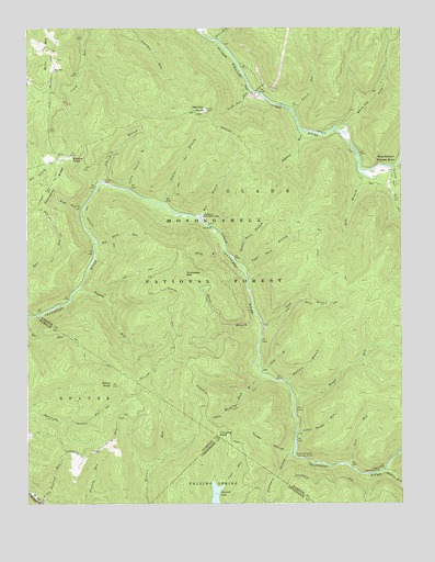
Webster Springs SW, WV USGS Topographic Map
Click on map above to begin viewing in our Map Viewer.

This topographic map contains these locations and features:
Feature Name Type Latitude Longitude GNIS ID View Map
Aldrich BranchStreamN38.3343°W80.4751°1550086View Map
Baldwin BranchStreamN38.2815°W80.4137°1550159View Map
Barrenshe TrailTrailN38.2734°W80.4959°1550174View Map
Bear Run TrailTrailN38.3134°W80.4937°1550199View Map
Bee Run TrailTrailN38.2915°W80.4818°1550242View Map
Big Swag RunStreamN38.3187°W80.4770°1550354View Map
Billy BranchStreamN38.3168°W80.4345°1550358View Map
Bishop KnobSummitN38.3409°W80.4854°1553910View Map
Bishop Knob Recreation AreaParkN38.3409°W80.4887°1727829View Map
Blacks Chapel CemeteryCemeteryN38.3670°W80.5000°2728609View Map
Briery KnobSummitN38.2809°W80.4718°1550465View Map
Central DistrictCivilN38.3470°W80.4539°1928185View Map
Cold RunStreamN38.2604°W80.3934°1550758View Map
Cranberry Back CountryParkN38.2559°W80.3776°1553625View Map
Cranberry CampgroundLocaleN38.3254°W80.4417°1550821View Map
Cranberry Wildlife Management AreaParkN38.2765°W80.4123°2043521View Map
Dogway Camping ShelterLocaleN38.2590°W80.3817°1550936View Map
Dogway ForkStreamN38.2587°W80.3806°1550937View Map
Foxtree RunStreamN38.3068°W80.4823°1551173View Map
Goose HollowValleyN38.2640°W80.4126°1551256View Map
Hanging RockSummitN38.2676°W80.4365°1554639View Map
Hanging Rock BranchStreamN38.2840°W80.4215°1551351View Map
Hanging Rock TrailTrailN38.2782°W80.4276°1551353View Map
Johnson RunStreamN38.3487°W80.4092°1551600View Map
Laurel BranchStreamN38.3290°W80.4548°1551699View Map
Laurel RunStreamN38.3532°W80.4109°1551741View Map
Lick BranchStreamN38.2973°W80.4215°1551783View Map
Lick BranchStreamN38.3373°W80.3890°1551784View Map
Lick Branch TrailTrailN38.3032°W80.4084°1551785View Map
Little ForkStreamN38.3382°W80.3773°1551853View Map
Little Hacking RunStreamN38.2512°W80.4956°1551860View Map
Little Laurel BranchStreamN38.3321°W80.4654°1551861View Map
Little Rough RunStreamN38.2687°W80.4104°1551889View Map
Lower Twin BranchStreamN38.3134°W80.4290°1551963View Map
Middle Fork Williams RiverStreamN38.3351°W80.3759°1552065View Map
Mill BranchStreamN38.3257°W80.4440°1552098View Map
Mills MountainRidgeN38.3673°W80.4918°1552149View Map
Mills Mountain ChurchChurchN38.3637°W80.4909°1552150View Map
North Cove RunStreamN38.3584°W80.4254°1552319View Map
Note BranchStreamN38.2840°W80.4209°1552349View Map
Pheasant HollowValleyN38.2629°W80.4123°1552466View Map
Pleasant Hollow Camping ShelterLocaleN38.2626°W80.4106°1552500View Map
Queer BranchStreamN38.2979°W80.4217°1552572View Map
Red Oak KnobSummitN38.3532°W80.4406°1552609View Map
Red Oak Lookout TowerLocaleN38.3532°W80.4406°1727903View Map
Rich HollowValleyN38.3284°W80.4829°1552643View Map
Rough RunStreamN38.2793°W80.4120°1552739View Map
Snakeden MountainSummitN38.3109°W80.4476°1555653View Map
Snakeden TrailTrailN38.3223°W80.4779°1552951View Map
Spice RunStreamN38.3721°W80.4362°1552999View Map
Summit LakeReservoirN38.2521°W80.4371°1553143View Map
Three Forks of Williams RiverLocaleN38.3404°W80.3762°1553229View Map
Upper Twin BranchStreamN38.3129°W80.4279°1553329View Map
White Oak ForkStreamN38.3493°W80.3970°1553425View Map

Note: Coordinates in the location and feature list above are referenced to NAD83 datum.


Copyright (C) 2008-2024 Ryan Niemi / Sunset Dynamics ... All Rights Reserved