TopoQuest Logo
Do you find TopoQuest useful?
Help keep TopoQuest running and adding new maps/features by donating!
Bitcoin:  19c7KJd3qBynnjoSw5npx9KScwjBe4ifkT
Litecoin:  LXs6TkuXGGXo1vDsWCkWVdjQX94eUKd6ui
Home View Maps Find Maps Find Places Resources & Links


Lobelia, West Virginia Topographic Map

USGS Map Title: Lobelia, WV
USGS Map MRC: 38080B3
DRG (GeoTIFF) Download: o38080b3.tif


Neighboring USGS Topographic Map Quads:


  Webster Springs SW, WV  
38080C4
 

  Webster Springs SE, WV  
38080C3
 

  Woodrow, WV  
38080C2
 

  Fork Mountain, WV  
38080B4
 

  Lobelia, WV  
38080B3
 

  Hillsboro, WV  
38080B2
 

  Trout, WV  
38080A4
 

  Droop, WV  
38080A3
 

  Denmar, WV  
38080A2


Map MRC Location:

N39°
W81°
N39°
W80°
H8 H7 H6 H5 H4 H3 H2 H1
G8 G7 G6 G5 G4 G3 G2 G1
F8 F7 F6 F5 F4 F3 F2 F1
E8 E7 E6 E5 E4 E3 E2 E1
D8 D7 D6 D5 D4 D3 D2 D1
C8 C7 C6 C5 C4 C3 C2 C1
B8 B7 B6 B5 B4 B3 B2 B1
A8 A7 A6 A5 A4 A3 A2 A1
N38°
W81°
N38°
W80°

Lobelia, WV USGS 1:24K Topographic Map Preview:
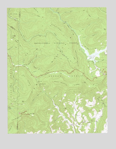
Lobelia, WV USGS Topographic Map
Click on map above to begin viewing in our Map Viewer.

This topographic map contains these locations and features:
Feature Name Type Latitude Longitude GNIS ID View Map
Bear RunStreamN38.1921°W80.3648°1550190View Map
Blue KnobSummitN38.1757°W80.2795°1550394View Map
Briery KnobSummitN38.1443°W80.3445°1553977View Map
Briery Knob Lookout TowerTowerN38.1443°W80.3445°1728009View Map
Bruffeys Creek School (historical)SchoolN38.1423°W80.2879°1728012View Map
Caesar MountainSummitN38.1471°W80.2609°1554049View Map
Caesar Mountain School (historical)SchoolN38.1410°W80.2590°1728023View Map
Cave RunStreamN38.1296°W80.2851°1550657View Map
Charles CreekStreamN38.2010°W80.2704°1550673View Map
Chestnut FlatsFlatN38.1621°W80.3051°1550692View Map
Cow Pasture TrailTrailN38.2121°W80.2512°1550811View Map
Cranberry GladesSwampN38.2010°W80.2681°1550822View Map
Cranberry Glades Botanical AreaParkN38.2032°W80.2665°1553588View Map
Cranberry Mountain Visitors CenterBuildingN38.1835°W80.2529°1728034View Map
Darnell RunStreamN38.1854°W80.3448°1550871View Map
Dean HollowValleyN38.1432°W80.3081°1550892View Map
DogwayPopulated PlaceN38.2409°W80.3726°1554316View Map
Eagles CampLocaleN38.1921°W80.3545°1551006View Map
Eagles Camp TrailTrailN38.1951°W80.3467°1551007View Map
Eagles School (historical)SchoolN38.1571°W80.3173°1728052View Map
Emmanuel ChurchChurchN38.1423°W80.2881°1551060View Map
Falls of Hills CreekFallsN38.1737°W80.3351°1551095View Map
Falls of Hills Creek Scenic AreaLocaleN38.1721°W80.3362°1553590View Map
Forks of Cranberry TrailTrailN38.2404°W80.2665°1551162View Map
Frosty GapGapN38.2090°W80.3395°1551189View Map
Frosty Gap TrailTrailN38.2029°W80.3292°1551190View Map
Glade RunStreamN38.1932°W80.3551°1551233View Map
Kennison Mountain TrailTrailN38.2282°W80.3117°1551633View Map
Kennison MountainsRidgeN38.2185°W80.2973°1551634View Map
Laurel RunStreamN38.1593°W80.3198°1551723View Map
Left Branch North Fork Cherry RiverStreamN38.1907°W80.3509°1551764View Map
Little BranchStreamN38.2190°W80.2854°1551839View Map
Little Levels DistrictCivilN38.1698°W80.2530°1928304View Map
Little Red RunStreamN38.2354°W80.3004°1728096View Map
Little RunStreamN38.2451°W80.3131°1551892View Map
LobeliaPopulated PlaceN38.1337°W80.2945°1551907View Map
Lost RunStreamN38.2434°W80.3098°1551947View Map
Mikes KnobSummitN38.2218°W80.3670°1555118View Map
Mikes Knob Lookout TowerLocaleN38.2218°W80.3670°1556446View Map
Pocahontas TrailTrailN38.1868°W80.3262°1553589View Map
Point MountainSummitN38.1729°W80.3470°1552524View Map
Red RunStreamN38.2218°W80.2862°1552612View Map
Rocky KnobSummitN38.1571°W80.3540°1552712View Map
Round MountainSummitN38.1498°W80.3042°1552746View Map
Rush RunStreamN38.1251°W80.3054°1552758View Map
South Fork ShelterLocaleN38.2351°W80.3023°1552981View Map
Spruce MountainSummitN38.1729°W80.3017°1553019View Map
Spruce RunStreamN38.1665°W80.3304°1553024View Map
Viney MountainSummitN38.1632°W80.2654°1555891View Map
Wildcat RockPillarN38.2223°W80.3326°1553451View Map

Note: Coordinates in the location and feature list above are referenced to NAD83 datum.


Copyright (C) 2008-2025 Ryan Niemi / Sunset Dynamics ... All Rights Reserved