TopoQuest Logo
Do you find TopoQuest useful?
Help keep TopoQuest running and adding new maps/features by donating!
Bitcoin:  19c7KJd3qBynnjoSw5npx9KScwjBe4ifkT
Litecoin:  LXs6TkuXGGXo1vDsWCkWVdjQX94eUKd6ui
Home View Maps Find Maps Find Places Resources & Links


Fort Motte, South Carolina Topographic Map

USGS Map Title: Fort Motte, SC
USGS Map MRC: 33080F6
DRG (GeoTIFF) Download: o33080f6.tif


Neighboring USGS Topographic Map Quads:


  Gadsden, SC  
33080G7
 

  Wateree, SC  
33080G6
 

  Poinsett State Park, SC  
33080G5
 

  Saint Matthews, SC  
33080F7
 

  Fort Motte, SC  
33080F6
 

  Lone Star, SC  
33080F5
 

  Orangeburg North, SC  
33080E7
 

  Cameron, SC  
33080E6
 

  Elloree, SC  
33080E5


Map MRC Location:

N34°
W81°
N34°
W80°
H8 H7 H6 H5 H4 H3 H2 H1
G8 G7 G6 G5 G4 G3 G2 G1
F8 F7 F6 F5 F4 F3 F2 F1
E8 E7 E6 E5 E4 E3 E2 E1
D8 D7 D6 D5 D4 D3 D2 D1
C8 C7 C6 C5 C4 C3 C2 C1
B8 B7 B6 B5 B4 B3 B2 B1
A8 A7 A6 A5 A4 A3 A2 A1
N33°
W81°
N33°
W80°

Fort Motte, SC USGS 1:24K Topographic Map Preview:
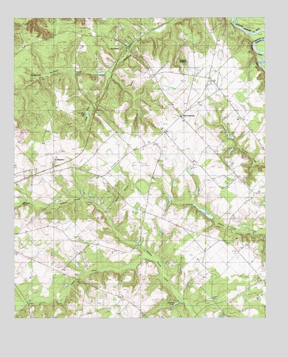
Fort Motte, SC USGS Topographic Map
Click on map above to begin viewing in our Map Viewer.

This topographic map contains these locations and features:
Feature Name Type Latitude Longitude GNIS ID View Map
Amaker School (historical)SchoolN33.6527°W80.6415°1234686View Map
Antley Spring BranchStreamN33.6307°W80.7468°1244914View Map
Bethel ChurchChurchN33.6357°W80.6356°1246780View Map
Bethel ChurchChurchN33.6821°W80.6409°1220557View Map
F M Wannamaker PondReservoirN33.6752°W80.7448°1238407View Map
Fort MottePopulated PlaceN33.7390°W80.6926°1247806View Map
Fort Motte Fire DepartmentBuildingN33.7121°W80.6691°2578336View Map
Fort Motte SchoolSchoolN33.7410°W80.7012°1234695View Map
Fort Motte-Lone Star DivisionCivilN33.6785°W80.6410°1938272View Map
Furlick BranchStreamN33.6685°W80.7048°1222609View Map
Holman PondReservoirN33.6299°W80.6751°1223246View Map
J L Wannamaker Cabin PondReservoirN33.7002°W80.7098°1239605View Map
Jerusalem Baptist ChurchChurchN33.7107°W80.7109°1246167View Map
Langsyne PlantationLocaleN33.7318°W80.6634°1223815View Map
Langsyne School (historical)SchoolN33.7360°W80.6601°1246297View Map
Lyons CreekStreamN33.6502°W80.6848°1246494View Map
Millwood PondReservoirN33.6743°W80.7437°1224585View Map
Mitchell SchoolSchoolN33.6818°W80.6426°1224606View Map
Mizpah ChurchChurchN33.6788°W80.6334°1246700View Map
Mount Pisgah ChurchChurchN33.7346°W80.6868°1224765View Map
Mount Pleasant ChurchChurchN33.6949°W80.6501°1224780View Map
Mount Salem ChurchChurchN33.6838°W80.7073°1224794View Map
Mount Salem School (historical)SchoolN33.6843°W80.7081°1234710View Map
Red ChurchChurchN33.7140°W80.6704°1225781View Map
Reid House PondReservoirN33.6946°W80.6419°1239625View Map
Reid House Pond Dam D-2655DamN33.6954°W80.6407°1239624View Map
Reid PondReservoirN33.6768°W80.6698°1239627View Map
Saint Luke ChurchChurchN33.6354°W80.6359°1226168View Map
Saint Lukes School (historical)SchoolN33.6415°W80.6281°1234719View Map
Saint Matthews City Sewage Dam D-2919DamN33.6385°W80.7498°1239636View Map
Saint Paul ChurchChurchN33.6638°W80.6854°1226225View Map
Saint Stephens ChurchChurchN33.6557°W80.7126°1226274View Map
Sam Reid Pond Dam D-2658DamN33.6734°W80.6718°1239626View Map
Saw Dust LandingLocaleN33.7313°W80.6284°1234724View Map
Shay Hane Cabin PondReservoirN33.6690°W80.6552°1238437View Map
Shehane Cabin Pond Dam D-2659DamN33.6702°W80.6565°1239630View Map
SingletonPopulated PlaceN33.6921°W80.7295°1231801View Map
South Carolina Noname 09023 D-2637 DamDamN33.6752°W80.7448°1238406View Map
South Carolina Noname 09024 D-2639 DamDamN33.7263°W80.7337°1238408View Map
South Carolina Noname 09039 D-2654 DamDamN33.6668°W80.6498°1238436View Map
South Carolina Noname 09044 D-2665 DamDamN33.7285°W80.7081°1238444View Map
Spigner PondReservoirN33.7285°W80.7081°1238445View Map
St Mathews Airport (historical)AirportN33.6884°W80.6866°1251961View Map
Sykes Pond Dam D-2636DamN33.6252°W80.7498°1239647View Map
True Blue CreekStreamN33.7274°W80.7018°1227220View Map
True Blue LakeLakeN33.7095°W80.7133°1227221View Map
Wienges LakeReservoirN33.7263°W80.7337°1227587View Map
Wienges LakeReservoirN33.6268°W80.7331°1238409View Map
Wiles CrossroadsPopulated PlaceN33.7099°W80.6668°1251447View Map
Wiles PondReservoirN33.6968°W80.6398°1239655View Map
Wiles Pond Dam D-2660DamN33.6998°W80.6406°1239654View Map

Note: Coordinates in the location and feature list above are referenced to NAD83 datum.


Copyright (C) 2008-2025 Ryan Niemi / Sunset Dynamics ... All Rights Reserved