TopoQuest Logo
Do you find TopoQuest useful?
Help keep TopoQuest running and adding new maps/features by donating!
Bitcoin:  19c7KJd3qBynnjoSw5npx9KScwjBe4ifkT
Litecoin:  LXs6TkuXGGXo1vDsWCkWVdjQX94eUKd6ui
Home View Maps Find Maps Find Places Resources & Links


Duckwall Mountain, California Topographic Map

USGS Map Title: Duckwall Mountain, CA
USGS Map MRC: 37120H1
DRG (GeoTIFF) Download: o37120h1.tif


Neighboring USGS Topographic Map Quads:


  Twain Harte, CA  
38120A2
 

  Hull Creek, CA  
38120A1
 

  Cherry Lake North, CA  
38119A8
 

  Tuolumne, CA  
37120H2
 

  Duckwall Mountain, CA  
37120H1
 

  Cherry Lake South, CA  
37119H8
 

  Groveland, CA  
37120G2
 

  Jawbone Ridge, CA  
37120G1
 

  Ascension Mountain, CA  
37119G8


Map MRC Location:

N38°
W121°
N38°
W120°
H8 H7 H6 H5 H4 H3 H2 H1
G8 G7 G6 G5 G4 G3 G2 G1
F8 F7 F6 F5 F4 F3 F2 F1
E8 E7 E6 E5 E4 E3 E2 E1
D8 D7 D6 D5 D4 D3 D2 D1
C8 C7 C6 C5 C4 C3 C2 C1
B8 B7 B6 B5 B4 B3 B2 B1
A8 A7 A6 A5 A4 A3 A2 A1
N37°
W121°
N37°
W120°

Duckwall Mountain, CA USGS 1:24K Topographic Map Preview:
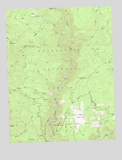
Duckwall Mountain, CA USGS Topographic Map
Click on map above to begin viewing in our Map Viewer.

This topographic map contains these locations and features:
Feature Name Type Latitude Longitude GNIS ID View Map
Bear CreekStreamN37.9774°W120.0188°256641View Map
Bear Springs CreekStreamN37.9224°W120.0669°256708View Map
Bull MeadowFlatN37.8955°W120.0574°257666View Map
Butcher Knife RidgeRidgeN37.8835°W120.1119°257749View Map
Camp Fourty FiveLocaleN37.9591°W120.0213°257851View Map
Corral CreekStreamN37.8785°W120.0130°258729View Map
Cottonwood CreekStreamN37.9802°W120.0549°258763View Map
Duckwall MountainSummitN37.9688°W120.1196°259599View Map
Duckwall RidgeRidgeN37.9641°W120.0896°259600View Map
FemmonsPopulated PlaceN37.9383°W120.0224°260076View Map
Femmons MeadowsFlatN37.9419°W120.0199°274812View Map
Grapevine PointSummitN37.8908°W120.1244°260780View Map
Indian SpringSpringN37.9144°W120.0849°261761View Map
Jawbone Forest Service StationLocaleN37.8991°W120.0007°1670266View Map
Niagara CreekStreamN37.9944°W120.0213°264083View Map
Quilty CreekStreamN37.9174°W120.0699°265111View Map
Quinn RanchLocaleN37.9208°W120.0902°265115View Map
Rackerby Jack SpringSpringN37.9335°W120.0340°265125View Map
Reed CreekStreamN37.9610°W120.0505°265358View Map
Round MeadowFlatN37.9221°W120.1238°265603View Map
Russell CreekStreamN37.9708°W120.0532°265689View Map
Thirteenmile CreekStreamN37.9863°W120.0738°268223View Map
Thompson MeadowFlatN37.9938°W120.0946°268236View Map
Thompson PeakSummitN37.9991°W120.0691°268238View Map
Walton Cabin SpringSpringN37.8777°W120.0966°268770View Map
Willow MeadowFlatN37.9919°W120.1060°269178View Map

Note: Coordinates in the location and feature list above are referenced to NAD83 datum.


Copyright (C) 2008-2024 Ryan Niemi / Sunset Dynamics ... All Rights Reserved