TopoQuest Logo
Do you find TopoQuest useful?
Help keep TopoQuest running and adding new maps/features by donating!
Bitcoin:  19c7KJd3qBynnjoSw5npx9KScwjBe4ifkT
Litecoin:  LXs6TkuXGGXo1vDsWCkWVdjQX94eUKd6ui
Home View Maps Find Maps Find Places Resources & Links


Fortune Fork, Louisiana Topographic Map

USGS Map Title: Fortune Fork, LA
USGS Map MRC: 32091C2
DRG (GeoTIFF) Download: o32091c2.tif


Neighboring USGS Topographic Map Quads:


  Tendal, LA  
32091D3
 

  Tallulah, LA  
32091D2
 

  Ashly, LA  
32091D1
 

  Waverly SE, LA  
32091C3
 

  Fortune Fork, LA  
32091C2
 

  Mound, LA  
32091C1
 

  Westwood, LA  
32091B3
 

  Somerset, LA  
32091B2
 

  Bedford, LA  
32091B1


Map MRC Location:

N33°
W92°
N33°
W91°
H8 H7 H6 H5 H4 H3 H2 H1
G8 G7 G6 G5 G4 G3 G2 G1
F8 F7 F6 F5 F4 F3 F2 F1
E8 E7 E6 E5 E4 E3 E2 E1
D8 D7 D6 D5 D4 D3 D2 D1
C8 C7 C6 C5 C4 C3 C2 C1
B8 B7 B6 B5 B4 B3 B2 B1
A8 A7 A6 A5 A4 A3 A2 A1
N32°
W92°
N32°
W91°

Fortune Fork, LA USGS 1:24K Topographic Map Preview:
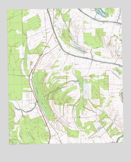
Fortune Fork, LA USGS Topographic Map
Click on map above to begin viewing in our Map Viewer.

This topographic map contains these locations and features:
Feature Name Type Latitude Longitude GNIS ID View Map
Alligator BayouLakeN32.2827°W91.2237°553287View Map
Alligator LakeSwampN32.2938°W91.2165°532137View Map
Bethlehem ChurchChurchN32.3332°W91.1840°532993View Map
Come and See ChurchChurchN32.3232°W91.1771°534062View Map
Coon BayouLakeN32.3397°W91.1408°534102View Map
Fortune ForkPopulated PlaceN32.3593°W91.1259°543215View Map
Horseshoe LakeLakeN32.3742°W91.1457°554781View Map
Islington (historical)Populated PlaceN32.3326°W91.1834°549236View Map
Lake SixteenLakeN32.3732°W91.1526°556056View Map
Madison ParishCivilN32.3644°W91.2426°558088View Map
Montrose CemeteryCemeteryN32.3249°W91.1487°537185View Map
Montrose ChurchChurchN32.3307°W91.1273°537186View Map
Mount Cella CemeteryCemeteryN32.3654°W91.1284°537312View Map
Pure Fountain ChurchChurchN32.2854°W91.1793°538443View Map
Roundaway BayouGutN32.3321°W91.1796°538751View Map
Saint Paul ChurchChurchN32.3632°W91.1432°539024View Map
Simmons Grove ChurchChurchN32.3651°W91.1543°539385View Map
Union ChurchChurchN32.3257°W91.1532°540096View Map

Note: Coordinates in the location and feature list above are referenced to NAD83 datum.


Copyright (C) 2008-2024 Ryan Niemi / Sunset Dynamics ... All Rights Reserved