TopoQuest Logo
Do you find TopoQuest useful?
Help keep TopoQuest running and adding new maps/features by donating!
Bitcoin:  19c7KJd3qBynnjoSw5npx9KScwjBe4ifkT
Litecoin:  LXs6TkuXGGXo1vDsWCkWVdjQX94eUKd6ui
Home View Maps Find Maps Find Places Resources & Links


Mound, Louisiana Topographic Map

USGS Map Title: Mound, LA
USGS Map MRC: 32091C1
DRG (GeoTIFF) Download: o32091c1.tif


Neighboring USGS Topographic Map Quads:


  Tallulah, LA  
32091D2
 

  Ashly, LA  
32091D1
 

  Long Lake, MS  
32090D8
 

  Fortune Fork, LA  
32091C2
 

  Mound, LA  
32091C1
 

  Vicksburg West, MS  
32090C8
 

  Somerset, LA  
32091B2
 

  Bedford, LA  
32091B1
 

  Yokena, MS  
32090B8


Map MRC Location:

N33°
W92°
N33°
W91°
H8 H7 H6 H5 H4 H3 H2 H1
G8 G7 G6 G5 G4 G3 G2 G1
F8 F7 F6 F5 F4 F3 F2 F1
E8 E7 E6 E5 E4 E3 E2 E1
D8 D7 D6 D5 D4 D3 D2 D1
C8 C7 C6 C5 C4 C3 C2 C1
B8 B7 B6 B5 B4 B3 B2 B1
A8 A7 A6 A5 A4 A3 A2 A1
N32°
W92°
N32°
W91°

Mound, LA USGS 1:24K Topographic Map Preview:
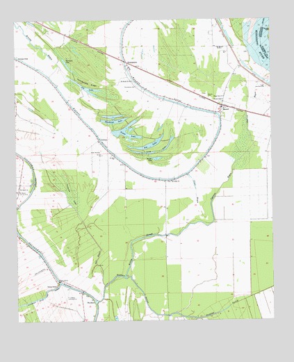
Mound, LA USGS Topographic Map
Click on map above to begin viewing in our Map Viewer.

This topographic map contains these locations and features:
Feature Name Type Latitude Longitude GNIS ID View Map
Alcadone PlantationLocaleN32.3404°W91.1001°549203View Map
Big LakeLakeN32.3233°W91.0605°553652View Map
California PlantationLocaleN32.3551°W91.0718°549210View Map
Cape PlantationLocaleN32.2710°W91.1098°549212View Map
Catfish LakeSwampN32.2793°W91.1057°549213View Map
Christmas Lake (historical)LakeN32.2538°W91.0221°549215View Map
ColemanPopulated PlaceN32.3257°W91.0846°541074View Map
Compton LakeSwampN32.3032°W91.0984°554064View Map
Cross BayouGutN32.3035°W91.0373°534269View Map
Crystal Springs PlantationLocaleN32.2507°W91.0173°549216View Map
Cypress BayouGutN32.3057°W91.0251°534335View Map
Dry Lake (historical)LakeN32.2954°W91.1093°549222View Map
Gar BayouGutN32.2763°W91.0857°554508View Map
Harper BayouGutN32.2640°W91.0665°535534View Map
Harrison LakeLakeN32.3579°W91.1004°554671View Map
Interchange 182CrossingN32.3296°W91.0237°541536View Map
K C Ranch Landing StripAirportN32.2599°W91.1009°549238View Map
Killarney Church (historical)ChurchN32.3488°W91.0029°549240View Map
Killarney PlanatationLocaleN32.3538°W91.0176°549241View Map
Long LakeLakeN32.3201°W91.0620°555153View Map
Mexico Store (historical)LocaleN32.3418°W91.0468°549244View Map
MoundPopulated PlaceN32.3393°W91.0240°543493View Map
Mound CemeteryCemeteryN32.3438°W91.0307°537277View Map
Mound Fire District 1BuildingN32.3388°W91.0247°2673142View Map
Mound PlantationLocaleN32.3154°W91.0751°549249View Map
Mount Abbey ChurchChurchN32.3082°W91.0493°537283View Map
Mount Moriah Church Number 1ChurchN32.3635°W91.0259°537339View Map
Mount Moriah Church Number 2ChurchN32.3499°W91.0679°537340View Map
Mount Pilgrim ChurchChurchN32.3054°W91.1237°537382View Map
Mount Zilla Church (historical)ChurchN32.3585°W91.1226°549253View Map
Nebraska BarBarN32.3668°W91.0046°712199View Map
Nebraska LandingLocaleN32.3613°W91.0104°549254View Map
Rattlesnake RidgeRidgeN32.3485°W91.0887°538503View Map
Red Beard Dusting Service AirportAirportN32.3036°W91.1249°549211View Map
Roundaway-Bayou Vidal CutoffBendN32.2571°W91.1229°538752View Map
Saint James Church (historical)ChurchN32.3174°W91.1218°549263View Map
Saint John CemeteryCemeteryN32.3190°W91.0829°538873View Map
Saint John ChurchChurchN32.3179°W91.0765°555896View Map
Sandbank LakeLakeN32.3330°W91.0759°555970View Map
Shady Grove ChurchChurchN32.3429°W91.0232°539280View Map
Sip LakeLakeN32.3489°W91.0944°556053View Map
Solomon TempleChurchN32.2649°W91.1057°556081View Map
Solomons Temple Church (historical)ChurchN32.3713°W91.0723°549266View Map
Texas LakeLakeN32.3277°W91.0705°556224View Map
Texas PlantationLocaleN32.3065°W91.0521°549273View Map
The BasinBasinN32.2582°W91.0871°539839View Map
Thomas ChapelChurchN32.3418°W91.0234°539877View Map
ThomastownPopulated PlaceN32.3574°W91.0698°539888View Map
Thomastown CemeteryCemeteryN32.3476°W91.0658°539889View Map
Thomastown SchoolSchoolN32.3549°W91.0684°549274View Map
Thompson Church (historical)ChurchN32.3185°W91.0318°549275View Map
Trinidad PlantationLocaleN32.3029°W91.1201°549276View Map
Vicksburg Tallulah Regional AirportAirportN32.3535°W91.0258°2013826View Map
Village of MoundCivilN32.3330°W91.0244°2407508View Map
Walnut BayouLakeN32.3450°W91.0561°540214View Map
Ward OneCivilN32.3532°W91.0571°545121View Map
Willow SloughLakeN32.2823°W91.0702°540471View Map
Yerger LakeLakeN32.3178°W91.0586°556484View Map
Yerger Landing StripAirportN32.3482°W91.0043°549278View Map
Youngs LandingLocaleN32.3551°W91.0043°549279View Map

Note: Coordinates in the location and feature list above are referenced to NAD83 datum.


Copyright (C) 2008-2025 Ryan Niemi / Sunset Dynamics ... All Rights Reserved