TopoQuest Logo
Do you find TopoQuest useful?
Help keep TopoQuest running and adding new maps/features by donating!
Bitcoin:  19c7KJd3qBynnjoSw5npx9KScwjBe4ifkT
Litecoin:  LXs6TkuXGGXo1vDsWCkWVdjQX94eUKd6ui
Home View Maps Find Maps Find Places Resources & Links


Franklin, Pennsylvania Topographic Map

USGS Map Title: Franklin, PA
USGS Map MRC: 41079D7
DRG (GeoTIFF) Download: o41079d7.tif


Neighboring USGS Topographic Map Quads:


  Sugar Lake, PA  
41079E8
 

  Dempseytown, PA  
41079E7
 

  Titusville South, PA  
41079E6
 

  Utica, PA  
41079D8
 

  Franklin, PA  
41079D7
 

  Oil City, PA  
41079D6
 

  Polk, PA  
41079C8
 

  Kennerdell, PA  
41079C7
 

  Cranberry, PA  
41079C6


Map MRC Location:

N42°
W80°
N42°
W79°
H8 H7 H6 H5 H4 H3 H2 H1
G8 G7 G6 G5 G4 G3 G2 G1
F8 F7 F6 F5 F4 F3 F2 F1
E8 E7 E6 E5 E4 E3 E2 E1
D8 D7 D6 D5 D4 D3 D2 D1
C8 C7 C6 C5 C4 C3 C2 C1
B8 B7 B6 B5 B4 B3 B2 B1
A8 A7 A6 A5 A4 A3 A2 A1
N41°
W80°
N41°
W79°

Franklin, PA USGS 1:24K Topographic Map Preview:
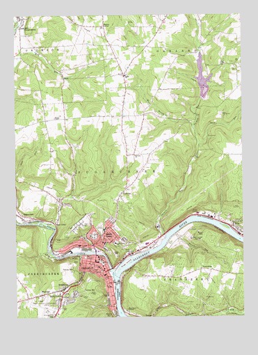
Franklin, PA USGS Topographic Map
Click on map above to begin viewing in our Map Viewer.

This topographic map contains these locations and features:
Feature Name Type Latitude Longitude GNIS ID View Map
Bethel ChurchChurchN41.4751°W79.8126°1198422View Map
Bleakley HillPopulated PlaceN41.4048°W79.8262°1198450View Map
Borough of CooperstownCivilN41.4998°W79.8736°1215637View Map
Borough of SugarcreekCivilN41.4380°W79.8184°1215643View Map
Borough of Sugarcreek Police DepartmentBuildingN41.4078°W79.8263°2780200View Map
Brannon RunStreamN41.4117°W79.7564°1198470View Map
BredinsburgPopulated PlaceN41.3948°W79.7726°1203142View Map
Camp Singing HillsLocaleN41.4595°W79.7601°1198527View Map
Camp Wil-BeeLocaleN41.4967°W79.8109°1198531View Map
City of FranklinCivilN41.3883°W79.8313°1215638View Map
Community Ambulance ServiceBuildingN41.3933°W79.8266°2719463View Map
CooperstownPopulated PlaceN41.4987°W79.8703°1199851View Map
EclipseLocaleN41.4017°W79.8131°1200654View Map
First Ward SchoolSchoolN41.4042°W79.8376°1198734View Map
Fisher AirportAirportN41.4933°W79.8329°1194242View Map
Foster CornerPopulated PlaceN41.4139°W79.8531°1203612View Map
FranklinPopulated PlaceN41.3978°W79.8314°1199873View Map
Franklin CemeteryCemeteryN41.4123°W79.8284°1198769View Map
Franklin City Police DepartmentBuildingN41.3972°W79.8319°2780143View Map
Franklin Fire DepartmentBuildingN41.4002°W79.8306°2645067View Map
Franklin Hospital AirportAirportN41.3834°W79.8331°1194225View Map
Franklin Post OfficePost OfficeN41.3987°W79.8272°2779645View Map
French CreekStreamN41.3917°W79.8203°950689View Map
Galena HillPopulated PlaceN41.3945°W79.8431°1203649View Map
GallowayPopulated PlaceN41.4248°W79.8173°1198782View Map
Galloway ChurchChurchN41.4417°W79.8081°1198783View Map
GurnetLocaleN41.3901°W79.8314°1214191View Map
Gurney HillPopulated PlaceN41.3862°W79.8376°1203735View Map
Haslets CornerPopulated PlaceN41.4959°W79.8245°1203758View Map
Hill Top Airport (historical)AirportN41.3834°W79.7998°1194224View Map
Hoge IslandIslandN41.3973°W79.8145°1198895View Map
Lake CreekStreamN41.4987°W79.8745°1198988View Map
MapledalePopulated PlaceN41.3842°W79.8609°1199109View Map
MasonPopulated PlaceN41.4737°W79.8470°1204116View Map
Miller-Sibley FieldParkN41.4084°W79.8306°1199169View Map
Mount Zion CemeteryCemeteryN41.4080°W79.8269°1199202View Map
Oak Forest School (historical)SchoolN41.4526°W79.8464°1200640View Map
Oak HillPopulated PlaceN41.4128°W79.8398°1199243View Map
Oakland SchoolSchoolN41.4867°W79.8023°1200641View Map
Patchel RunStreamN41.4117°W79.8528°1209317View Map
Pioneer CemeteryCemeteryN41.4007°W79.8362°1199317View Map
Point HillPopulated PlaceN41.4017°W79.8212°1204431View Map
PrenticeLocaleN41.4076°W79.7856°1200638View Map
Prichard School (historical)SchoolN41.4859°W79.7723°1200639View Map
Read RunStreamN41.4464°W79.7731°1199360View Map
RenoPopulated PlaceN41.4098°W79.7523°1199372View Map
Reno Post OfficePost OfficeN41.4096°W79.7519°2779598View Map
Reno ReservoirReservoirN41.4203°W79.7520°1199373View Map
Reno Volunteer Fire DepartmentBuildingN41.4097°W79.7516°2645009View Map
River Ridge Golf CourseLocaleN41.3998°W79.7573°1205782View Map
Rocky GrovePopulated PlaceN41.4051°W79.8320°1199406View Map
Rocky Grove Volunteer Fire DepartmentBuildingN41.4126°W79.8210°2644766View Map
Saint Johns ChurchChurchN41.3956°W79.8287°1199443View Map
Saint Patricks CemeteryCemeteryN41.4170°W79.8351°1199465View Map
Saint Patricks SchoolSchoolN41.3926°W79.8259°1199466View Map
Seneca RunStreamN41.4095°W79.7864°1199507View Map
Seventh Saint SchoolSchoolN41.3876°W79.8231°1199508View Map
Speer Public Golf CourseLocaleN41.4964°W79.7964°1206136View Map
Two Mile Run DamDamN41.4659°W79.7715°1195593View Map
Two Mile Run ReservoirReservoirN41.4651°W79.7714°1195594View Map
Twomile RunStreamN41.4084°W79.7917°1199712View Map
Twomile Run County ParkParkN41.4842°W79.7714°1205110View Map
UniontownPopulated PlaceN41.3867°W79.8487°1199716View Map
Valley Grove SchoolSchoolN41.4056°W79.8198°1199721View Map
Venango CountyCivilN41.4010°W79.7579°1213690View Map
Venango County Sheriff's OfficeBuildingN41.3976°W79.8269°2780308View Map
Venango Regional AirportAirportN41.3772°W79.8576°1194222View Map
Venango Regional Airport Aircraft Rescue and Fire FightingBuildingN41.3768°W79.8555°2645725View Map
West Branch Twomile RunStreamN41.4545°W79.7764°1199762View Map
WFRA-AM (Franklin)TowerN41.3909°W79.8117°1200500View Map
White Fathers NovitiateSchoolN41.4070°W79.7778°1199783View Map
White Sisters NovitiateSchoolN41.3778°W79.8139°1199786View Map
Wooden ChapelChurchN41.4576°W79.8526°1199811View Map
WVEN-FM (Franklin)TowerN41.3909°W79.8117°1200306View Map

Note: Coordinates in the location and feature list above are referenced to NAD83 datum.


Copyright (C) 2008-2025 Ryan Niemi / Sunset Dynamics ... All Rights Reserved