TopoQuest Logo
Do you find TopoQuest useful?
Help keep TopoQuest running and adding new maps/features by donating!
Bitcoin:  19c7KJd3qBynnjoSw5npx9KScwjBe4ifkT
Litecoin:  LXs6TkuXGGXo1vDsWCkWVdjQX94eUKd6ui
Home View Maps Find Maps Find Places Resources & Links


Sugar Lake, Pennsylvania Topographic Map

USGS Map Title: Sugar Lake, PA
USGS Map MRC: 41079E8
DRG (GeoTIFF) Download: o41079e8.tif


Neighboring USGS Topographic Map Quads:


  Blooming Valley, PA  
41080F1
 

  Townville, PA  
41079F8
 

  Centerville, PA  
41079F7
 

  Cochranton, PA  
41080E1
 

  Sugar Lake, PA  
41079E8
 

  Dempseytown, PA  
41079E7
 

  New Lebanon, PA  
41080D1
 

  Utica, PA  
41079D8
 

  Franklin, PA  
41079D7


Map MRC Location:

N42°
W80°
N42°
W79°
H8 H7 H6 H5 H4 H3 H2 H1
G8 G7 G6 G5 G4 G3 G2 G1
F8 F7 F6 F5 F4 F3 F2 F1
E8 E7 E6 E5 E4 E3 E2 E1
D8 D7 D6 D5 D4 D3 D2 D1
C8 C7 C6 C5 C4 C3 C2 C1
B8 B7 B6 B5 B4 B3 B2 B1
A8 A7 A6 A5 A4 A3 A2 A1
N41°
W80°
N41°
W79°

Sugar Lake, PA USGS 1:24K Topographic Map Preview:
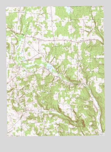
Sugar Lake, PA USGS Topographic Map
Click on map above to begin viewing in our Map Viewer.

This topographic map contains these locations and features:
Feature Name Type Latitude Longitude GNIS ID View Map
Black AshPopulated PlaceN41.5912°W79.9003°1169685View Map
Black Ash ChurchChurchN41.5926°W79.8903°1169686View Map
Brawley CemeteryCemeteryN41.6000°W79.9923°1170179View Map
Brawley RunStreamN41.5928°W79.9798°1170180View Map
Dead-Ice Terminal MoraineRidgeN41.5842°W79.9303°1201304View Map
DeckardPopulated PlaceN41.5245°W79.9756°1173042View Map
Donation Hill ChurchChurchN41.5256°W79.9178°1173367View Map
Donation School (historical)SchoolN41.5295°W79.9173°1201016View Map
Drake SchoolSchoolN41.5451°W79.9767°1200905View Map
East WaynePopulated PlaceN41.5723°W79.9078°1203485View Map
Erie National Wildlife RefugeParkN41.5834°W79.9841°1192436View Map
Erie NWR Pool Number NineDamN41.5801°W79.9881°1195677View Map
Erie NWR Pool Number SevenDamN41.5767°W79.9848°1195672View Map
Little Sugar CreekStreamN41.6023°W79.8853°1179684View Map
Little Sugar Creek DamDamN41.6217°W79.9198°1195708View Map
Maple Cave Park Airport (historical)AirportN41.5030°W79.8814°1194245View Map
McCauley RunStreamN41.5120°W79.9067°1180662View Map
McDaniel ChurchChurchN41.5664°W79.9831°1180685View Map
McDaniels SchoolSchoolN41.5673°W79.9851°1200947View Map
Mount HopePopulated PlaceN41.5939°W79.9576°1181706View Map
Mount Hope ChurchChurchN41.5870°W79.9626°1201080View Map
Mount Joy ChurchChurchN41.5426°W79.9487°1181732View Map
Mount Joy School (historical)SchoolN41.5414°W79.9417°1200906View Map
Mount Pleasant ChurchChurchN41.5031°W79.9173°1181826View Map
Mount Pleasant SchoolSchoolN41.5031°W79.9214°1200908View Map
Oakes SchoolSchoolN41.5806°W79.9576°1201081View Map
Peters CemeteryCemeteryN41.5234°W79.9562°1183620View Map
Peters SchoolSchoolN41.5176°W79.9548°1200907View Map
Raughs CornersLocaleN41.5012°W79.9503°1212147View Map
Saint Johns ChurchChurchN41.5234°W79.9762°1186164View Map
Sugar Grove SchoolSchoolN41.5223°W79.8817°1201015View Map
Sugar LakeLakeN41.5666°W79.9445°1188951View Map
Sugar Lake ChurchChurchN41.5601°W79.9331°1188952View Map
Sugar Lake SchoolSchoolN41.5570°W79.9328°1201082View Map
Township of JacksonCivilN41.5124°W79.8770°1217146View Map
Township of WayneCivilN41.5473°W79.9801°1216326View Map
Trout RunStreamN41.5462°W79.8973°1189856View Map
Trout Run School (historical)SchoolN41.5506°W79.8973°1201017View Map
Wilson MillsPopulated PlaceN41.5498°W79.9109°1204962View Map

Note: Coordinates in the location and feature list above are referenced to NAD83 datum.


Copyright (C) 2008-2025 Ryan Niemi / Sunset Dynamics ... All Rights Reserved