TopoQuest Logo
Do you find TopoQuest useful?
Help keep TopoQuest running and adding new maps/features by donating!
Bitcoin:  19c7KJd3qBynnjoSw5npx9KScwjBe4ifkT
Litecoin:  LXs6TkuXGGXo1vDsWCkWVdjQX94eUKd6ui
Home View Maps Find Maps Find Places Resources & Links


Utica, Pennsylvania Topographic Map

USGS Map Title: Utica, PA
USGS Map MRC: 41079D8
DRG (GeoTIFF) Download: o41079d8.tif


Neighboring USGS Topographic Map Quads:


  Cochranton, PA  
41080E1
 

  Sugar Lake, PA  
41079E8
 

  Dempseytown, PA  
41079E7
 

  New Lebanon, PA  
41080D1
 

  Utica, PA  
41079D8
 

  Franklin, PA  
41079D7
 

  Sandy Lake, PA  
41080C1
 

  Polk, PA  
41079C8
 

  Kennerdell, PA  
41079C7


Map MRC Location:

N42°
W80°
N42°
W79°
H8 H7 H6 H5 H4 H3 H2 H1
G8 G7 G6 G5 G4 G3 G2 G1
F8 F7 F6 F5 F4 F3 F2 F1
E8 E7 E6 E5 E4 E3 E2 E1
D8 D7 D6 D5 D4 D3 D2 D1
C8 C7 C6 C5 C4 C3 C2 C1
B8 B7 B6 B5 B4 B3 B2 B1
A8 A7 A6 A5 A4 A3 A2 A1
N41°
W80°
N41°
W79°

Utica, PA USGS 1:24K Topographic Map Preview:
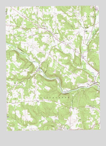
Utica, PA USGS Topographic Map
Click on map above to begin viewing in our Map Viewer.

This topographic map contains these locations and features:
Feature Name Type Latitude Longitude GNIS ID View Map
Beatty RunStreamN41.4612°W79.8912°1198384View Map
Bethesda Church (historical)ChurchN41.4345°W79.9148°1200636View Map
Bodine CornersLocaleN41.4051°W79.9598°1198458View Map
Borough of UticaCivilN41.4360°W79.9592°1215644View Map
Canal CenterPopulated PlaceN41.4720°W79.9339°1198535View Map
Canal ChurchChurchN41.4798°W79.9481°1198536View Map
Forest Chapel CemeteryCemeteryN41.4545°W79.8873°1198751View Map
Foster RunStreamN41.4548°W79.8989°1198762View Map
HannasvillePopulated PlaceN41.4778°W79.9478°1198858View Map
Hannasville Census Designated PlaceCensusN41.4716°W79.9310°2584465View Map
Lick RunStreamN41.4253°W79.8753°1199037View Map
Lupher ChapelChurchN41.4623°W79.9153°1199097View Map
McCuneLocaleN41.4695°W79.9887°1212140View Map
McCune RunStreamN41.4595°W79.9881°1199136View Map
McKenzie CornersLocaleN41.4756°W79.8945°1199138View Map
Mill CreekStreamN41.4337°W79.9503°1199157View Map
Millcreek CemeteryCemeteryN41.4220°W79.9884°1199163View Map
NicklinPopulated PlaceN41.3984°W79.8853°1199224View Map
NilesPopulated PlaceN41.3978°W79.9148°1199225View Map
North SandyPopulated PlaceN41.3884°W79.9995°1204305View Map
Oakwood CemeteryCemeteryN41.4795°W79.9481°1199245View Map
Polk CenterLocaleN41.3795°W79.9239°1212138View Map
Polk CenterLocaleN41.3976°W79.9481°1212139View Map
Polk DamDamN41.3751°W79.9298°1195511View Map
Port Roydel Airport (historical)AirportN41.4726°W79.9981°1194238View Map
Reynolds ChurchChurchN41.4031°W79.9892°1199376View Map
Reynolds School (historical)SchoolN41.4031°W79.9895°1200637View Map
Rocky Grove Volunteer Fire Department SubstationBuildingN41.4230°W79.8837°2645399View Map
Sleepy Hollow Golf CourseLocaleN41.4659°W79.8920°1213362View Map
Sugar CreekStreamN41.4178°W79.8762°1199987View Map
Sugar Creek Memorial ChurchChurchN41.4773°W79.8912°1199637View Map
SugarcreekPopulated PlaceN41.4214°W79.8812°1199989View Map
TakitezyPopulated PlaceN41.4134°W79.9195°1204795View Map
The Farm AirportAirportN41.4582°W79.9855°1194236View Map
Township of CanalCivilN41.4777°W79.9470°1217139View Map
Township of FrenchcreekCivilN41.4005°W79.9395°1217144View Map
UticaPopulated PlaceN41.4356°W79.9573°1199720View Map
Utica Elementary SchoolSchoolN41.4351°W79.9592°1205653View Map
Utica Post OfficePost OfficeN41.4346°W79.9579°2768371View Map
Utica Post Office (historical)Post OfficeN41.4359°W79.9581°1214489View Map
Utica Volunteer Fire Company Station 1BuildingN41.4349°W79.9571°2645402View Map
Utica Volunteer Fire Company Station 2BuildingN41.4746°W79.9393°2645368View Map
Warden RunStreamN41.4370°W79.8973°1199744View Map
Wolf RunStreamN41.4717°W79.8814°1199807View Map
WyattvillePopulated PlaceN41.4503°W79.8967°1199818View Map

Note: Coordinates in the location and feature list above are referenced to NAD83 datum.


Copyright (C) 2008-2025 Ryan Niemi / Sunset Dynamics ... All Rights Reserved