TopoQuest Logo
Do you find TopoQuest useful?
Help keep TopoQuest running and adding new maps/features by donating!
Bitcoin:  19c7KJd3qBynnjoSw5npx9KScwjBe4ifkT
Litecoin:  LXs6TkuXGGXo1vDsWCkWVdjQX94eUKd6ui
Home View Maps Find Maps Find Places Resources & Links


Frolona, Georgia Topographic Map

USGS Map Title: Frolona, GA
USGS Map MRC: 33085C2
DRG (GeoTIFF) Download: o33085c2.tif


Neighboring USGS Topographic Map Quads:


  Graham, AL  
33085D3
 

  Roopville, GA  
33085D2
 

  Lowell, GA  
33085D1
 

  Napoleon, AL  
33085C3
 

  Frolona, GA  
33085C2
 

  Franklin, GA  
33085C1
 

  Roanoke East, AL  
33085B3
 

  Glenn, GA  
33085B2
 

  Hillcrest, GA  
33085B1


Map MRC Location:

N34°
W86°
N34°
W85°
H8 H7 H6 H5 H4 H3 H2 H1
G8 G7 G6 G5 G4 G3 G2 G1
F8 F7 F6 F5 F4 F3 F2 F1
E8 E7 E6 E5 E4 E3 E2 E1
D8 D7 D6 D5 D4 D3 D2 D1
C8 C7 C6 C5 C4 C3 C2 C1
B8 B7 B6 B5 B4 B3 B2 B1
A8 A7 A6 A5 A4 A3 A2 A1
N33°
W86°
N33°
W85°

Frolona, GA USGS 1:24K Topographic Map Preview:
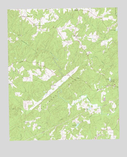
Frolona, GA USGS Topographic Map
Click on map above to begin viewing in our Map Viewer.

This topographic map contains these locations and features:
Feature Name Type Latitude Longitude GNIS ID View Map
AdamsonPopulated PlaceN33.2679°W85.2322°331000View Map
Allens LakeReservoirN33.2797°W85.1588°310466View Map
Allens Lake DamDamN33.2793°W85.1586°337581View Map
Almon CemeteryCemeteryN33.2826°W85.2227°346996View Map
Answered Prayer AirportAirportN33.2542°W85.1707°347090View Map
Awbreys LakeReservoirN33.2639°W85.1726°310688View Map
Awbreys Lake DamDamN33.2651°W85.1699°337583View Map
Backbone RidgeRidgeN33.2943°W85.1913°310705View Map
Barkers CrossroadsPopulated PlaceN33.3740°W85.1711°310800View Map
Camp Ground School (historical)SchoolN33.2548°W85.1486°347009View Map
Cedar CreekStreamN33.2821°W85.1786°312463View Map
Centralia LakeReservoirN33.3066°W85.1345°312535View Map
Centralia Lake DamDamN33.3068°W85.1344°339363View Map
Copeland CreekStreamN33.3023°W85.1908°312963View Map
Crews CreekStreamN33.3079°W85.1838°313114View Map
EleryPopulated PlaceN33.3554°W85.1338°326261View Map
Flat Rock CampgroundLocaleN33.2537°W85.1483°355827View Map
Flat Rock Campgrounds ChurchChurchN33.2540°W85.1483°347043View Map
FrolonaPopulated PlaceN33.3246°W85.2361°331776View Map
Frolona Fire Department Station 7BuildingN33.3211°W85.2495°2604461View Map
Heard CountyCivilN33.2970°W85.1283°347067View Map
Heard County QuarryMineN33.2558°W85.1750°2563625View Map
Hearn CemeteryCemeteryN33.2562°W85.1322°315286View Map
HyattPopulated PlaceN33.3437°W85.1694°347078View Map
Lancaster CemeteryCemeteryN33.3518°W85.2263°347082View Map
Lashley CemeteryCemeteryN33.2523°W85.1491°347083View Map
Little CreekStreamN33.2865°W85.2144°317038View Map
Macedonia CemeteryCemeteryN33.3496°W85.2347°347086View Map
Macedonia Missionary Baptist ChurchChurchN33.2671°W85.2347°347087View Map
Maedonia ChurchChurchN33.3501°W85.2344°317600View Map
Mahailey CrossroadsPopulated PlaceN33.3590°W85.2186°332307View Map
Merrill-Roop CemeteryCemeteryN33.2882°W85.1924°347092View Map
Miller CemeteryCemeteryN33.2843°W85.1299°347093View Map
Mount Olive CemeteryCemeteryN33.3087°W85.1713°347095View Map
Mount Olive Missionary Baptist ChurchChurchN33.3085°W85.1713°318767View Map
Mount Salem School (historical)SchoolN33.3210°W85.1594°347098View Map
New Hope CemeteryCemeteryN33.2632°W85.2141°347104View Map
New Hope Missionary Baptist ChurchChurchN33.2632°W85.2141°319409View Map
New Spring Congregational Methodist ChurchChurchN33.3487°W85.1733°319546View Map
New Springs CemeteryCemeteryN33.3490°W85.1733°347106View Map
Noles CemeteryCemeteryN33.3207°W85.2094°347108View Map
Notnomis Acres LakeReservoirN33.3537°W85.1259°319716View Map
Old New Hope ChurchChurchN33.2612°W85.2119°347115View Map
Olive Branch CemeteryCemeteryN33.3015°W85.1360°347118View Map
Olive Branch Missionary Baptist ChurchChurchN33.3012°W85.1358°320046View Map
RidgewayPopulated PlaceN33.3051°W85.2486°347132View Map
Ridgeway CemeteryCemeteryN33.3048°W85.2494°347133View Map
Ridgeway Methodist ChurchChurchN33.3043°W85.2486°321597View Map
Ridgeway School (historical)SchoolN33.3046°W85.2488°347134View Map
RidleyPopulated PlaceN33.3012°W85.2002°332854View Map
Ridley-Davis CemeteryCemeteryN33.3023°W85.2005°347135View Map
RockridgePopulated PlaceN33.3054°W85.1338°332890View Map
Rooks-Lewis CemeteryCemeteryN33.2618°W85.2099°347141View Map
Salem CemeteryCemeteryN33.3204°W85.1588°347142View Map
Salem United Methodist ChurchChurchN33.3207°W85.1594°322362View Map
ShellnutPopulated PlaceN33.3015°W85.1347°347144View Map
SimpsonPopulated PlaceN33.3473°W85.1719°333059View Map
Simpson School (historical)SchoolN33.3418°W85.1677°347146View Map
Skinner ChapelChurchN33.3062°W85.1336°323057View Map
Stone Mill MountainSummitN33.3040°W85.1297°347149View Map
Tolieson BranchStreamN33.2740°W85.1441°324211View Map
Town CreekStreamN33.2996°W85.1938°153707View Map
ViolaPopulated PlaceN33.2548°W85.1488°326575View Map
Walnut Hill Baptist Church (historical)ChurchN33.3462°W85.2469°347160View Map
Walnut Hill School (historical)SchoolN33.3459°W85.2469°347161View Map
Watkins BridgeBridgeN33.2826°W85.1263°347164View Map
Wood CemeteryCemeteryN33.2915°W85.1699°347172View Map
Yates CrossroadsPopulated PlaceN33.3679°W85.2322°326602View Map

Note: Coordinates in the location and feature list above are referenced to NAD83 datum.


Copyright (C) 2008-2025 Ryan Niemi / Sunset Dynamics ... All Rights Reserved