TopoQuest Logo
Do you find TopoQuest useful?
Help keep TopoQuest running and adding new maps/features by donating!
Bitcoin:  19c7KJd3qBynnjoSw5npx9KScwjBe4ifkT
Litecoin:  LXs6TkuXGGXo1vDsWCkWVdjQX94eUKd6ui
Home View Maps Find Maps Find Places Resources & Links


Roanoke East, Alabama Topographic Map

USGS Map Title: Roanoke East, AL
USGS Map MRC: 33085B3
DRG (GeoTIFF) Download: o33085b3.tif


Neighboring USGS Topographic Map Quads:


  Wedowee, AL  
33085C4
 

  Napoleon, AL  
33085C3
 

  Frolona, GA  
33085C2
 

  Roanoke West, AL  
33085B4
 

  Roanoke East, AL  
33085B3
 

  Glenn, GA  
33085B2
 

  Milltown, AL  
33085A4
 

  Five Points, AL  
33085A3
 

  Abbottsford, GA  
33085A2


Map MRC Location:

N34°
W86°
N34°
W85°
H8 H7 H6 H5 H4 H3 H2 H1
G8 G7 G6 G5 G4 G3 G2 G1
F8 F7 F6 F5 F4 F3 F2 F1
E8 E7 E6 E5 E4 E3 E2 E1
D8 D7 D6 D5 D4 D3 D2 D1
C8 C7 C6 C5 C4 C3 C2 C1
B8 B7 B6 B5 B4 B3 B2 B1
A8 A7 A6 A5 A4 A3 A2 A1
N33°
W86°
N33°
W85°

Roanoke East, AL USGS 1:24K Topographic Map Preview:
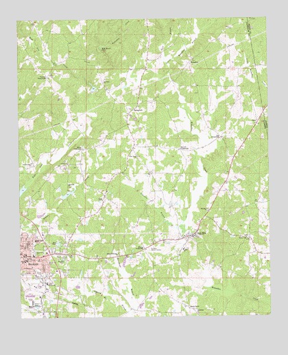
Roanoke East, AL USGS Topographic Map
Click on map above to begin viewing in our Map Viewer.

This topographic map contains these locations and features:
Feature Name Type Latitude Longitude GNIS ID View Map
Bacon LevelPopulated PlaceN33.1287°W85.2908°156011View Map
Barrett CrossroadsPopulated PlaceN33.1954°W85.2938°156030View Map
Bartlett PondReservoirN33.1496°W85.3532°113522View Map
Bell LakeLakeN33.1767°W85.3511°140188View Map
Bethany Lime ChurchChurchN33.1573°W85.2599°164027View Map
Bethel Methodist Episcopal ChurchChurchN33.1471°W85.3630°140189View Map
Booger Hill CemeteryCemeteryN33.1482°W85.3611°114729View Map
Brown CemeteryCemeteryN33.1434°W85.3644°114988View Map
Cedarwood CemeteryCemeteryN33.1521°W85.3680°115822View Map
Center ChapelChurchN33.1740°W85.3333°115831View Map
Center ChapelPopulated PlaceN33.1771°W85.3322°140203View Map
City of RoanokeCivilN33.1454°W85.3694°2404627View Map
Dickert Volunteer Fire DepartmentBuildingN33.1498°W85.3329°2683135View Map
Fellowship Baptist ChurchChurchN33.1271°W85.2869°118246View Map
First Baptist ChurchChurchN33.1512°W85.3733°140212View Map
First United Methodist ChurchChurchN33.1518°W85.3719°140245View Map
Forest Home ChurchChurchN33.1923°W85.3155°118496View Map
Greshamton (historical)LocaleN33.2001°W85.3611°139668View Map
Handley High SchoolSchoolN33.1487°W85.3727°140221View Map
Handley Middle SchoolSchoolN33.1493°W85.3719°165439View Map
High Pine Creek Lake Number 3ReservoirN33.1751°W85.3533°131270View Map
High Pine Creek Watershed Dam Number 3DamN33.1751°W85.3533°131269View Map
High ShoalsPopulated PlaceN33.2340°W85.3413°140223View Map
High Shoals FallsFallsN33.2371°W85.3328°120069View Map
Highpine Creek Lake Number 1ReservoirN33.2185°W85.3366°131315View Map
Highpine Creek Watershed Dam Number 1DamN33.2185°W85.3366°131314View Map
Knight Enloe Elementary SchoolSchoolN33.1573°W85.3672°165461View Map
Lebanon ChurchChurchN33.1896°W85.3505°121453View Map
Lee CrossroadsPopulated PlaceN33.1998°W85.2736°156594View Map
LimePopulated PlaceN33.1587°W85.2599°156610View Map
Little Wehadkee BranchStreamN33.2271°W85.2986°121906View Map
Macedonia ChurchChurchN33.1804°W85.3505°122159View Map
Midway Full Gospel ChurchChurchN33.1510°W85.3263°164078View Map
Moores CrossroadsPopulated PlaceN33.1537°W85.3127°156732View Map
Neighborhood Chapel Church of GodChurchN33.1590°W85.3736°140246View Map
Old Salem Primitive Baptist Church CemeteryCemeteryN33.1376°W85.3108°1884384View Map
ParanPopulated PlaceN33.2071°W85.2555°156857View Map
Paran ChurchChurchN33.2085°W85.2536°163656View Map
Pine Hill ChurchChurchN33.2404°W85.2749°135799View Map
Randolph County Training SchoolSchoolN33.1396°W85.3619°135806View Map
Randolph Memory GardensCemeteryN33.1537°W85.3108°164110View Map
Rice DamDamN33.1568°W85.3566°131253View Map
Rice PondReservoirN33.1563°W85.3556°153142View Map
RoanokePopulated PlaceN33.1512°W85.3722°153164View Map
Roanoke City HallBuildingN33.1510°W85.3724°135810View Map
Roanoke DivisionCivilN33.1812°W85.3402°165935View Map
Roanoke Fire Department Station 2BuildingN33.1297°W85.3691°2683148View Map
Roanoke Municipal AirportAirportN33.1296°W85.3742°129454View Map
Roanoke Police Department HeadquartersBuildingN33.1511°W85.3746°2751849View Map
Roanoke Post OfficePost OfficeN33.1496°W85.3573°167900View Map
Roanoke Public LibraryBuildingN33.1657°W85.3713°135811View Map
Rock MillsPopulated PlaceN33.1598°W85.2874°153181View Map
Rock Mills Census Designated PlaceCensusN33.1563°W85.2862°2403487View Map
Rock Mills ChurchChurchN33.1626°W85.2855°135814View Map
Rock Mills First Baptist ChurchChurchN33.1590°W85.2924°135813View Map
Rock Mills Junior High SchoolSchoolN33.1537°W85.2924°135815View Map
Rock Mills Volunteer Fire DepartmentBuildingN33.1605°W85.2861°2683136View Map
Salem Primitive Baptist Church (historical)ChurchN33.1371°W85.3111°1884383View Map
Schuessler DamDamN33.2218°W85.3183°131321View Map
Southside Baptist ChurchChurchN33.1298°W85.3652°153511View Map
SpringfieldPopulated PlaceN33.2121°W85.3172°157096View Map
Springfield Baptist ChurchChurchN33.2132°W85.3169°135820View Map
Springfield CemeteryCemeteryN33.2132°W85.3161°1805735View Map
Stitt BranchStreamN33.2321°W85.3002°127413View Map
Taylor Crossroads ChurchChurchN33.2282°W85.3583°135823View Map
Taylors CrossroadsPopulated PlaceN33.2260°W85.3605°157146View Map
Trinity Baptist ChurchChurchN33.1541°W85.3622°2651978View Map
Vineyard BranchStreamN33.1626°W85.2922°128464View Map
WehadkeePopulated PlaceN33.2326°W85.2880°157228View Map
Wehadkee ChurchChurchN33.1701°W85.2811°128707View Map
Wehadkee ChurchChurchN33.2235°W85.3319°128708View Map
Welcome Home ChurchChurchN33.1896°W85.3686°128727View Map
WELR-AM (Roanoke)TowerN33.1626°W85.3749°160991View Map
White CrossroadsPopulated PlaceN33.1957°W85.3433°157247View Map

Note: Coordinates in the location and feature list above are referenced to NAD83 datum.


Copyright (C) 2008-2025 Ryan Niemi / Sunset Dynamics ... All Rights Reserved