TopoQuest Logo
Do you find TopoQuest useful?
Help keep TopoQuest running and adding new maps/features by donating!
Bitcoin:  19c7KJd3qBynnjoSw5npx9KScwjBe4ifkT
Litecoin:  LXs6TkuXGGXo1vDsWCkWVdjQX94eUKd6ui
Home View Maps Find Maps Find Places Resources & Links


Gentry, Arkansas Topographic Map

USGS Map Title: Gentry, AR
USGS Map MRC: 36094C4
DRG (GeoTIFF) Download: o36094c4.tif


Neighboring USGS Topographic Map Quads:


  Colcord NE, AR  
36094D5
 

  Gravette, AR  
36094D4
 

  Hiwasse, AR  
36094D3
 

  Cherokee City, AR  
36094C5
 

  Gentry, AR  
36094C4
 

  Centerton, AR  
36094C3
 

  Siloam Springs, AR  
36094B5
 

  Gallatin, AR  
36094B4
 

  Robinson, AR  
36094B3


Map MRC Location:

N37°
W95°
N37°
W94°
H8 H7 H6 H5 H4 H3 H2 H1
G8 G7 G6 G5 G4 G3 G2 G1
F8 F7 F6 F5 F4 F3 F2 F1
E8 E7 E6 E5 E4 E3 E2 E1
D8 D7 D6 D5 D4 D3 D2 D1
C8 C7 C6 C5 C4 C3 C2 C1
B8 B7 B6 B5 B4 B3 B2 B1
A8 A7 A6 A5 A4 A3 A2 A1
N36°
W95°
N36°
W94°

Gentry, AR USGS 1:24K Topographic Map Preview:
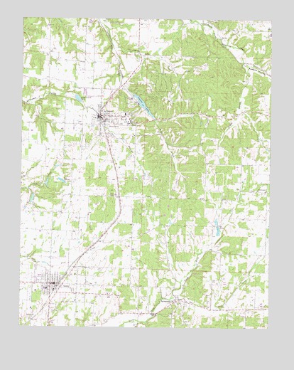
Gentry, AR USGS Topographic Map
Click on map above to begin viewing in our Map Viewer.

This topographic map contains these locations and features:
Feature Name Type Latitude Longitude GNIS ID View Map
Bethel Heights ChurchChurchN36.3059°W94.3816°46461View Map
Big SpringSpringN36.2620°W94.4208°75391View Map
City of DecaturCivilN36.3401°W94.4580°2404207View Map
City of GentryCivilN36.2572°W94.4908°2403688View Map
Clementine (historical)Populated PlaceN36.3731°W94.4516°75442View Map
Corner SpringSpringN36.3320°W94.4565°76674View Map
Cross Roads (historical)Populated PlaceN36.2862°W94.4441°75456View Map
Cross Roads School (historical)SchoolN36.2856°W94.4447°75457View Map
Crown (historical)Populated PlaceN36.2945°W94.3941°75458View Map
Crown School (historical)SchoolN36.2981°W94.3991°75459View Map
Crystal LakeReservoirN36.3402°W94.4392°74774View Map
Crystal Lake AirportAirportN36.3436°W94.4434°83673View Map
Crystal Lake DamDamN36.3439°W94.4442°79702View Map
DecaturPopulated PlaceN36.3359°W94.4608°76769View Map
Decatur CemeteryCemeteryN36.3359°W94.4572°75461View Map
Decatur Elementary SchoolSchoolN36.3525°W94.4659°75462View Map
Decatur Fire StationBuildingN36.3369°W94.4591°2116349View Map
Decatur High SchoolSchoolN36.3332°W94.4455°75463View Map
Decatur Middle SchoolSchoolN36.3324°W94.4468°2093347View Map
Decatur ParkParkN36.3340°W94.4616°75464View Map
Decatur Police DepartmentBuildingN36.3365°W94.4609°2119009View Map
Decatur Post OfficePost OfficeN36.3361°W94.4536°84542View Map
East Flint CreekStreamN36.2617°W94.4244°48759View Map
GentryPopulated PlaceN36.2676°W94.4847°77005View Map
Gentry CemeteryCemeteryN36.2537°W94.4938°49368View Map
Gentry Elementary SchoolSchoolN36.2656°W94.4877°75529View Map
Gentry High SchoolSchoolN36.2574°W94.4948°75530View Map
Gentry Intermediate SchoolSchoolN36.2656°W94.4882°2039012View Map
Gentry Middle SchoolSchoolN36.2567°W94.4947°75531View Map
Gentry Police DepartmentBuildingN36.2678°W94.4843°2119006View Map
Gentry Primary SchoolSchoolN36.2550°W94.4961°2039006View Map
Gentry Volunteer Fire DepartmentBuildingN36.2636°W94.4901°2116473View Map
Grape HollowValleyN36.3545°W94.3872°49559View Map
Guerrero Lake Number OneReservoirN36.2979°W94.4980°80138View Map
Guerrero Lake Number One DamDamN36.2984°W94.4985°80137View Map
Guerrero Lake Number ThreeReservoirN36.3084°W94.4872°80142View Map
Guerrero Lake Number Three DamDamN36.3084°W94.4885°80141View Map
Guerrero Lake Number Two DamDamN36.3034°W94.4935°80139View Map
Gurrero Lake Number TwoReservoirN36.3020°W94.4944°80140View Map
Midway ChurchChurchN36.3612°W94.4422°77657View Map
New Salem School (historical)SchoolN36.3704°W94.3805°75930View Map
North Flint CreekStreamN36.2617°W94.4244°52817View Map
Pawpaw HollowValleyN36.3565°W94.3858°53233View Map
Pleasant Valley School (historical)SchoolN36.2695°W94.3885°75975View Map
SpringtownPopulated PlaceN36.2609°W94.4233°78441View Map
Springtown CemeteryCemeteryN36.2598°W94.4169°76039View Map
Springtown Post OfficePost OfficeN36.2609°W94.4233°84639View Map
Springtown School (historical)SchoolN36.2587°W94.4238°76040View Map
Town of SpringtownCivilN36.2608°W94.4238°2407390View Map
Township of Decatur (historical)CivilN36.3417°W94.4349°69578View Map
Township of Flint (historical)CivilN36.2737°W94.4058°69583View Map
Township of Gentry (historical)CivilN36.2709°W94.4835°69586View Map
Trammell (historical)Populated PlaceN36.2945°W94.4708°76057View Map

Note: Coordinates in the location and feature list above are referenced to NAD83 datum.


Copyright (C) 2008-2025 Ryan Niemi / Sunset Dynamics ... All Rights Reserved