TopoQuest Logo
Do you find TopoQuest useful?
Help keep TopoQuest running and adding new maps/features by donating!
Bitcoin:  19c7KJd3qBynnjoSw5npx9KScwjBe4ifkT
Litecoin:  LXs6TkuXGGXo1vDsWCkWVdjQX94eUKd6ui
Home View Maps Find Maps Find Places Resources & Links


Gin Creek, Alabama Topographic Map

USGS Map Title: Gin Creek, AL
USGS Map MRC: 33087D6
DRG (GeoTIFF) Download: o33087d6.tif


Neighboring USGS Topographic Map Quads:


  Newtonville, AL  
33087E7
 

  New Lexington, AL  
33087E6
 

  Berry SE, AL  
33087E5
 

  Brownville, AL  
33087D7
 

  Gin Creek, AL  
33087D6
 

  Lake Tuscaloosa North, AL  
33087D5
 

  Elrod, AL  
33087C7
 

  Lake Lurleen, AL  
33087C6
 

  Lake Tuscaloosa South, AL  
33087C5


Map MRC Location:

N34°
W88°
N34°
W87°
H8 H7 H6 H5 H4 H3 H2 H1
G8 G7 G6 G5 G4 G3 G2 G1
F8 F7 F6 F5 F4 F3 F2 F1
E8 E7 E6 E5 E4 E3 E2 E1
D8 D7 D6 D5 D4 D3 D2 D1
C8 C7 C6 C5 C4 C3 C2 C1
B8 B7 B6 B5 B4 B3 B2 B1
A8 A7 A6 A5 A4 A3 A2 A1
N33°
W88°
N33°
W87°

Gin Creek, AL USGS 1:24K Topographic Map Preview:
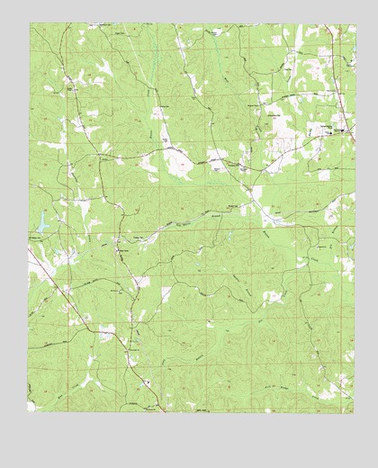
Gin Creek, AL USGS Topographic Map
Click on map above to begin viewing in our Map Viewer.

This topographic map contains these locations and features:
Feature Name Type Latitude Longitude GNIS ID View Map
Barbee CreekStreamN33.4321°W87.6597°113463View Map
Barbee School (historical)SchoolN33.4534°W87.6536°147835View Map
Bethabara Baptist ChurchChurchN33.3762°W87.7050°113983View Map
Bethabara CemeteryCemeteryN33.3759°W87.7050°147853View Map
Binions Creek (historical)LocaleN33.4384°W87.6592°147878View Map
Brownville ChurchChurchN33.3951°W87.7117°115028View Map
Church of GodChurchN33.4787°W87.6322°116141View Map
Deal School (historical)SchoolN33.4240°W87.6672°148049View Map
Dry BranchStreamN33.4229°W87.6350°117512View Map
Edmondson CemeteryCemeteryN33.4707°W87.6594°158819View Map
Espy CemeteryCemeteryN33.4859°W87.6533°118030View Map
Espy CreekStreamN33.4501°W87.6514°148105View Map
Espy SpringsSpringN33.4876°W87.6322°148106View Map
Espy Springs Church (historical)ChurchN33.4832°W87.6328°148107View Map
Fellowship Temple Assembly of God ChurchChurchN33.4537°W87.6683°118253View Map
Fernvale (historical)LocaleN33.4012°W87.7264°148124View Map
Friendship Baptist ChurchChurchN33.4546°W87.6708°118695View Map
Friendship CemeteryCemeteryN33.4412°W87.6542°158728View Map
Fulmer MineMineN33.4084°W87.7258°146437View Map
Gilliam CemeteryCemeteryN33.4965°W87.6794°118958View Map
Gin CreekStreamN33.4251°W87.6431°118987View Map
Gospel TabernacleChurchN33.4876°W87.6286°119187View Map
Haygood CemeteryCemeteryN33.4748°W87.6625°159026View Map
Haygood Methodist ChurchChurchN33.4743°W87.6628°119895View Map
Hendrix CemeteryCemeteryN33.4532°W87.6803°119963View Map
Hoehn MineMineN33.4051°W87.7286°146461View Map
Kemp CemeteryCemeteryN33.4734°W87.7011°121130View Map
Longs Store (historical)LocaleN33.4659°W87.6275°148345View Map
McConnell School (historical)SchoolN33.4296°W87.7489°157827View Map
McConnells (historical)LocaleN33.4021°W87.7481°157828View Map
Montgomery LakesPopulated PlaceN33.3979°W87.7095°1700463View Map
Montgomery Volunteer Fire DepartmentBuildingN33.3970°W87.7109°2682984View Map
Mount Zion CemeteryCemeteryN33.4134°W87.7156°148356View Map
Mount Zion Freewill Baptist ChurchChurchN33.4140°W87.7156°152530View Map
Nazareth CemeteryCemeteryN33.4282°W87.6394°148362View Map
Nazareth Primitive Baptist ChurchChurchN33.4287°W87.6395°152584View Map
Northside High SchoolSchoolN33.4665°W87.6300°152711View Map
Northside StadiumLocaleN33.4678°W87.6303°2352833View Map
Phillips Chapel CemeteryCemeteryN33.4776°W87.7333°148439View Map
Phillips Chapel Freewill Baptist ChurchChurchN33.4784°W87.7336°124684View Map
Pine Bluff School (historical)SchoolN33.4915°W87.7386°148441View Map
Pine LakeReservoirN33.4352°W87.7445°131537View Map
Pine Lake DamDamN33.4334°W87.7467°131538View Map
Rogers CemeteryCemeteryN33.4971°W87.7147°125902View Map
Sam Norris BranchStreamN33.4362°W87.6625°126281View Map
Samantha DivisionCivilN33.4616°W87.6695°165977View Map
Samantha Post OfficePost OfficeN33.4677°W87.6260°165644View Map
Samantha Volunteer Fire DepartmentBuildingN33.4653°W87.6319°2683386View Map
Sinners Friend Church (historical)ChurchN33.3793°W87.6308°148556View Map
Spencer BranchStreamN33.4065°W87.6595°127179View Map
Stewarts Mill (historical)LocaleN33.4165°W87.6520°148602View Map
Tilly BranchStreamN33.3948°W87.6772°127984View Map
Traweek CemeteryCemeteryN33.4312°W87.7064°128058View Map
Trawick School (historical)SchoolN33.4279°W87.7150°148646View Map
Union ChurchChurchN33.4346°W87.6389°148677View Map
Walker Elementary SchoolSchoolN33.4651°W87.6347°165568View Map
Wilson CemeteryCemeteryN33.4621°W87.6978°129072View Map
Winters CemeteryCemeteryN33.4412°W87.6703°129129View Map
Wolf CreekStreamN33.4468°W87.6542°129164View Map
Wommack CemeteryCemeteryN33.4996°W87.7247°155312View Map

Note: Coordinates in the location and feature list above are referenced to NAD83 datum.


Copyright (C) 2008-2025 Ryan Niemi / Sunset Dynamics ... All Rights Reserved