TopoQuest Logo
Do you find TopoQuest useful?
Help keep TopoQuest running and adding new maps/features by donating!
Bitcoin:  19c7KJd3qBynnjoSw5npx9KScwjBe4ifkT
Litecoin:  LXs6TkuXGGXo1vDsWCkWVdjQX94eUKd6ui
Home View Maps Find Maps Find Places Resources & Links


Glenmont, Ohio Topographic Map

USGS Map Title: Glenmont, OH
USGS Map MRC: 40082E1
DRG (GeoTIFF) Download: o40082e1.tif


Neighboring USGS Topographic Map Quads:


  Loudonville, OH  
40082F2
 

  Shreve, OH  
40082F1
 

  Holmesville, OH  
40081F8
 

  Greer, OH  
40082E2
 

  Glenmont, OH  
40082E1
 

  Millersburg, OH  
40081E8
 

  Brinkhaven, OH  
40082D2
 

  Spring Mountain, OH  
40082D1
 

  Killbuck, OH  
40081D8


Map MRC Location:

N41°
W83°
N41°
W82°
H8 H7 H6 H5 H4 H3 H2 H1
G8 G7 G6 G5 G4 G3 G2 G1
F8 F7 F6 F5 F4 F3 F2 F1
E8 E7 E6 E5 E4 E3 E2 E1
D8 D7 D6 D5 D4 D3 D2 D1
C8 C7 C6 C5 C4 C3 C2 C1
B8 B7 B6 B5 B4 B3 B2 B1
A8 A7 A6 A5 A4 A3 A2 A1
N40°
W83°
N40°
W82°

Glenmont, OH USGS 1:24K Topographic Map Preview:
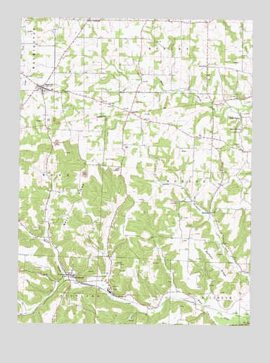
Glenmont, OH USGS Topographic Map
Click on map above to begin viewing in our Map Viewer.

This topographic map contains these locations and features:
Feature Name Type Latitude Longitude GNIS ID View Map
Bell RidgeRidgeN40.5484°W82.0974°1037824View Map
Bell Ridge School (historical)SchoolN40.5520°W82.0915°1056036View Map
Birds School (historical)SchoolN40.5501°W82.0543°1056038View Map
Brumme FarmsLocaleN40.6047°W82.0067°2709755View Map
Buffalo RidgeRidgeN40.5251°W82.0182°1038497View Map
Buffalo School (historical)SchoolN40.5067°W82.0132°1069155View Map
Dar-Re FarmLocaleN40.5872°W82.0614°2628462View Map
Finney CemeteryCemeteryN40.5909°W82.0160°1961584View Map
GlenmontPopulated PlaceN40.5201°W82.0974°1064731View Map
Glenmont Post OfficePost OfficeN40.5195°W82.0971°2013542View Map
Glenmont Volunteer Fire DepartmentBuildingN40.5207°W82.0971°2549518View Map
Grassbaugh Dairy FarmLocaleN40.5233°W82.1086°2703616View Map
Highland School (historical)SchoolN40.6142°W82.0913°1056051View Map
Hopewell CemeteryCemeteryN40.6062°W82.0235°1700902View Map
Hopewell ChurchChurchN40.6059°W82.0240°1041781View Map
Johnson School (historical)SchoolN40.5795°W82.0065°1067085View Map
Maple Grove ChurchChurchN40.5803°W82.0057°1042955View Map
Margandale FarmsLocaleN40.6081°W82.0250°2628467View Map
McMillen School (historical)SchoolN40.6020°W82.0438°1056064View Map
Miley CrossroadsPopulated PlaceN40.6242°W82.0879°1062898View Map
NashvillePopulated PlaceN40.5962°W82.1121°1043776View Map
Nashville Elementary SchoolSchoolN40.5956°W82.1077°1056070View Map
Nashville Methodist CemeteryCemeteryN40.5962°W82.1157°1806420View Map
Nashville Methodist ChurchChurchN40.5967°W82.1157°1806421View Map
Nashville Post OfficePost OfficeN40.5959°W82.1124°2013540View Map
Oak Grove School (historical)SchoolN40.5101°W82.0610°1056072View Map
Old Dutch Lutheran CemeteryCemeteryN40.5951°W82.1061°1961611View Map
Paint ValleyPopulated PlaceN40.5859°W82.0057°1049052View Map
Paint Valley Post Office (historical)Post OfficeN40.5862°W82.0054°2013574View Map
Philips School (historical)SchoolN40.5495°W82.0138°1056074View Map
Phinney School (historical)SchoolN40.5781°W82.0577°1056075View Map
Presbyterian CemeteryCemeteryN40.5953°W82.1071°1961614View Map
Richland Township Emergency Medical ServicesBuildingN40.5207°W82.0971°2550864View Map
Stone School (historical)SchoolN40.5798°W82.0979°1056079View Map
Sunnyside CemeteryCemeteryN40.5196°W82.0825°1046864View Map
Temple CemeteryCemeteryN40.5910°W82.0634°1046982View Map
Township of MonroeCivilN40.5606°W82.0315°1086333View Map
Village of GlenmontCivilN40.5191°W82.0925°2398976View Map
Village of NashvilleCivilN40.5958°W82.1130°2399437View Map
WBZW-FM (Loudonville)TowerN40.6162°W82.0927°1083857View Map
WelcomePopulated PlaceN40.5462°W82.0218°1047660View Map
Welcome CemeteryCemeteryN40.5520°W82.0324°1961627View Map
Welcome Church of ChristChurchN40.5506°W82.0310°1047663View Map
Welcome Post Office (historical)Post OfficeN40.5459°W82.0221°2013583View Map
Western Holmes Fire District Nashville StationBuildingN40.5970°W82.1135°2550244View Map

Note: Coordinates in the location and feature list above are referenced to NAD83 datum.


Copyright (C) 2008-2025 Ryan Niemi / Sunset Dynamics ... All Rights Reserved