TopoQuest Logo
Do you find TopoQuest useful?
Help keep TopoQuest running and adding new maps/features by donating!
Bitcoin:  19c7KJd3qBynnjoSw5npx9KScwjBe4ifkT
Litecoin:  LXs6TkuXGGXo1vDsWCkWVdjQX94eUKd6ui
Home View Maps Find Maps Find Places Resources & Links


Spring Mountain, Ohio Topographic Map

USGS Map Title: Spring Mountain, OH
USGS Map MRC: 40082D1
DRG (GeoTIFF) Download: o40082d1.tif


Neighboring USGS Topographic Map Quads:


  Greer, OH  
40082E2
 

  Glenmont, OH  
40082E1
 

  Millersburg, OH  
40081E8
 

  Brinkhaven, OH  
40082D2
 

  Spring Mountain, OH  
40082D1
 

  Killbuck, OH  
40081D8
 

  Walhonding, OH  
40082C2
 

  Warsaw, OH  
40082C1
 

  Randle, OH  
40081C8


Map MRC Location:

N41°
W83°
N41°
W82°
H8 H7 H6 H5 H4 H3 H2 H1
G8 G7 G6 G5 G4 G3 G2 G1
F8 F7 F6 F5 F4 F3 F2 F1
E8 E7 E6 E5 E4 E3 E2 E1
D8 D7 D6 D5 D4 D3 D2 D1
C8 C7 C6 C5 C4 C3 C2 C1
B8 B7 B6 B5 B4 B3 B2 B1
A8 A7 A6 A5 A4 A3 A2 A1
N40°
W83°
N40°
W82°

Spring Mountain, OH USGS 1:24K Topographic Map Preview:
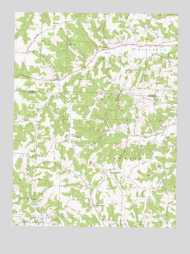
Spring Mountain, OH USGS Topographic Map
Click on map above to begin viewing in our Map Viewer.

This topographic map contains these locations and features:
Feature Name Type Latitude Longitude GNIS ID View Map
Barnes CemeteryCemeteryN40.4935°W82.1243°1961568View Map
Big Run CemeteryCemeteryN40.4340°W82.0078°1038035View Map
Big Run School (historical)SchoolN40.4306°W82.0104°1069566View Map
Bucy CemeteryCemeteryN40.4903°W82.0949°1961572View Map
Dutch Run CemeteryCemeteryN40.4023°W82.1072°1039906View Map
Dutch Run ChurchChurchN40.3909°W82.1099°1039907View Map
Dutch Run School (historical)SchoolN40.3917°W82.1126°1050280View Map
Election School (historical)SchoolN40.4762°W82.1154°1056047View Map
Fort FizzlePopulated PlaceN40.4928°W82.0929°1062770View Map
French RidgeRidgeN40.4834°W82.1102°1040677View Map
Harmony CemeteryCemeteryN40.4284°W82.0808°1041337View Map
Harmony Church (historical)ChurchN40.4284°W82.0818°1050281View Map
Hazel Glen School (historical)SchoolN40.4453°W82.0421°1050284View Map
Lookout School (historical)SchoolN40.4376°W82.0763°1050282View Map
McKee CemeteryCemeteryN40.3817°W82.1190°1043116View Map
McKelvey School (historical)SchoolN40.4745°W82.0235°1056063View Map
Monroe CemeteryCemeteryN40.4501°W82.0571°1043442View Map
Monroe Church (historical)ChurchN40.4503°W82.0579°1050285View Map
New PrincetonPopulated PlaceN40.3876°W82.0613°1065132View Map
New Princeton Post Office (historical)Post OfficeN40.3876°W82.0610°1967446View Map
Pleasant Hill CemeteryCemeteryN40.4225°W82.0038°1048359View Map
Pleasant Hill Church (historical)ChurchN40.4223°W82.0035°1050286View Map
Pleasant Valley School (historical)SchoolN40.4223°W82.0646°1050283View Map
Rock Ridge School (historical)SchoolN40.3987°W82.0101°1050287View Map
Spring MountainPopulated PlaceN40.4087°W82.0507°1061656View Map
Spring Mountain CemeteryCemeteryN40.4055°W82.0498°1964140View Map
Spring Mountain Post Office (historical)Post OfficeN40.4084°W82.0513°1967449View Map
StillwellPopulated PlaceN40.4606°W82.0943°1065386View Map
Stillwell CemeteryCemeteryN40.4603°W82.0951°1961625View Map
Stilwell Post Office (historical)Post OfficeN40.4612°W82.0943°2013579View Map
Stuber School (historical)SchoolN40.4795°W82.0529°1056081View Map
Township of MonroeCivilN40.4157°W82.0393°1085922View Map
Township of RichlandCivilN40.4910°W82.1129°1086336View Map
Union Grove CemeteryCemeteryN40.4770°W82.1149°1699148View Map
Union Grove ChurchChurchN40.4767°W82.1149°1047323View Map
Wolf Creek CemeteryCemeteryN40.4798°W82.0522°1048038View Map

Note: Coordinates in the location and feature list above are referenced to NAD83 datum.


Copyright (C) 2008-2025 Ryan Niemi / Sunset Dynamics ... All Rights Reserved