TopoQuest Logo
Do you find TopoQuest useful?
Help keep TopoQuest running and adding new maps/features by donating!
Bitcoin:  19c7KJd3qBynnjoSw5npx9KScwjBe4ifkT
Litecoin:  LXs6TkuXGGXo1vDsWCkWVdjQX94eUKd6ui
Home View Maps Find Maps Find Places Resources & Links


Grange, Arkansas Topographic Map

USGS Map Title: Grange, AR
USGS Map MRC: 35091H4
DRG (GeoTIFF) Download: o35091h4.tif


Neighboring USGS Topographic Map Quads:


  Evening Shade, AR  
36091A5
 

  Poughkeepsie, AR  
36091A4
 

  Smithville, AR  
36091A3
 

  Cave City, AR  
35091H5
 

  Grange, AR  
35091H4
 

  Strawberry, AR  
35091H3
 

  Sulphur Rock, AR  
35091G5
 

  Charlotte, AR  
35091G4
 

  Cord, AR  
35091G3


Map MRC Location:

N36°
W92°
N36°
W91°
H8 H7 H6 H5 H4 H3 H2 H1
G8 G7 G6 G5 G4 G3 G2 G1
F8 F7 F6 F5 F4 F3 F2 F1
E8 E7 E6 E5 E4 E3 E2 E1
D8 D7 D6 D5 D4 D3 D2 D1
C8 C7 C6 C5 C4 C3 C2 C1
B8 B7 B6 B5 B4 B3 B2 B1
A8 A7 A6 A5 A4 A3 A2 A1
N35°
W92°
N35°
W91°

Grange, AR USGS 1:24K Topographic Map Preview:
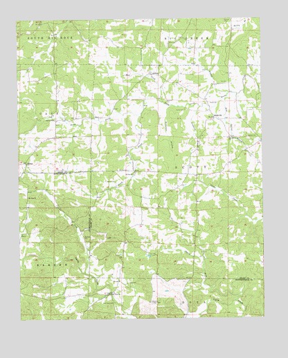
Grange, AR USGS Topographic Map
Click on map above to begin viewing in our Map Viewer.

This topographic map contains these locations and features:
Feature Name Type Latitude Longitude GNIS ID View Map
AetnaPopulated PlaceN35.9365°W91.4401°66149View Map
Bold Spring BranchStreamN35.9665°W91.3940°46817View Map
Bold Spring ChurchChurchN35.9506°W91.3918°46818View Map
Cache ForkStreamN35.8940°W91.4665°47263View Map
Cedar Grove CemeteryCemeteryN35.8815°W91.4515°47603View Map
Cedar Grove ChurchChurchN35.8815°W91.4518°47610View Map
Cedar LakeReservoirN35.9011°W91.4338°80956View Map
Ceder Lake DamDamN35.9017°W91.4335°80955View Map
Charlotte Lookout TowerTowerN35.8817°W91.4326°82001View Map
Crabtree BranchStreamN35.9634°W91.4065°48130View Map
Dawson CemeteryCemeteryN35.9326°W91.4507°48399View Map
Devils ForkStreamN35.8820°W91.3899°48489View Map
Fairview ChurchChurchN35.9584°W91.4815°48974View Map
Gardner CemeteryCemeteryN35.9509°W91.3823°49339View Map
GrangeLocaleN35.9773°W91.4318°77053View Map
Grange - Calamine Volunteer Fire Department Main StationBuildingN35.9812°W91.4346°2116493View Map
HilltopLocaleN35.9404°W91.4962°50131View Map
James CemeteryCemeteryN35.8901°W91.4440°50579View Map
Lick BranchStreamN35.9690°W91.3915°51131View Map
Mill CreekStreamN35.9656°W91.4257°51995View Map
Mobley (historical)Populated PlaceN35.9009°W91.4479°66166View Map
Mount Tabor ChurchChurchN35.9265°W91.4946°52423View Map
Mount View CemeteryCemeteryN35.9373°W91.4437°52431View Map
Mount View ChurchChurchN35.9351°W91.4412°52434View Map
North Prong Reeds CreekStreamN35.9606°W91.4371°52836View Map
Parsley CemeteryCemeteryN35.9620°W91.4146°53202View Map
Pools ChapelStreamN35.9573°W91.4896°78075View Map
Rawlings CemeteryCemeteryN35.9092°W91.4668°53916View Map
Roe CemeteryCemeteryN35.9737°W91.3926°54159View Map
Shaver CemeteryCemeteryN35.9648°W91.4015°54741View Map
ShelbyvillePopulated PlaceN35.9590°W91.3996°78339View Map
Simco (historical)Populated PlaceN35.9209°W91.3837°66172View Map
South Prong Reeds CreekStreamN35.9606°W91.4371°55039View Map
Township of ScottCivilN35.9359°W91.4094°69152View Map
Wilkerson BranchStreamN35.9634°W91.4193°56377View Map
Wilkerson CemeteryCemeteryN35.9659°W91.4237°56380View Map

Note: Coordinates in the location and feature list above are referenced to NAD83 datum.


Copyright (C) 2008-2024 Ryan Niemi / Sunset Dynamics ... All Rights Reserved