TopoQuest Logo
Do you find TopoQuest useful?
Help keep TopoQuest running and adding new maps/features by donating!
Bitcoin:  19c7KJd3qBynnjoSw5npx9KScwjBe4ifkT
Litecoin:  LXs6TkuXGGXo1vDsWCkWVdjQX94eUKd6ui
Home View Maps Find Maps Find Places Resources & Links


Cave City, Arkansas Topographic Map

USGS Map Title: Cave City, AR
USGS Map MRC: 35091H5
DRG (GeoTIFF) Download: o35091h5.tif


Neighboring USGS Topographic Map Quads:


  Sidney, AR  
36091A6
 

  Evening Shade, AR  
36091A5
 

  Poughkeepsie, AR  
36091A4
 

  Sandtown, AR  
35091H6
 

  Cave City, AR  
35091H5
 

  Grange, AR  
35091H4
 

  Batesville, AR  
35091G6
 

  Sulphur Rock, AR  
35091G5
 

  Charlotte, AR  
35091G4


Map MRC Location:

N36°
W92°
N36°
W91°
H8 H7 H6 H5 H4 H3 H2 H1
G8 G7 G6 G5 G4 G3 G2 G1
F8 F7 F6 F5 F4 F3 F2 F1
E8 E7 E6 E5 E4 E3 E2 E1
D8 D7 D6 D5 D4 D3 D2 D1
C8 C7 C6 C5 C4 C3 C2 C1
B8 B7 B6 B5 B4 B3 B2 B1
A8 A7 A6 A5 A4 A3 A2 A1
N35°
W92°
N35°
W91°

Cave City, AR USGS 1:24K Topographic Map Preview:
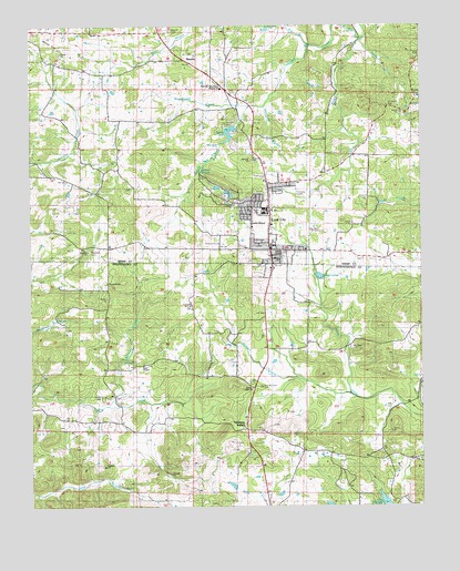
Cave City, AR USGS Topographic Map
Click on map above to begin viewing in our Map Viewer.

This topographic map contains these locations and features:
Feature Name Type Latitude Longitude GNIS ID View Map
A G Gray MineMineN35.8851°W91.6118°81390View Map
Ball CemeteryCemeteryN35.9006°W91.5099°67975View Map
Ball MineMineN35.8929°W91.5196°81396View Map
Barnett CemeteryCemeteryN35.9037°W91.6024°67976View Map
Barnett CreekStreamN35.9009°W91.6004°76237View Map
Basket CreekStreamN35.9001°W91.6040°46134View Map
Bray HillSummitN35.9876°W91.5329°57430View Map
Cave CityPopulated PlaceN35.9417°W91.5485°76551View Map
Cave City CemeteryCemeteryN35.9384°W91.5549°47536View Map
Cave City Elementary SchoolSchoolN35.9524°W91.5506°66153View Map
Cave City High SchoolSchoolN35.9500°W91.5462°66154View Map
Cave City Police DepartmentBuildingN35.9395°W91.5469°2118639View Map
Cave City Post OfficePost OfficeN35.9404°W91.5479°84360View Map
Cave City Volunteer Fire StationBuildingN35.9460°W91.5483°2116243View Map
Church of GodChurchN35.9331°W91.6007°67989View Map
City of Cave CityCivilN35.9484°W91.5473°2404007View Map
Cochran ProspectMineN35.9804°W91.5051°81622View Map
Cotton Hill ChurchChurchN35.9556°W91.6010°48068View Map
Doctor Toms ParkParkN35.9792°W91.5107°66155View Map
Dokken HollowValleyN35.9762°W91.5243°48561View Map
E W Roach ProspectMineN35.9076°W91.6051°81424View Map
Eliza Patterson ProspectMineN35.8926°W91.5776°81426View Map
Goat DenValleyN35.9712°W91.5612°49458View Map
Gray ChapelChurchN35.9115°W91.5890°77062View Map
Gray HillSummitN35.8856°W91.6110°57843View Map
Green Acres Estate Lake One DamDamN35.9601°W91.5685°80963View Map
Hawkins HillSummitN35.8854°W91.6024°57901View Map
Hawkins MineMineN35.8942°W91.6249°81441View Map
Hickory ValleyPopulated PlaceN35.8959°W91.5565°77177View Map
Hickory Valley CemeteryCemeteryN35.9062°W91.5515°68018View Map
Hickory Valley ChurchChurchN35.9056°W91.5543°50082View Map
Hills HillSummitN35.9795°W91.5154°50129View Map
Hodge SchoolSchoolN35.8826°W91.5782°50163View Map
Hunt HollowValleyN35.8779°W91.6226°81445View Map
Jackson CreekStreamN35.9012°W91.5062°50564View Map
Jackson ProspectMineN35.9376°W91.5712°81452View Map
Jackson SpringsSpringN35.9620°W91.5707°66163View Map
Jeff Weaver ProspectMineN35.8967°W91.6246°81454View Map
Jesse PinesSummitN35.9948°W91.5082°50640View Map
Johnson BranchStreamN35.9970°W91.5174°50674View Map
K D Aldridge ProspectMineN35.9426°W91.5710°81623View Map
KZIG-FM (Cave City)TowerN35.9520°W91.5496°85375View Map
Lake Cave CityReservoirN35.9751°W91.5585°79679View Map
Lake Cave City DamDamN35.9751°W91.5585°79678View Map
Lake KimberlyReservoirN35.8753°W91.5124°80954View Map
Lick ForkStreamN35.9967°W91.5187°51150View Map
Lower Lake - Green Acres EstatesReservoirN35.9601°W91.5685°80964View Map
M D Aldridge ProspectMineN35.9417°W91.5582°81624View Map
Matlock MineMineN35.9426°W91.5762°81625View Map
MaxvillePopulated PlaceN35.9915°W91.5757°66164View Map
Maxville CemeteryCemeteryN35.9987°W91.5804°66165View Map
Maxville Missionary Baptist ChurchChurchN35.9837°W91.5632°77618View Map
Maxville SchoolSchoolN35.9926°W91.5774°51744View Map
McGee MineMineN35.8831°W91.6121°81467View Map
McLeod ProspectMineN35.9804°W91.5010°81626View Map
Milligan ProspectMineN35.8926°W91.5632°81470View Map
Milligan-Perrin ProspectMineN35.8787°W91.5996°81469View Map
Mount Tabor CemeteryCemeteryN35.9162°W91.5232°68029View Map
Palestine CemeteryCemeteryN35.9415°W91.6062°66167View Map
Palestine ChurchChurchN35.9415°W91.6068°53137View Map
Pine Springs SchoolSchoolN35.9101°W91.6004°53470View Map
Prosperity ChurchChurchN35.9662°W91.5162°53818View Map
Smith HillSummitN35.9712°W91.5393°58642View Map
Smith ProspectMineN35.8759°W91.6210°81510View Map
Spring River Paramedic Ambulance ServiceBuildingN35.9890°W91.5719°2119190View Map
Stanfield BranchStreamN35.9792°W91.5501°55154View Map
Story MineMineN35.9381°W91.5737°81513View Map
Three DamDamN35.9584°W91.5635°80959View Map
Township of BarrenCivilN35.9042°W91.5377°68757View Map
Township of CaveCivilN35.9601°W91.5267°69135View Map
Township of East SullivanCivilN35.9889°W91.5981°69138View Map
Upper Lake - Green Acres EstatesReservoirN35.9580°W91.5654°80960View Map
W T Gray MineMineN35.8848°W91.6099°81522View Map
White HillSummitN35.9940°W91.6165°58869View Map
Willmuth HillSummitN35.9651°W91.5551°58895View Map
Woodyard ProspectMineN35.9376°W91.5557°81530View Map
Wooldridge CreekStreamN35.9790°W91.5549°56537View Map

Note: Coordinates in the location and feature list above are referenced to NAD83 datum.


Copyright (C) 2008-2025 Ryan Niemi / Sunset Dynamics ... All Rights Reserved