TopoQuest Logo
Do you find TopoQuest useful?
Help keep TopoQuest running and adding new maps/features by donating!
Bitcoin:  19c7KJd3qBynnjoSw5npx9KScwjBe4ifkT
Litecoin:  LXs6TkuXGGXo1vDsWCkWVdjQX94eUKd6ui
Home View Maps Find Maps Find Places Resources & Links


Hartman, Arkansas Topographic Map

USGS Map Title: Hartman, AR
USGS Map MRC: 35093D5
DRG (GeoTIFF) Download: o35093d5.tif


Neighboring USGS Topographic Map Quads:


  Hunt, AR  
35093E6
 

  Harmony, AR  
35093E5
 

  Ludwig, AR  
35093E4
 

  Coal Hill, AR  
35093D6
 

  Hartman, AR  
35093D5
 

  Clarksville, AR  
35093D4
 

  Paris, AR  
35093C6
 

  Scranton, AR  
35093C5
 

  New Blaine, AR  
35093C4


Map MRC Location:

N36°
W94°
N36°
W93°
H8 H7 H6 H5 H4 H3 H2 H1
G8 G7 G6 G5 G4 G3 G2 G1
F8 F7 F6 F5 F4 F3 F2 F1
E8 E7 E6 E5 E4 E3 E2 E1
D8 D7 D6 D5 D4 D3 D2 D1
C8 C7 C6 C5 C4 C3 C2 C1
B8 B7 B6 B5 B4 B3 B2 B1
A8 A7 A6 A5 A4 A3 A2 A1
N35°
W94°
N35°
W93°

Hartman, AR USGS 1:24K Topographic Map Preview:
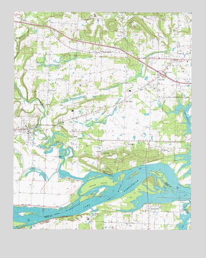
Hartman, AR USGS Topographic Map
Click on map above to begin viewing in our Map Viewer.

This topographic map contains these locations and features:
Feature Name Type Latitude Longitude GNIS ID View Map
Arkansas State PoliceBuildingN35.4645°W93.5232°79242View Map
Arkansas State Police Troop JBuildingN35.4646°W93.5225°2118865View Map
Burt CreekStreamN35.4745°W93.5088°79230View Map
Bushtown (historical)Populated PlaceN35.4737°W93.5363°65132View Map
Cane CreekStreamN35.3926°W93.5016°70987View Map
Cane Creek Public Use AreaParkN35.3876°W93.5035°79175View Map
City of HartmanCivilN35.4344°W93.6212°2403811View Map
Clarksville Primary SchoolSchoolN35.4612°W93.5051°2039095View Map
Fernwood Assembly of God ChurchChurchN35.4201°W93.5635°79232View Map
First Baptist Church of HartmanChurchN35.4315°W93.6141°65142View Map
Goose CampLocaleN35.4195°W93.5630°49510View Map
HartmanPopulated PlaceN35.4326°W93.6155°49922View Map
Hartman CemeteryCemeteryN35.4254°W93.6177°79233View Map
Hartman United Methodist ChurchChurchN35.4323°W93.6144°65148View Map
Hays ChapelLocaleN35.4487°W93.5494°49966View Map
Hays Chapel United Methodist ChurchChurchN35.4479°W93.5491°65149View Map
HinklePopulated PlaceN35.4279°W93.5835°57059View Map
Hogskin CreekStreamN35.4454°W93.5074°50177View Map
Horse Head Public Use AreaParkN35.4073°W93.5185°79237View Map
Horsehead CreekStreamN35.4065°W93.5521°77225View Map
HoytPopulated PlaceN35.4265°W93.5638°57065View Map
Interchange 55CrossingN35.4654°W93.5210°58985View Map
Johnson County LandfillLocaleN35.4883°W93.5386°2726687View Map
Johnson County Rural Fire Department Station 9 SpadraBuildingN35.4265°W93.5255°2116649View Map
Johnson County Rural Fire District 4BuildingN35.4315°W93.6157°2116644View Map
Kendall CemeteryCemeteryN35.4956°W93.6210°50804View Map
Kendall ChurchChurchN35.4965°W93.6210°79145View Map
KGMR Radio TowerTowerN35.4704°W93.5171°79240View Map
KGMR-FM (Clarksville)TowerN35.4673°W93.5196°85379View Map
KLYR Radio TowerTowerN35.4937°W93.5410°79241View Map
KLYR-FM (Clarksville)TowerN35.4940°W93.5394°85378View Map
MontanaPopulated PlaceN35.4251°W93.5449°58205View Map
Morrison BluffPopulated PlaceN35.3879°W93.5285°79144View Map
New Life Christian SchoolSchoolN35.4701°W93.5160°79236View Map
New SpadraPopulated PlaceN35.4204°W93.5163°58260View Map
Sacred HeartLocaleN35.4551°W93.6016°54299View Map
Sacred Heart Catholic ChurchChurchN35.4534°W93.6007°65171View Map
Saint's Peter and Paul Catholic CemeteryCemeteryN35.3873°W93.5286°79235View Map
Saints Peter and Paul Catholic ChurchChurchN35.3873°W93.5296°79234View Map
Scranton Gas FieldOilfieldN35.3815°W93.5905°64171View Map
Shady GrovePopulated PlaceN35.4629°W93.5241°57185View Map
Shady Grove CemeteryCemeteryN35.4720°W93.5093°54693View Map
Sixmile CreekStreamN35.3784°W93.6096°73594View Map
Skaggs IslandIslandN35.4012°W93.5657°54887View Map
Slough CreekStreamN35.4251°W93.6010°54913View Map
Spadra CemeteryCemeteryN35.4281°W93.5021°79143View Map
Sulphur SpringsPopulated PlaceN35.4776°W93.5641°57197View Map
Tick HillSummitN35.4165°W93.5546°79239View Map
Town of Morrison BluffCivilN35.3820°W93.5244°2406197View Map
Township of PrairieCivilN35.4313°W93.5421°66767View Map
Township of RiverCivilN35.3829°W93.5307°68801View Map
Township of WardCivilN35.4374°W93.6110°66772View Map
Union CityPopulated PlaceN35.4879°W93.5480°79238View Map
Union City Gas FieldOilfieldN35.4668°W93.5710°65176View Map
Union Grove Baptist ChurchChurchN35.4773°W93.5646°78618View Map
West Mount Zion ChurchChurchN35.4615°W93.5907°56195View Map
Westside Elementary SchoolSchoolN35.4340°W93.6166°65177View Map
Westside SchoolSchoolN35.4343°W93.6163°79231View Map

Note: Coordinates in the location and feature list above are referenced to NAD83 datum.


Copyright (C) 2008-2025 Ryan Niemi / Sunset Dynamics ... All Rights Reserved