TopoQuest Logo
Do you find TopoQuest useful?
Help keep TopoQuest running and adding new maps/features by donating!
Bitcoin:  19c7KJd3qBynnjoSw5npx9KScwjBe4ifkT
Litecoin:  LXs6TkuXGGXo1vDsWCkWVdjQX94eUKd6ui
Home View Maps Find Maps Find Places Resources & Links


Hermitage, Arkansas Topographic Map

USGS Map Title: Hermitage, AR
USGS Map MRC: 33092D2
DRG (GeoTIFF) Download: o33092d2.tif


Neighboring USGS Topographic Map Quads:


  Banks, AR  
33092E3
 

  Farmville, AR  
33092E2
 

  Warren, AR  
33092E1
 

  Jersey, AR  
33092D3
 

  Hermitage, AR  
33092D2
 

  Sumpter, AR  
33092D1
 

  Moro Bay, AR  
33092C3
 

  Marsden, AR  
33092C2
 

  Vick, AR  
33092C1


Map MRC Location:

N34°
W93°
N34°
W92°
H8 H7 H6 H5 H4 H3 H2 H1
G8 G7 G6 G5 G4 G3 G2 G1
F8 F7 F6 F5 F4 F3 F2 F1
E8 E7 E6 E5 E4 E3 E2 E1
D8 D7 D6 D5 D4 D3 D2 D1
C8 C7 C6 C5 C4 C3 C2 C1
B8 B7 B6 B5 B4 B3 B2 B1
A8 A7 A6 A5 A4 A3 A2 A1
N33°
W93°
N33°
W92°

Hermitage, AR USGS 1:24K Topographic Map Preview:
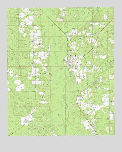
Hermitage, AR USGS Topographic Map
Click on map above to begin viewing in our Map Viewer.

This topographic map contains these locations and features:
Feature Name Type Latitude Longitude GNIS ID View Map
Antioch Baptist ChurchChurchN33.4476°W92.2199°60563View Map
Beech CreekStreamN33.4907°W92.1549°46315View Map
Beech CreekStreamN33.4432°W92.1346°46321View Map
Beech CreekStreamN33.3804°W92.1818°46327View Map
Bradley CountyCivilN33.4664°W92.1624°63757View Map
Brushy L'Aigle CreekStreamN33.4509°W92.1924°76447View Map
Buckhead CreekStreamN33.4604°W92.1985°47141View Map
Caney CreekStreamN33.4426°W92.1385°60572View Map
Castleberry (historical)Populated PlaceN33.4984°W92.2113°60567View Map
City of HermitageCivilN33.4480°W92.1716°2405820View Map
Grassy Pond CreekStreamN33.3915°W92.1801°49580View Map
GravelridgePopulated PlaceN33.4465°W92.2190°77060View Map
Gravelridge CemeteryCemeteryN33.4476°W92.2204°60564View Map
Gravelridge School (historical)SchoolN33.4343°W92.2176°60561View Map
Greens Chapel (historical)ChurchN33.4776°W92.2199°60565View Map
GreenvillePopulated PlaceN33.4765°W92.1321°60573View Map
Hall BranchStreamN33.4659°W92.1890°60570View Map
HermitagePopulated PlaceN33.4465°W92.1740°57909View Map
Hermitage Elementary SchoolSchoolN33.4534°W92.1759°60569View Map
Hermitage High SchoolSchoolN33.4521°W92.1704°60568View Map
Hermitage Middle SchoolSchoolN33.4529°W92.1708°2121482View Map
Hermitage Police DepartmentBuildingN33.4405°W92.1686°2118703View Map
Hermitage Post OfficePost OfficeN33.4474°W92.1744°2781857View Map
Hermitage Rural Fire DepartmentBuildingN33.4493°W92.1739°2116557View Map
Holly Springs CemeteryCemeteryN33.4551°W92.1462°50242View Map
IngallsPopulated PlaceN33.3834°W92.1510°77272View Map
Landmark Missionary Baptist ChurchChurchN33.4468°W92.2193°60562View Map
Neal CemeteryCemeteryN33.3965°W92.2221°52584View Map
Pirlte (historical)Populated PlaceN33.3887°W92.2288°60560View Map
Spring Hill School (historical)SchoolN33.4859°W92.2321°60566View Map
Springhill CreekStreamN33.4943°W92.2126°78440View Map
Springhill Freewill Baptist ChurchChurchN33.4823°W92.2188°55136View Map
Township of OuachitaCivilN33.4160°W92.2263°63691View Map
Township of WashingtonCivilN33.4355°W92.1347°63696View Map
Union Hill Baptist ChurchChurchN33.3907°W92.1304°78622View Map
Union Hill CemeteryCemeteryN33.3912°W92.1299°60571View Map

Note: Coordinates in the location and feature list above are referenced to NAD83 datum.


Copyright (C) 2008-2025 Ryan Niemi / Sunset Dynamics ... All Rights Reserved