TopoQuest Logo
Do you find TopoQuest useful?
Help keep TopoQuest running and adding new maps/features by donating!
Bitcoin:  19c7KJd3qBynnjoSw5npx9KScwjBe4ifkT
Litecoin:  LXs6TkuXGGXo1vDsWCkWVdjQX94eUKd6ui
Home View Maps Find Maps Find Places Resources & Links


Mahogany Point, Utah Topographic Map

USGS Map Title: Mahogany Point, UT
USGS Map MRC: 39111C2
DRG (GeoTIFF) Download: o39111c2.tif


Neighboring USGS Topographic Map Quads:


  South Tent Mountain, UT  
39111D3
 

  Rilda Canyon, UT  
39111D2
 

  Hiawatha, UT  
39111D1
 

  Joes Valley Reservoir, UT  
39111C3
 

  Mahogany Point, UT  
39111C2
 

  Red Point, UT  
39111C1
 

  Ferron Canyon, UT  
39111B3
 

  The Cap, UT  
39111B2
 

  Castle Dale, UT  
39111B1


Map MRC Location:

N40°
W112°
N40°
W111°
H8 H7 H6 H5 H4 H3 H2 H1
G8 G7 G6 G5 G4 G3 G2 G1
F8 F7 F6 F5 F4 F3 F2 F1
E8 E7 E6 E5 E4 E3 E2 E1
D8 D7 D6 D5 D4 D3 D2 D1
C8 C7 C6 C5 C4 C3 C2 C1
B8 B7 B6 B5 B4 B3 B2 B1
A8 A7 A6 A5 A4 A3 A2 A1
N39°
W112°
N39°
W111°

Mahogany Point, UT USGS 1:24K Topographic Map Preview:
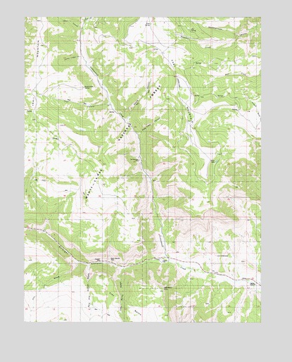
Mahogany Point, UT USGS Topographic Map
Click on map above to begin viewing in our Map Viewer.

This topographic map contains these locations and features:
Feature Name Type Latitude Longitude GNIS ID View Map
Black Diamond MineMineN39.2758°W111.2054°1438842View Map
CCC TrailTrailN39.3066°W111.2488°1439407View Map
CCC TrailTrailN39.3069°W111.2385°1448242View Map
Clay Banks SwaleValleyN39.2719°W111.1996°1439775View Map
Coal Mining Monument Point of IneterstLocaleN39.2769°W111.2066°1453041View Map
Cox SwaleValleyN39.2744°W111.2224°1440108View Map
Dairy CanyonValleyN39.3711°W111.2221°1440229View Map
Elk SpringSpringN39.3695°W111.1634°1440910View Map
Flaglake CanyonValleyN39.3272°W111.1910°1441107View Map
Indian Lodge CanyonValleyN39.3586°W111.2207°1442014View Map
Mahogany PointSummitN39.2639°W111.1779°1443091View Map
Mill CanyonValleyN39.3739°W111.2188°1443410View Map
North Point SpringSpringN39.3461°W111.2196°1443969View Map
Oliphant MineMineN39.2752°W111.2107°1444080View Map
Pine SpringSpringN39.3720°W111.1843°1444408View Map
Reid and Nielson SwaleValleyN39.2733°W111.2163°1444859View Map
Roans CanyonValleyN39.3327°W111.1968°1445013View Map
Snow LakeLakeN39.3158°W111.1495°1445746View Map
Straight CanyonValleyN39.2752°W111.1749°1446172View Map
Trail CanyonValleyN39.3391°W111.2054°1446665View Map
Trail Mountain MineMineN39.3164°W111.1899°1446688View Map
Whetstone CreekStreamN39.3672°W111.1377°1447219View Map

Note: Coordinates in the location and feature list above are referenced to NAD83 datum.


Copyright (C) 2008-2025 Ryan Niemi / Sunset Dynamics ... All Rights Reserved