TopoQuest Logo
Do you find TopoQuest useful?
Help keep TopoQuest running and adding new maps/features by donating!
Bitcoin:  19c7KJd3qBynnjoSw5npx9KScwjBe4ifkT
Litecoin:  LXs6TkuXGGXo1vDsWCkWVdjQX94eUKd6ui
Home View Maps Find Maps Find Places Resources & Links


Hillisburg, Indiana Topographic Map

USGS Map Title: Hillisburg, IN
USGS Map MRC: 40086C3
DRG (GeoTIFF) Download: o40086c3.tif


Neighboring USGS Topographic Map Quads:


  Burlington, IN  
40086D4
 

  Russiaville, IN  
40086D3
 

  Kokomo West, IN  
40086D2
 

  Michigantown, IN  
40086C4
 

  Hillisburg, IN  
40086C3
 

  Kempton, IN  
40086C2
 

  Mechanicsburg, IN  
40086B4
 

  Kirklin, IN  
40086B3
 

  Sheridan, IN  
40086B2


Map MRC Location:

N41°
W87°
N41°
W86°
H8 H7 H6 H5 H4 H3 H2 H1
G8 G7 G6 G5 G4 G3 G2 G1
F8 F7 F6 F5 F4 F3 F2 F1
E8 E7 E6 E5 E4 E3 E2 E1
D8 D7 D6 D5 D4 D3 D2 D1
C8 C7 C6 C5 C4 C3 C2 C1
B8 B7 B6 B5 B4 B3 B2 B1
A8 A7 A6 A5 A4 A3 A2 A1
N40°
W87°
N40°
W86°

Hillisburg, IN USGS 1:24K Topographic Map Preview:
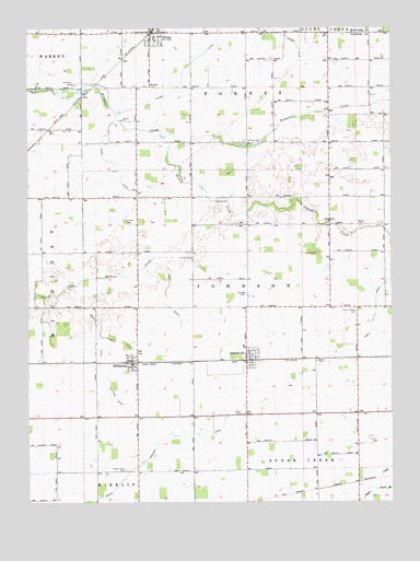
Hillisburg, IN USGS Topographic Map
Click on map above to begin viewing in our Map Viewer.

This topographic map contains these locations and features:
Feature Name Type Latitude Longitude GNIS ID View Map
Bacon CemeteryCemeteryN40.3228°W86.2604°430393View Map
Baker CemeteryCemeteryN40.2873°W86.2756°430423View Map
Cripe Sandlin DitchCanalN40.2961°W86.3503°433134View Map
Davis DitchCanalN40.3398°W86.3461°433356View Map
Dunn DitchCanalN40.2828°W86.3503°433795View Map
ForestPopulated PlaceN40.3736°W86.3328°434646View Map
Forest Fire DepartmentBuildingN40.3742°W86.3331°2626046View Map
HillisburgPopulated PlaceN40.2864°W86.3392°449669View Map
Johnson Township Volunteer Fire DepartmentBuildingN40.2865°W86.3382°2626087View Map
Kent DitchCanalN40.3034°W86.3269°437254View Map
Kings Corner CemeteryCemeteryN40.2585°W86.3415°437333View Map
Merrit CemeteryCemeteryN40.3298°W86.3085°439031View Map
Paris DitchCanalN40.3114°W86.2503°440867View Map
Plummer CemeteryCemeteryN40.3233°W86.3402°441375View Map
Prairie Chapel CemeteryCemeteryN40.3002°W86.2621°441536View Map
Saint Paul CemeteryCemeteryN40.3452°W86.3003°442759View Map
ScirclevillePopulated PlaceN40.2875°W86.3000°443130View Map
Scott CemeteryCemeteryN40.2732°W86.3017°443140View Map
Scott Wincorp DitchCanalN40.2539°W86.3447°443156View Map
South Branch Sugar CreekStreamN40.2528°W86.2553°443791View Map
Stroup CemeteryCemeteryN40.3158°W86.2753°444279View Map
Stump DitchCanalN40.3686°W86.3133°444301View Map
Swamp CreekStreamN40.3450°W86.3272°444457View Map
Township of ForestCivilN40.3749°W86.3120°453299View Map
Township of JohnsonCivilN40.3052°W86.2996°453510View Map
Veneman CemeteryCemeteryN40.3602°W86.3588°445244View Map

Note: Coordinates in the location and feature list above are referenced to NAD83 datum.


Copyright (C) 2008-2024 Ryan Niemi / Sunset Dynamics ... All Rights Reserved