TopoQuest Logo
Do you find TopoQuest useful?
Help keep TopoQuest running and adding new maps/features by donating!
Bitcoin:  19c7KJd3qBynnjoSw5npx9KScwjBe4ifkT
Litecoin:  LXs6TkuXGGXo1vDsWCkWVdjQX94eUKd6ui
Home View Maps Find Maps Find Places Resources & Links


Michigantown, Indiana Topographic Map

USGS Map Title: Michigantown, IN
USGS Map MRC: 40086C4
DRG (GeoTIFF) Download: o40086c4.tif


Neighboring USGS Topographic Map Quads:


  Rossville, IN  
40086D5
 

  Burlington, IN  
40086D4
 

  Russiaville, IN  
40086D3
 

  Frankfort, IN  
40086C5
 

  Michigantown, IN  
40086C4
 

  Hillisburg, IN  
40086C3
 

  Thorntown, IN  
40086B5
 

  Mechanicsburg, IN  
40086B4
 

  Kirklin, IN  
40086B3


Map MRC Location:

N41°
W87°
N41°
W86°
H8 H7 H6 H5 H4 H3 H2 H1
G8 G7 G6 G5 G4 G3 G2 G1
F8 F7 F6 F5 F4 F3 F2 F1
E8 E7 E6 E5 E4 E3 E2 E1
D8 D7 D6 D5 D4 D3 D2 D1
C8 C7 C6 C5 C4 C3 C2 C1
B8 B7 B6 B5 B4 B3 B2 B1
A8 A7 A6 A5 A4 A3 A2 A1
N40°
W87°
N40°
W86°

Michigantown, IN USGS 1:24K Topographic Map Preview:
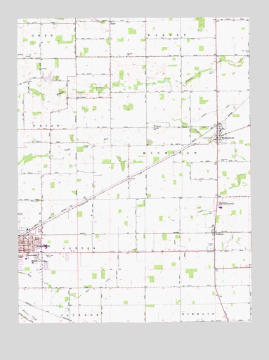
Michigantown, IN USGS Topographic Map
Click on map above to begin viewing in our Map Viewer.

This topographic map contains these locations and features:
Feature Name Type Latitude Longitude GNIS ID View Map
AveryPopulated PlaceN40.3089°W86.4406°430354View Map
BeardPopulated PlaceN40.3736°W86.4506°430647View Map
BoylestonPopulated PlaceN40.2864°W86.3947°431430View Map
Brandon CemeteryCemeteryN40.3297°W86.4276°431445View Map
Brant DitchCanalN40.2814°W86.4147°431453View Map
Clinton Central Elementary SchoolSchoolN40.3289°W86.3911°446521View Map
Clinton Central High SchoolSchoolN40.2984°W86.3911°432673View Map
Clinton CountyCivilN40.3017°W86.4752°450342View Map
East ParkPopulated PlaceN40.2845°W86.4922°433923View Map
Hopewell CemeteriesCemeteryN40.3592°W86.4411°1955448View Map
Hopewell ChurchChurchN40.3595°W86.4419°436463View Map
Jenkins DitchCanalN40.3364°W86.3942°436986View Map
KentwoodPopulated PlaceN40.2770°W86.4897°437259View Map
Laymon CemeteryCemeteryN40.3532°W86.3964°437682View Map
Layton CemeteryCemeteryN40.3223°W86.4647°437686View Map
Little LakeReservoirN40.3512°W86.4834°447768View Map
Little Lakes Estates DamDamN40.3500°W86.4833°447767View Map
Mann DitchCanalN40.2589°W86.4747°438524View Map
Michigan Township Volunteer Fire DepartmentBuildingN40.3305°W86.3925°2626077View Map
MichigantownPopulated PlaceN40.3264°W86.3928°439080View Map
Old Liberty CemeteryCemeteryN40.3609°W86.3750°440576View Map
Old Whiteman CemeteryCemeteryN40.3251°W86.3952°440622View Map
Paris CemeteryCemeteryN40.2953°W86.3979°440865View Map
RissePopulated PlaceN40.2750°W86.4869°442063View Map
Talbert DitchCanalN40.3000°W86.3947°444549View Map
Town of MichigantownCivilN40.3280°W86.3916°2396757View Map
Township of CenterCivilN40.2789°W86.4971°453174View Map
Township of MichiganCivilN40.3131°W86.4062°453620View Map
Walker DitchCanalN40.2867°W86.3861°445377View Map
Whiteman CemeteryCemeteryN40.3161°W86.3922°445972View Map
WilshirePopulated PlaceN40.2756°W86.4886°446118View Map

Note: Coordinates in the location and feature list above are referenced to NAD83 datum.


Copyright (C) 2008-2024 Ryan Niemi / Sunset Dynamics ... All Rights Reserved