TopoQuest Logo
Do you find TopoQuest useful?
Help keep TopoQuest running and adding new maps/features by donating!
Bitcoin:  19c7KJd3qBynnjoSw5npx9KScwjBe4ifkT
Litecoin:  LXs6TkuXGGXo1vDsWCkWVdjQX94eUKd6ui
Home View Maps Find Maps Find Places Resources & Links


Russiaville, Indiana Topographic Map

USGS Map Title: Russiaville, IN
USGS Map MRC: 40086D3
DRG (GeoTIFF) Download: o40086d3.tif


Neighboring USGS Topographic Map Quads:


  Deer Creek, IN  
40086E4
 

  Young America, IN  
40086E3
 

  Galveston, IN  
40086E2
 

  Burlington, IN  
40086D4
 

  Russiaville, IN  
40086D3
 

  Kokomo West, IN  
40086D2
 

  Michigantown, IN  
40086C4
 

  Hillisburg, IN  
40086C3
 

  Kempton, IN  
40086C2


Map MRC Location:

N41°
W87°
N41°
W86°
H8 H7 H6 H5 H4 H3 H2 H1
G8 G7 G6 G5 G4 G3 G2 G1
F8 F7 F6 F5 F4 F3 F2 F1
E8 E7 E6 E5 E4 E3 E2 E1
D8 D7 D6 D5 D4 D3 D2 D1
C8 C7 C6 C5 C4 C3 C2 C1
B8 B7 B6 B5 B4 B3 B2 B1
A8 A7 A6 A5 A4 A3 A2 A1
N40°
W87°
N40°
W86°

Russiaville, IN USGS 1:24K Topographic Map Preview:
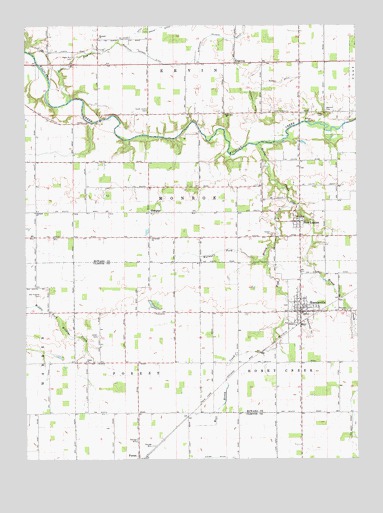
Russiaville, IN USGS Topographic Map
Click on map above to begin viewing in our Map Viewer.

This topographic map contains these locations and features:
Feature Name Type Latitude Longitude GNIS ID View Map
Barnett CemeteryCemeteryN40.4756°W86.2617°430511View Map
Burchard Davison DitchCanalN40.4961°W86.2992°431825View Map
Cloverdale ChurchChurchN40.4389°W86.3281°432690View Map
Dearinger DitchCanalN40.4775°W86.2886°433396View Map
Honey CreekStreamN40.4659°W86.2864°436386View Map
Howard ChurchChurchN40.4967°W86.3469°436536View Map
Kiddle DitchCanalN40.4839°W86.2772°437286View Map
New LondonPopulated PlaceN40.4434°W86.2714°440082View Map
New Zion ChurchChurchN40.4745°W86.2994°440131View Map
Oakland ChurchChurchN40.4461°W86.3714°440469View Map
Old Prophet CemeteryCemeteryN40.4223°W86.3693°440585View Map
Petes RunStreamN40.4781°W86.3589°441062View Map
Petes Run CemeteryCemeteryN40.4909°W86.3565°441063View Map
Price CemeteryCemeteryN40.4750°W86.2636°441591View Map
RidgewayPopulated PlaceN40.4892°W86.2956°442001View Map
RussiavillePopulated PlaceN40.4175°W86.2714°442420View Map
Russiaville Ambulance ServiceBuildingN40.4191°W86.2706°2719438View Map
Russiaville Volunteer Fire DepartmentBuildingN40.4177°W86.2706°2625939View Map
ShanghaiPopulated PlaceN40.4461°W86.3283°443278View Map
South Union CemeteryCemeteryN40.4753°W86.3288°443862View Map
Squirrel CreekStreamN40.4181°W86.2744°444039View Map
Town of RussiavilleCivilN40.4186°W86.2731°2396895View Map
Township of Honey CreekCivilN40.4072°W86.2677°453416View Map
Township of MonroeCivilN40.4522°W86.3127°453639View Map
Union CemeteryCemeteryN40.4104°W86.3473°445063View Map
Union ChurchChurchN40.4031°W86.3522°445113View Map
Walnut ForkStreamN40.4325°W86.2847°445418View Map
West Honey CreekStreamN40.4486°W86.2733°445774View Map

Note: Coordinates in the location and feature list above are referenced to NAD83 datum.


Copyright (C) 2008-2024 Ryan Niemi / Sunset Dynamics ... All Rights Reserved