TopoQuest Logo
Do you find TopoQuest useful?
Help keep TopoQuest running and adding new maps/features by donating!
Bitcoin:  19c7KJd3qBynnjoSw5npx9KScwjBe4ifkT
Litecoin:  LXs6TkuXGGXo1vDsWCkWVdjQX94eUKd6ui
Home View Maps Find Maps Find Places Resources & Links


Woodlawn, Virginia Topographic Map

USGS Map Title: Woodlawn, VA
USGS Map MRC: 36080F7
DRG (GeoTIFF) Download: o36080f7.tif


Neighboring USGS Topographic Map Quads:


  Austinville, VA  
36080G8
 

  Sylvatus, VA  
36080G7
 

  Hillsville, VA  
36080G6
 

  Galax, VA  
36080F8
 

  Woodlawn, VA  
36080F7
 

  Fancy Gap, VA  
36080F6
 

  Cumberland Knob, NC  
36080E8
 

  Lambsburg, VA  
36080E7
 

  Cana, VA  
36080E6


Map MRC Location:

N37°
W81°
N37°
W80°
H8 H7 H6 H5 H4 H3 H2 H1
G8 G7 G6 G5 G4 G3 G2 G1
F8 F7 F6 F5 F4 F3 F2 F1
E8 E7 E6 E5 E4 E3 E2 E1
D8 D7 D6 D5 D4 D3 D2 D1
C8 C7 C6 C5 C4 C3 C2 C1
B8 B7 B6 B5 B4 B3 B2 B1
A8 A7 A6 A5 A4 A3 A2 A1
N36°
W81°
N36°
W80°

Woodlawn, VA USGS 1:24K Topographic Map Preview:
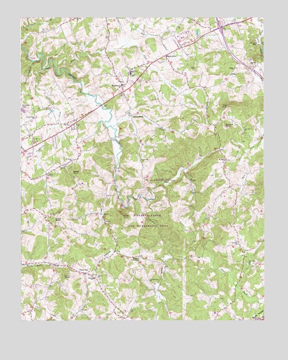
Woodlawn, VA USGS Topographic Map
Click on map above to begin viewing in our Map Viewer.

This topographic map contains these locations and features:
Feature Name Type Latitude Longitude GNIS ID View Map
Beamer CemeteryCemeteryN36.6687°W80.7506°1738596View Map
Beaverdam CreekStreamN36.7046°W80.8279°1462953View Map
Bethany CemeteryCemeteryN36.6890°W80.8520°1738597View Map
Bethany ChurchChurchN36.6893°W80.8520°1738598View Map
Bethany SchoolSchoolN36.6882°W80.8551°1463148View Map
Browns StorePopulated PlaceN36.7343°W80.8004°1499171View Map
CapLocaleN36.6951°W80.7734°1464424View Map
Carter CemeteryCemeteryN36.6929°W80.8684°1738627View Map
Center Valley ChurchChurchN36.7085°W80.8681°1464678View Map
Chisel KnobSummitN36.6679°W80.8240°1499261View Map
Cranberry CemeteryCemeteryN36.6857°W80.8606°1738644View Map
Cranberry ChurchChurchN36.6882°W80.8554°1465404View Map
Cranberry CreekStreamN36.7282°W80.8634°1465405View Map
Cranberry School (historical)SchoolN36.6857°W80.8620°1738645View Map
Crooked Creek CemeteryCemeteryN36.6410°W80.8087°1738646View Map
Crooked Creek ChurchChurchN36.6410°W80.8092°1465464View Map
Crooked Creek Fish Management AreaParkN36.6662°W80.8104°1738647View Map
Crooked Creek School (historical)SchoolN36.6376°W80.8045°1738648View Map
East Fork Crooked CreekStreamN36.6746°W80.8095°1466100View Map
Edwards CemeteryCemeteryN36.6996°W80.8006°1738673View Map
Edwards KnobSummitN36.7046°W80.7704°1499380View Map
Elkhorn ChurchChurchN36.6685°W80.8329°1466231View Map
Elkhorn CreekStreamN36.6804°W80.8262°1466232View Map
Elkhorn School (historical)SchoolN36.6690°W80.8326°1738679View Map
EonaPopulated PlaceN36.7265°W80.7673°1499389View Map
Forest Oak ChurchChurchN36.6904°W80.8126°1466768View Map
Forest Oak School (historical)SchoolN36.6912°W80.8129°1738692View Map
Gardner CemeteryCemeteryN36.7215°W80.7556°1738699View Map
Gardner MillsPopulated PlaceN36.7387°W80.7529°1499460View Map
Gay Hills Country ClubLocaleN36.7126°W80.8590°1491152View Map
Glade CreekStreamN36.7293°W80.8567°1467116View Map
Good Hope CemeteryCemeteryN36.6487°W80.7584°1738705View Map
Good Hope ChurchChurchN36.6485°W80.7581°1467205View Map
Good Hope School (historical)SchoolN36.6482°W80.7584°1738706View Map
Hanks KnobSummitN36.6426°W80.8495°1467709View Map
Harmony ChurchChurchN36.7312°W80.7562°1467755View Map
Higgins CrossroadsPopulated PlaceN36.6512°W80.8145°1477412View Map
High Point School (historical)SchoolN36.6565°W80.7879°1738722View Map
Interchange 14CrossingN36.7457°W80.7726°1738735View Map
Jones NurseryBuildingN36.7281°W80.8128°2677809View Map
Kennedys LakeReservoirN36.7117°W80.8738°1484556View Map
Kyle School (historical)SchoolN36.7135°W80.8609°1738764View Map
Lebanon School (historical)SchoolN36.6904°W80.7692°1738769View Map
Liberty CemeteryCemeteryN36.7293°W80.7654°1738772View Map
Liberty ChurchChurchN36.7287°W80.7656°1469355View Map
Little Cranberry CreekStreamN36.7318°W80.8692°1484888View Map
Mount Lebanon ChurchChurchN36.6907°W80.7698°1470921View Map
Mount Olivet CemeteryCemeteryN36.6921°W80.8487°1738823View Map
Mount Olivet ChurchChurchN36.6918°W80.8487°1470996View Map
New Hope CemeteryCemeteryN36.6573°W80.7634°1738833View Map
New Hope ChurchChurchN36.6568°W80.7634°1471430View Map
New Life Christian AcademySchoolN36.7014°W80.8684°2498424View Map
New Mount Lebanon CemeteryCemeteryN36.6912°W80.7690°1738834View Map
Oak Grove ChurchChurchN36.7035°W80.7606°1471705View Map
Oakland CemeteryCemeteryN36.6421°W80.8353°1738839View Map
Oakland ChurchChurchN36.6426°W80.8359°1471776View Map
Oakland Elementary SchoolSchoolN36.6426°W80.8378°1471786View Map
Old Burnett CemeteryCemeteryN36.7236°W80.7767°2558322View Map
Old Mount Lebanon CemeteryCemeteryN36.6904°W80.7701°1738846View Map
Pike KnobSummitN36.7134°W80.7684°1493852View Map
Pine BranchStreamN36.7382°W80.8217°1472327View Map
Piper Gap DistrictCivilN36.6678°W80.7978°1927446View Map
Pipers GapPopulated PlaceN36.6443°W80.8420°1472430View Map
Pipers Gap Rescue SquadBuildingN36.6473°W80.8355°2086325View Map
Poplar KnobSummitN36.6662°W80.8576°1499895View Map
Russell DamDamN36.7118°W80.8748°1489401View Map
Thomas L Fells Memorial BridgeBridgeN36.7140°W80.8337°1738928View Map
Walker CemeteryCemeteryN36.7171°W80.8509°1738941View Map
Walker KnobSummitN36.6862°W80.8487°1500270View Map
West Fork Little Reed Island CreekStreamN36.7296°W80.7529°1476485View Map
Williams CemeteryCemeteryN36.7465°W80.8367°1738958View Map
Williams-Jenkins CemeteryCemeteryN36.6848°W80.7776°1738959View Map
WoodlawnPopulated PlaceN36.7223°W80.8229°1476952View Map
Woodlawn CemeteryCemeteryN36.7276°W80.8201°1738964View Map
Woodlawn Census Designated PlaceCensusN36.7385°W80.8167°2390533View Map
Woodlawn Methodist ChurchChurchN36.7273°W80.8195°1738965View Map
Woodlawn Post OfficePost OfficeN36.7201°W80.8221°2766328View Map
Woodlawn SchoolSchoolN36.7274°W80.8181°1476958View Map

Note: Coordinates in the location and feature list above are referenced to NAD83 datum.


Copyright (C) 2008-2025 Ryan Niemi / Sunset Dynamics ... All Rights Reserved