TopoQuest Logo
Do you find TopoQuest useful?
Help keep TopoQuest running and adding new maps/features by donating!
Bitcoin:  19c7KJd3qBynnjoSw5npx9KScwjBe4ifkT
Litecoin:  LXs6TkuXGGXo1vDsWCkWVdjQX94eUKd6ui
Home View Maps Find Maps Find Places Resources & Links


Hodges, Alabama Topographic Map

USGS Map Title: Hodges, AL
USGS Map MRC: 34087C8
DRG (GeoTIFF) Download: o34087c8.tif


Neighboring USGS Topographic Map Quads:


  Halltown, AL  
34088D1
 

  Guinn Cross Roads, AL  
34087D8
 

  Isbell, AL  
34087D7
 

  Vina, AL  
34088C1
 

  Hodges, AL  
34087C8
 

  Hackleburg, AL  
34087C7
 

  Weston, AL  
34088B1
 

  Hamilton, AL  
34087B8
 

  Hamilton NE, AL  
34087B7


Map MRC Location:

N35°
W88°
N35°
W87°
H8 H7 H6 H5 H4 H3 H2 H1
G8 G7 G6 G5 G4 G3 G2 G1
F8 F7 F6 F5 F4 F3 F2 F1
E8 E7 E6 E5 E4 E3 E2 E1
D8 D7 D6 D5 D4 D3 D2 D1
C8 C7 C6 C5 C4 C3 C2 C1
B8 B7 B6 B5 B4 B3 B2 B1
A8 A7 A6 A5 A4 A3 A2 A1
N34°
W88°
N34°
W87°

Hodges, AL USGS 1:24K Topographic Map Preview:
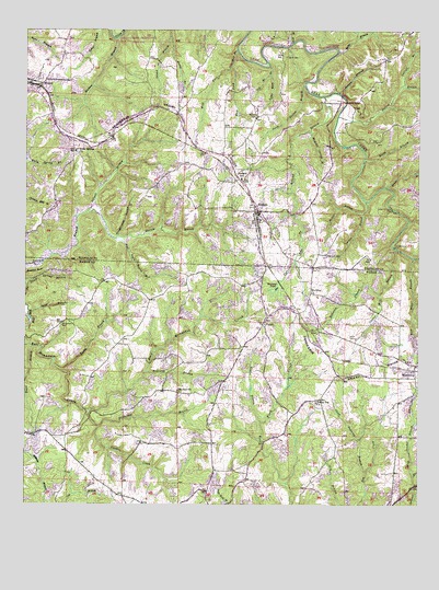
Hodges, AL USGS Topographic Map
Click on map above to begin viewing in our Map Viewer.

This topographic map contains these locations and features:
Feature Name Type Latitude Longitude GNIS ID View Map
AtwoodPopulated PlaceN34.3607°W87.9950°113274View Map
Atwood ChurchChurchN34.3615°W87.9995°154376View Map
Bailey BranchStreamN34.3270°W87.8928°113342View Map
Bony Bluff BranchStreamN34.3148°W87.8767°114728View Map
Bridge BranchStreamN34.3340°W87.8861°114896View Map
Bullock BranchStreamN34.3523°W87.9009°115193View Map
Buzzard BluffCliffN34.3109°W87.9995°115328View Map
Clear Running BranchStreamN34.2587°W87.8914°116239View Map
Cole Mill BranchStreamN34.3698°W87.9334°116406View Map
Davis CemeteryCemeteryN34.3298°W87.9898°136149View Map
East Fork Cole Mill BranchStreamN34.3651°W87.9350°117757View Map
Fowler BranchStreamN34.2718°W87.9248°118564View Map
Gann BranchStreamN34.3034°W87.8761°118809View Map
Garrett BranchStreamN34.3607°W87.8806°118848View Map
Green HollowValleyN34.2718°W87.8756°119343View Map
Green Spring BranchStreamN34.3084°W87.9992°119348View Map
Green Williams FordCrossingN34.3282°W87.8834°119354View Map
HodgesPopulated PlaceN34.3270°W87.9264°120172View Map
Hodges CemeteryCemeteryN34.3279°W87.9270°136185View Map
Hodges DamDamN34.3068°W87.9184°131995View Map
Hodges Junior High SchoolSchoolN34.3359°W87.9317°165449View Map
Hodges Post OfficePost OfficeN34.3265°W87.9260°167405View Map
Hodges Volunteer Fire DepartmentBuildingN34.3283°W87.9263°2683475View Map
Holcomb BranchStreamN34.3576°W87.9053°120217View Map
Holloway BranchStreamN34.2854°W87.9611°120265View Map
Holly Spring ChurchChurchN34.3432°W87.9845°120280View Map
Holly Springs CemeteryCemeteryN34.3434°W87.9834°136186View Map
Hulsey BranchStreamN34.3587°W87.9006°120542View Map
Jim Williams FordCrossingN34.3182°W87.8828°1958571View Map
Keller BranchStreamN34.3698°W87.9011°121107View Map
Lawler CemeteryCemeteryN34.2943°W87.8948°121425View Map
Lawler Mill BranchStreamN34.3176°W87.8828°121429View Map
Lime Kiln BranchStreamN34.3657°W87.9228°121635View Map
Mars Hill ChurchChurchN34.2882°W87.8786°138007View Map
McCurley CemeteryCemeteryN34.3526°W87.9267°122513View Map
McKelly Spring BranchStreamN34.3484°W87.9095°122568View Map
Mill Gann BranchStreamN34.3007°W87.9986°122804View Map
Miller BranchStreamN34.2987°W87.8761°122820View Map
Mount Carmel CemeteryCemeteryN34.2979°W87.9878°123167View Map
Mount Carmel ChurchChurchN34.2982°W87.9839°138014View Map
Mount Carmel ChurchChurchN34.3057°W87.9570°138015View Map
Mount Olive Baptist ChurchChurchN34.3057°W87.9098°152472View Map
Mount Olive CemeteryCemeteryN34.3062°W87.9098°138017View Map
Mount Zion CemeteryCemeteryN34.2798°W87.9506°138020View Map
Mount Zion ChurchChurchN34.2801°W87.9514°123492View Map
Mountain View ChurchChurchN34.2823°W87.9367°138023View Map
New Home School (historical)SchoolN34.2568°W87.9689°138026View Map
Oilwell BranchStreamN34.3273°W87.9806°124190View Map
Old Line ChurchChurchN34.3157°W87.9048°136227View Map
Old Lion CemeteryCemeteryN34.3159°W87.9042°136228View Map
Old Mount Carmel ChurchChurchN34.2979°W87.9875°154435View Map
Pig BranchStreamN34.3632°W87.9225°124710View Map
PigeyePopulated PlaceN34.2979°W87.9242°156884View Map
Pilot Hill Gas FieldOilfieldN34.3293°W87.9853°154951View Map
Plum Orchard BranchStreamN34.3248°W87.8781°125068View Map
Polebridge BranchStreamN34.2745°W87.9795°125093View Map
Prospect HollowValleyN34.2718°W87.8759°125311View Map
Railroad PondReservoirN34.3066°W87.9200°153100View Map
Raven BranchStreamN34.3734°W87.9545°125449View Map
Robinson BranchStreamN34.3057°W87.8873°125714View Map
Rock BridgeArchN34.3631°W87.9328°2571541View Map
Rock Bridge Canyon ParkParkN34.3612°W87.9231°136258View Map
Rocky BranchStreamN34.2854°W87.9881°125808View Map
Rocky BranchStreamN34.3407°W87.8925°125810View Map
Rocky BranchStreamN34.3732°W87.8950°125831View Map
Rocky Top ChurchChurchN34.2770°W87.9075°125882View Map
Rough Leg HollowValleyN34.3204°W87.9714°125964View Map
Scott BridgeBridgeN34.3562°W87.8984°126478View Map
Scott CemeteryCemeteryN34.3681°W87.9175°126482View Map
Scott FordCrossingN34.3709°W87.9195°157026View Map
Smith BranchStreamN34.3712°W87.9164°127001View Map
Steep Hollow BranchStreamN34.3607°W87.9120°127352View Map
Town of HodgesCivilN34.3339°W87.9298°2405846View Map
Trace BranchStreamN34.2918°W87.9975°128049View Map
Turner Bobo BranchStreamN34.3265°W87.9148°128186View Map
Turner BranchStreamN34.3301°W87.8917°128188View Map
Twomile CreekStreamN34.2707°W87.9764°128233View Map
Unity ChurchChurchN34.2515°W87.9334°154434View Map
Walt Davis Spring BranchStreamN34.3198°W87.9711°128560View Map
West Fork Cole Mill BranchStreamN34.3651°W87.9350°128770View Map
West Gowder BranchStreamN34.2576°W87.8767°128780View Map
WigintonPopulated PlaceN34.2868°W87.8759°128947View Map
Wiginton Junior High School (historical)SchoolN34.2845°W87.8764°154848View Map

Note: Coordinates in the location and feature list above are referenced to NAD83 datum.


Copyright (C) 2008-2024 Ryan Niemi / Sunset Dynamics ... All Rights Reserved