TopoQuest Logo
Do you find TopoQuest useful?
Help keep TopoQuest running and adding new maps/features by donating!
Bitcoin:  19c7KJd3qBynnjoSw5npx9KScwjBe4ifkT
Litecoin:  LXs6TkuXGGXo1vDsWCkWVdjQX94eUKd6ui
Home View Maps Find Maps Find Places Resources & Links


Improve, Mississippi Topographic Map

USGS Map Title: Improve, MS
USGS Map MRC: 31089C6
DRG (GeoTIFF) Download: o31089c6.tif


Neighboring USGS Topographic Map Quads:


  Bunker Hill, MS  
31089D7
 

  Bassfield, MS  
31089D6
 

  Sumrall, MS  
31089D5
 

  Columbia North, MS  
31089C7
 

  Improve, MS  
31089C6
 

  Oloh, MS  
31089C5
 

  Columbia South, MS  
31089B7
 

  Pinebur, MS  
31089B6
 

  Baxterville NE, MS  
31089B5


Map MRC Location:

N32°
W90°
N32°
W89°
H8 H7 H6 H5 H4 H3 H2 H1
G8 G7 G6 G5 G4 G3 G2 G1
F8 F7 F6 F5 F4 F3 F2 F1
E8 E7 E6 E5 E4 E3 E2 E1
D8 D7 D6 D5 D4 D3 D2 D1
C8 C7 C6 C5 C4 C3 C2 C1
B8 B7 B6 B5 B4 B3 B2 B1
A8 A7 A6 A5 A4 A3 A2 A1
N31°
W90°
N31°
W89°

Improve, MS USGS 1:24K Topographic Map Preview:
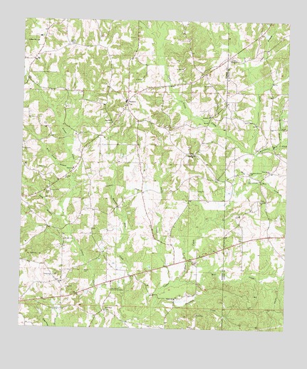
Improve, MS USGS Topographic Map
Click on map above to begin viewing in our Map Viewer.

This topographic map contains these locations and features:
Feature Name Type Latitude Longitude GNIS ID View Map
Advent Church (historical)ChurchN31.3513°W89.6520°685761View Map
Baylis ChapelChurchN31.2577°W89.7095°666593View Map
Baylis Chapel CemeteryCemeteryN31.2574°W89.7090°710512View Map
Beaver Dam CreekStreamN31.2535°W89.7009°666710View Map
Bob BranchStreamN31.3488°W89.6381°685768View Map
Broom CemeteryCemeteryN31.2738°W89.7195°667604View Map
Buchanan BranchStreamN31.3249°W89.6290°667716View Map
Buckhalter Mill CreekStreamN31.3207°W89.6392°667742View Map
Christian Union ChurchChurchN31.3210°W89.6698°668432View Map
Cook CreekStreamN31.2505°W89.7012°678708View Map
East Marion Community CenterLocaleN31.2666°W89.7065°669592View Map
EnonPopulated PlaceN31.2624°W89.6759°710533View Map
Enon CemeteryCemeteryN31.2618°W89.6770°710534View Map
Enon ChurchChurchN31.2624°W89.6773°669786View Map
Ford BranchStreamN31.3610°W89.6370°685778View Map
Graves Creek ChurchChurchN31.2713°W89.7342°670623View Map
Gully CreekStreamN31.2685°W89.6790°670779View Map
Hartfield Mill CreekStreamN31.3099°W89.6434°670992View Map
HopewellPopulated PlaceN31.3363°W89.6612°710547View Map
Hopewell CemeteryCemeteryN31.3357°W89.6617°710548View Map
Hopewell ChurchChurchN31.3018°W89.6373°671413View Map
Hopewell ChurchChurchN31.3363°W89.6612°671414View Map
Hopewell School (historical)SchoolN31.3366°W89.6615°710549View Map
ImprovePopulated PlaceN31.3430°W89.7004°671659View Map
Improve CemeteryCemeteryN31.3152°W89.7251°710553View Map
Improve ChurchChurchN31.3149°W89.7256°671660View Map
Improve Lookout TowerTowerN31.3655°W89.7256°711251View Map
Improve Oil FieldOilfieldN31.3030°W89.7390°689679View Map
Improve SchoolSchoolN31.3421°W89.7012°689680View Map
La Marion School (historical)SchoolN31.3213°W89.6684°689682View Map
Lloyd BranchStreamN31.3546°W89.6434°672737View Map
Long BranchStreamN31.2955°W89.7298°672807View Map
Lott School (historical)SchoolN31.2980°W89.6406°685789View Map
Mill CreekStreamN31.2693°W89.6765°673617View Map
Old Advance ChurchChurchN31.3596°W89.6506°675157View Map
Old Rocky Branch CemeteryCemeteryN31.3138°W89.6423°675243View Map
Parkers Chapel (historical)ChurchN31.2930°W89.6470°685799View Map
Polk CreekStreamN31.3224°W89.6415°676182View Map
Rocky BranchStreamN31.3127°W89.6417°676775View Map
Rocky BranchPopulated PlaceN31.3141°W89.6326°685806View Map
Rocky Branch ChurchChurchN31.3141°W89.6331°676780View Map
Rocky Branch School (historical)SchoolN31.3174°W89.6295°685807View Map
Rose Hill CemeteryCemeteryN31.3332°W89.7090°710572View Map
Rose Hill ChurchChurchN31.3335°W89.7079°676852View Map
Saint Marys ChurchChurchN31.3666°W89.7445°677149View Map
Singley CemeteryCemeteryN31.2860°W89.7292°677847View Map
Singley Lake DamDamN31.2735°W89.7134°680637View Map
Stogner Lake DamDamN31.2618°W89.7167°680631View Map
Stringer CemeteryCemeteryN31.3110°W89.7298°678358View Map
Supervisor District 1CivilN31.3217°W89.7105°711977View Map
Thompson CreekStreamN31.2582°W89.6870°678703View Map
Tolar CemeteryCemeteryN31.2777°W89.6678°678797View Map
Tri - Community Volunteer Fire Department Station 3BuildingN31.3421°W89.7009°2667920View Map
Tri - Community Volunteer Fire Department Station 5BuildingN31.2577°W89.7102°2667929View Map
W E Stogner Lake DamDamN31.2668°W89.7167°680633View Map
Watts CemeteryCemeteryN31.3288°W89.7231°710579View Map
Watts CemeteryCemeteryN31.3346°W89.6456°679384View Map
Watts School (historical)SchoolN31.3330°W89.6376°685818View Map
Wolf Island BranchStreamN31.3141°W89.7273°679819View Map

Note: Coordinates in the location and feature list above are referenced to NAD83 datum.


Copyright (C) 2008-2025 Ryan Niemi / Sunset Dynamics ... All Rights Reserved