TopoQuest Logo
Do you find TopoQuest useful?
Help keep TopoQuest running and adding new maps/features by donating!
Bitcoin:  19c7KJd3qBynnjoSw5npx9KScwjBe4ifkT
Litecoin:  LXs6TkuXGGXo1vDsWCkWVdjQX94eUKd6ui
Home View Maps Find Maps Find Places Resources & Links


Oloh, Mississippi Topographic Map

USGS Map Title: Oloh, MS
USGS Map MRC: 31089C5
DRG (GeoTIFF) Download: o31089c5.tif


Neighboring USGS Topographic Map Quads:


  Bassfield, MS  
31089D6
 

  Sumrall, MS  
31089D5
 

  Sanford, MS  
31089D4
 

  Improve, MS  
31089C6
 

  Oloh, MS  
31089C5
 

  Hattiesburg SW, MS  
31089C4
 

  Pinebur, MS  
31089B6
 

  Baxterville NE, MS  
31089B5
 

  Purvis, MS  
31089B4


Map MRC Location:

N32°
W90°
N32°
W89°
H8 H7 H6 H5 H4 H3 H2 H1
G8 G7 G6 G5 G4 G3 G2 G1
F8 F7 F6 F5 F4 F3 F2 F1
E8 E7 E6 E5 E4 E3 E2 E1
D8 D7 D6 D5 D4 D3 D2 D1
C8 C7 C6 C5 C4 C3 C2 C1
B8 B7 B6 B5 B4 B3 B2 B1
A8 A7 A6 A5 A4 A3 A2 A1
N31°
W90°
N31°
W89°

Oloh, MS USGS 1:24K Topographic Map Preview:
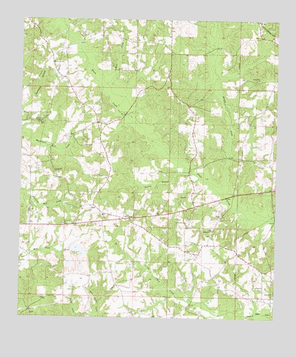
Oloh, MS USGS Topographic Map
Click on map above to begin viewing in our Map Viewer.

This topographic map contains these locations and features:
Feature Name Type Latitude Longitude GNIS ID View Map
Baptist BranchStreamN31.2799°W89.6015°685763View Map
Bear BayStreamN31.3730°W89.6048°666630View Map
Bob Lott BridgeBridgeN31.3005°W89.5248°707453View Map
Buchanan CemeteryCemeteryN31.3318°W89.6167°667717View Map
Central Lamar County Fire DepartmentBuildingN31.2682°W89.5016°2667802View Map
Clyde Camp (historical)LocaleN31.2521°W89.5703°685772View Map
Doctor Richard Clark Pond DamDamN31.2668°W89.5451°680632View Map
Dogwood Island (historical)LocaleN31.2718°W89.5690°685773View Map
Irby-Alexander Pond DamDamN31.2735°W89.5767°680636View Map
J D Broome Pond DamDamN31.2718°W89.6034°680635View Map
J D Broome Pond DamDamN31.2785°W89.5984°680640View Map
Martin-Lott CemeteryCemeteryN31.3571°W89.6042°673198View Map
Midway Cemetery Number OneCemeteryN31.2871°W89.5306°707463View Map
Midway Cemetery Number ThreeCemeteryN31.2849°W89.5317°707465View Map
Midway Cemetery Number TwoCemeteryN31.2849°W89.5312°707464View Map
Midway ChurchChurchN31.2863°W89.5320°673545View Map
Midway School (historical)SchoolN31.2780°W89.5184°685790View Map
Mill CreekStreamN31.3466°W89.5856°673618View Map
Monroe CreekStreamN31.3016°W89.5253°673731View Map
Olah Lookout TowerTowerN31.2921°W89.5712°711285View Map
OlohPopulated PlaceN31.2968°W89.5901°675286View Map
Oloh Baptist ChurchChurchN31.2932°W89.5845°685798View Map
Oloh CemeteryCemeteryN31.2924°W89.5845°707468View Map
Oloh Volunteer Fire DepartmentBuildingN31.2770°W89.5821°2667690View Map
Powell School (historical)SchoolN31.2691°W89.5815°685802View Map
Robert Lotts (historical)LocaleN31.3002°W89.5278°685805View Map
Russell CemeteryCemeteryN31.3693°W89.5965°676965View Map
Slade CemeteryCemeteryN31.3318°W89.6153°677874View Map
Supervisor District 4CivilN31.2695°W89.5224°711936View Map
Supervisor District 5CivilN31.3640°W89.5490°711937View Map
Turkey BranchStreamN31.3135°W89.5445°678942View Map
West Black Creek ChurchChurchN31.2891°W89.5440°679469View Map

Note: Coordinates in the location and feature list above are referenced to NAD83 datum.


Copyright (C) 2008-2024 Ryan Niemi / Sunset Dynamics ... All Rights Reserved