TopoQuest Logo
Do you find TopoQuest useful?
Help keep TopoQuest running and adding new maps/features by donating!
Bitcoin:  19c7KJd3qBynnjoSw5npx9KScwjBe4ifkT
Litecoin:  LXs6TkuXGGXo1vDsWCkWVdjQX94eUKd6ui
Home View Maps Find Maps Find Places Resources & Links


Lambrook, Arkansas Topographic Map

USGS Map Title: Lambrook, AR
USGS Map MRC: 34090C8
DRG (GeoTIFF) Download: o34090c8.tif


Neighboring USGS Topographic Map Quads:


  Turner, AR  
34091D1
 

  Watkins Corner, AR  
34090D8
 

  Lakeview, AR  
34090D7
 

  Indian Bay SE, AR  
34091C1
 

  Lambrook, AR  
34090C8
 

  Elaine, AR  
34090C7
 

  Henrico NE, AR  
34091B1
 

  Mellwood, AR  
34090B8
 

  Rena Lara, MS  
34090B7


Map MRC Location:

N35°
W91°
N35°
W90°
H8 H7 H6 H5 H4 H3 H2 H1
G8 G7 G6 G5 G4 G3 G2 G1
F8 F7 F6 F5 F4 F3 F2 F1
E8 E7 E6 E5 E4 E3 E2 E1
D8 D7 D6 D5 D4 D3 D2 D1
C8 C7 C6 C5 C4 C3 C2 C1
B8 B7 B6 B5 B4 B3 B2 B1
A8 A7 A6 A5 A4 A3 A2 A1
N34°
W91°
N34°
W90°

Lambrook, AR USGS 1:24K Topographic Map Preview:
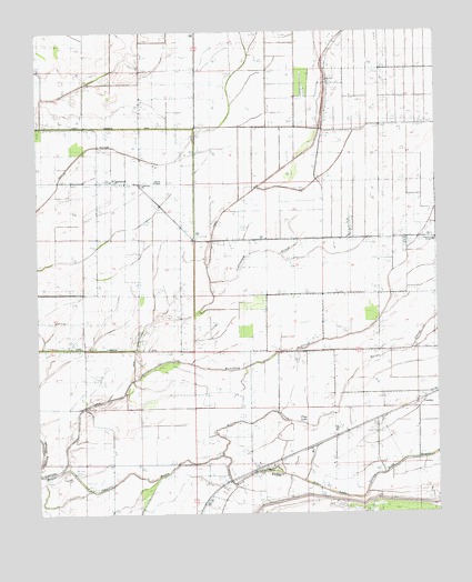
Lambrook, AR USGS Topographic Map
Click on map above to begin viewing in our Map Viewer.

This topographic map contains these locations and features:
Feature Name Type Latitude Longitude GNIS ID View Map
Allen LakeLakeN34.2559°W90.9096°74625View Map
Beach Tree Church (historical)ChurchN34.3320°W90.9643°81648View Map
Beach Tree School (historical)SchoolN34.3315°W90.9634°81649View Map
Bear BayouStreamN34.2697°W90.9890°46193View Map
Bethlehem ChurchChurchN34.3215°W90.8998°46471View Map
Brooks ChapelChurchN34.3359°W90.9623°46980View Map
Church of the Living GodChurchN34.3209°W90.8754°65612View Map
Cottonwood SloughStreamN34.3087°W90.9457°48077View Map
CountissPopulated PlaceN34.2804°W90.8782°57590View Map
Cypress DitchCanalN34.3173°W90.9451°48313View Map
Flag LakeLakeN34.2732°W90.9165°74837View Map
Gauzley BayouStreamN34.2612°W90.9923°49361View Map
Govan SloughStreamN34.2657°W90.9426°49526View Map
Gumwood ChurchChurchN34.2593°W90.9409°81653View Map
Humphrey SloughStreamN34.2848°W90.9712°50410View Map
LambrookPopulated PlaceN34.3357°W90.9676°58044View Map
Lambrook Baptist ChurchChurchN34.3357°W90.9676°65631View Map
Lambrook Post OfficePost OfficeN34.3359°W90.9762°2781877View Map
Mary SpurPopulated PlaceN34.2668°W90.9157°77609View Map
Morning Star ChurchChurchN34.3682°W90.9087°52203View Map
RatioPopulated PlaceN34.2612°W90.9321°58463View Map
Ratio School (historical)SchoolN34.2568°W90.9432°70131View Map
Township of TappanCivilN34.3483°W90.8875°68959View Map
Yellow Bank BayouStreamN34.2601°W90.9234°56589View Map
Zion Hill ChurchChurchN34.2773°W90.8854°56643View Map

Note: Coordinates in the location and feature list above are referenced to NAD83 datum.


Copyright (C) 2008-2025 Ryan Niemi / Sunset Dynamics ... All Rights Reserved