TopoQuest Logo
Do you find TopoQuest useful?
Help keep TopoQuest running and adding new maps/features by donating!
Bitcoin:  19c7KJd3qBynnjoSw5npx9KScwjBe4ifkT
Litecoin:  LXs6TkuXGGXo1vDsWCkWVdjQX94eUKd6ui
Home View Maps Find Maps Find Places Resources & Links


Ingalls, Indiana Topographic Map

USGS Map Title: Ingalls, IN
USGS Map MRC: 39085H7
DRG (GeoTIFF) Download: o39085h7.tif


Neighboring USGS Topographic Map Quads:


  Riverwood, IN  
40085A8
 

  Lapel, IN  
40085A7
 

  Anderson South, IN  
40085A6
 

  McCordsville, IN  
39085H8
 

  Ingalls, IN  
39085H7
 

  Pendleton, IN  
39085H6
 

  Cumberland, IN  
39085G8
 

  Greenfield, IN  
39085G7
 

  Cleveland, IN  
39085G6


Map MRC Location:

N40°
W86°
N40°
W85°
H8 H7 H6 H5 H4 H3 H2 H1
G8 G7 G6 G5 G4 G3 G2 G1
F8 F7 F6 F5 F4 F3 F2 F1
E8 E7 E6 E5 E4 E3 E2 E1
D8 D7 D6 D5 D4 D3 D2 D1
C8 C7 C6 C5 C4 C3 C2 C1
B8 B7 B6 B5 B4 B3 B2 B1
A8 A7 A6 A5 A4 A3 A2 A1
N39°
W86°
N39°
W85°

Ingalls, IN USGS 1:24K Topographic Map Preview:
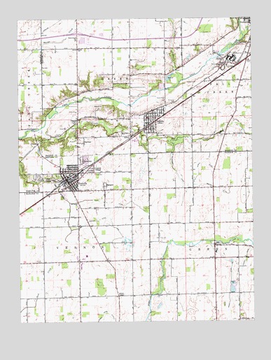
Ingalls, IN USGS Topographic Map
Click on map above to begin viewing in our Map Viewer.

This topographic map contains these locations and features:
Feature Name Type Latitude Longitude GNIS ID View Map
AlfontPopulated PlaceN39.9514°W85.8147°430069View Map
Barrett DitchCanalN39.8928°W85.7616°430535View Map
Beech Grove ChurchChurchN39.9914°W85.8436°430728View Map
Beeler DitchCanalN39.9303°W85.7691°430742View Map
Cahill Shore DitchCanalN39.8784°W85.8280°431942View Map
Caudell - Simmons CemeteryCemeteryN39.9365°W85.8320°432913View Map
Center SchoolSchoolN39.9878°W85.8428°432339View Map
Chappell - Shore CemeteryCemeteryN39.8864°W85.8017°432414View Map
Colonial VillagePopulated PlaceN39.9375°W85.8350°432809View Map
Correctional Industrial FacilityBuildingN39.9752°W85.7718°2757184View Map
Crosley CemeteryCemeteryN39.9737°W85.7803°433179View Map
Denny CornerPopulated PlaceN39.8856°W85.8222°433479View Map
Doty CemeteryCemeteryN39.9500°W85.8508°433649View Map
EastgatePopulated PlaceN39.9309°W85.8297°433951View Map
EdenPopulated PlaceN39.9062°W85.7700°434004View Map
Fausset CemeteryCemeteryN39.9521°W85.8548°434419View Map
Fort CemeteryCemeteryN39.9495°W85.8632°434684View Map
FortvillePopulated PlaceN39.9323°W85.8480°434692View Map
Fortville ParkParkN39.9339°W85.8591°434693View Map
Fortville Police DepartmentBuildingN39.9348°W85.8406°2662807View Map
Fortville Post OfficePost OfficeN39.9334°W85.8485°2775166View Map
Fortville Volunteer Fire DepartmentBuildingN39.9347°W85.8406°2625709View Map
Fortville-Vernon Townsip LibraryBuildingN39.9344°W85.8430°2662916View Map
Foster BranchStreamN39.9737°W85.7883°434697View Map
Gravel Lawn CemeteryCemeteryN39.9578°W85.8449°435356View Map
Green Township Volunteer Fire DepartmentBuildingN39.9014°W85.7702°2626168View Map
Hancock County Sheriff OfficeBuildingN39.9026°W85.8437°2662896View Map
HelmcrestPopulated PlaceN39.9406°W85.8405°435995View Map
Hiday CemeteryCemeteryN39.9550°W85.8430°436124View Map
IdlewoldPopulated PlaceN39.9862°W85.7528°446673View Map
Indiana State Police Department District 51BuildingN39.9733°W85.7700°2758408View Map
IngallsPopulated PlaceN39.9570°W85.8053°436815View Map
Ingalls Fire DepartmentBuildingN39.9566°W85.8048°2626287View Map
Ingalls Police DepartmentBuildingN39.9568°W85.8048°2758207View Map
Jackson DitchCanalN39.9206°W85.8478°436886View Map
Jackson Ditch ArmCanalN39.9162°W85.8258°436889View Map
Jones CemeteryCemeteryN39.9767°W85.8151°437084View Map
Lick CreekStreamN39.9545°W85.8641°437853View Map
McFadden DitchCanalN39.9364°W85.7897°438861View Map
Mendon ChurchChurchN39.9525°W85.7672°439010View Map
Mingle DitchCanalN39.9406°W85.7769°439266View Map
Mount Carmel CemeteryCemeteryN39.9651°W85.7913°439541View Map
Mount Carmel ChurchChurchN39.9239°W85.8436°439551View Map
Mount Vernon Elementary SchoolSchoolN39.9350°W85.8491°447055View Map
Mount Vernon High SchoolSchoolN39.9023°W85.8416°447053View Map
Mount Vernon Middle SchoolSchoolN39.9023°W85.8416°447054View Map
Olvey CemeteryCemeteryN39.9081°W85.7999°440659View Map
Pendleton Correctional FacilityBuildingN39.9833°W85.7603°2757192View Map
Pendleton Juvenile Correctional FacilityBuildingN39.9698°W85.7755°2757194View Map
Rash DitchCanalN39.9239°W85.8261°441779View Map
Reeves Sand and Gravel PitMineN39.8889°W85.7608°2649683View Map
Seals Ambulance ServiceBuildingN39.9275°W85.8577°2719318View Map
SunviewPopulated PlaceN39.9489°W85.8400°444434View Map
Town of FortvilleCivilN39.9241°W85.8465°2396943View Map
Town of IngallsCivilN39.9592°W85.8056°2397007View Map
Township of GreenCivilN39.9879°W85.8246°453342View Map
Township of VernonCivilN39.9033°W85.8679°453955View Map
Whybrew FieldAirportN39.9156°W85.8466°2770299View Map
Wilson DitchCanalN39.8953°W85.7569°446139View Map
Wynn CemeteryCemeteryN39.9423°W85.8054°446357View Map

Note: Coordinates in the location and feature list above are referenced to NAD83 datum.


Copyright (C) 2008-2025 Ryan Niemi / Sunset Dynamics ... All Rights Reserved