TopoQuest Logo
Do you find TopoQuest useful?
Help keep TopoQuest running and adding new maps/features by donating!
Bitcoin:  19c7KJd3qBynnjoSw5npx9KScwjBe4ifkT
Litecoin:  LXs6TkuXGGXo1vDsWCkWVdjQX94eUKd6ui
Home View Maps Find Maps Find Places Resources & Links


Pendleton, Indiana Topographic Map

USGS Map Title: Pendleton, IN
USGS Map MRC: 39085H6
DRG (GeoTIFF) Download: o39085h6.tif


Neighboring USGS Topographic Map Quads:


  Lapel, IN  
40085A7
 

  Anderson South, IN  
40085A6
 

  Middletown, IN  
40085A5
 

  Ingalls, IN  
39085H7
 

  Pendleton, IN  
39085H6
 

  Shirley, IN  
39085H5
 

  Greenfield, IN  
39085G7
 

  Cleveland, IN  
39085G6
 

  Knightstown, IN  
39085G5


Map MRC Location:

N40°
W86°
N40°
W85°
H8 H7 H6 H5 H4 H3 H2 H1
G8 G7 G6 G5 G4 G3 G2 G1
F8 F7 F6 F5 F4 F3 F2 F1
E8 E7 E6 E5 E4 E3 E2 E1
D8 D7 D6 D5 D4 D3 D2 D1
C8 C7 C6 C5 C4 C3 C2 C1
B8 B7 B6 B5 B4 B3 B2 B1
A8 A7 A6 A5 A4 A3 A2 A1
N39°
W86°
N39°
W85°

Pendleton, IN USGS 1:24K Topographic Map Preview:
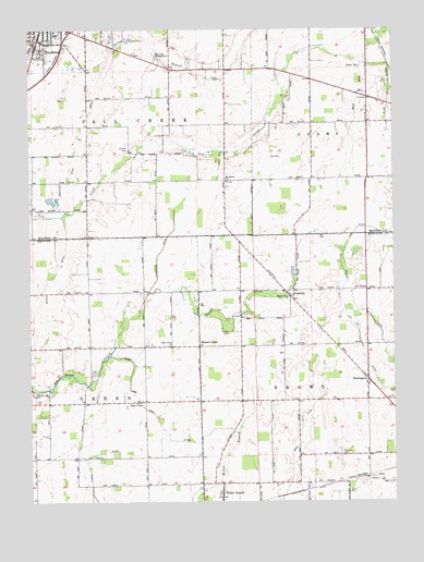
Pendleton, IN USGS Topographic Map
Click on map above to begin viewing in our Map Viewer.

This topographic map contains these locations and features:
Feature Name Type Latitude Longitude GNIS ID View Map
Adams Markleville Fire Protection TerritoryBuildingN39.9976°W85.6345°2625692View Map
Bunker CemeteryCemeteryN39.9681°W85.7159°431806View Map
Cook CemeteryCemeteryN39.9088°W85.7285°432912View Map
Dunwoody DitchCanalN39.9345°W85.7064°433803View Map
Fall Creek MeetinghouseBuildingN39.9931°W85.7066°434375View Map
Ham DitchCanalN39.9473°W85.6314°435627View Map
Harless Airport (historical)AirportN39.9489°W85.7322°449302View Map
Hays CemeteryCemeteryN39.9197°W85.6822°435926View Map
Keck DitchCanalN39.8870°W85.6603°437186View Map
Kuhn DitchCanalN39.8775°W85.6450°437472View Map
Manifold DitchCanalN39.9575°W85.7391°438517View Map
Maple Grove ChurchChurchN39.9292°W85.6611°438558View Map
March and Trees DitchCanalN39.8973°W85.7072°438648View Map
Markleville Fire DepartmentBuildingN39.9976°W85.6346°2701453View Map
Milners CornerPopulated PlaceN39.9162°W85.6922°449697View Map
Mount Gilead ChurchChurchN39.9600°W85.6825°439569View Map
Mud RunStreamN39.9917°W85.6383°439845View Map
NashvillePopulated PlaceN39.9284°W85.6594°439942View Map
O'Hara DitchCanalN39.8789°W85.7291°440390View Map
PendletonPopulated PlaceN39.9975°W85.7466°440989View Map
Redskin BrookStreamN39.9442°W85.6255°441840View Map
Reeves CemeteryCemeteryN39.8875°W85.6431°441874View Map
Sauer-Harter AirportAirportN39.8808°W85.7017°2676982View Map
Sugar Grove ChurchChurchN39.9162°W85.7019°444344View Map
Sunnyside GreenhousesBuildingN39.8858°W85.7456°2649872View Map
Township of BrownCivilN39.9093°W85.6341°453137View Map
Township of Fall CreekCivilN39.9959°W85.7300°453292View Map
Township of GreenCivilN39.9085°W85.7486°453341View Map
Village BrookStreamN39.9448°W85.6272°445294View Map
Walker CemeteryCemeteryN39.9900°W85.6362°445373View Map
WarringtonPopulated PlaceN39.9075°W85.6339°445486View Map
WEEM-FM (Pendleton)TowerN39.9978°W85.7353°448976View Map
Willow BranchPopulated PlaceN39.8762°W85.6844°446097View Map
Zion ChapelChurchN39.9314°W85.6347°446449View Map

Note: Coordinates in the location and feature list above are referenced to NAD83 datum.


Copyright (C) 2008-2025 Ryan Niemi / Sunset Dynamics ... All Rights Reserved