TopoQuest Logo
Do you find TopoQuest useful?
Help keep TopoQuest running and adding new maps/features by donating!
Bitcoin:  19c7KJd3qBynnjoSw5npx9KScwjBe4ifkT
Litecoin:  LXs6TkuXGGXo1vDsWCkWVdjQX94eUKd6ui
Home View Maps Find Maps Find Places Resources & Links


Bloomingdale, Michigan Topographic Map

USGS Map Title: Bloomingdale, MI
USGS Map MRC: 42085D8
DRG (GeoTIFF) Download: o42085d8.tif


Neighboring USGS Topographic Map Quads:


  Fennville, MI  
42086E1
 

  Millgrove, MI  
42085E8
 

  Allegan, MI  
42085E7
 

  Pullman, MI  
42086D1
 

  Bloomingdale, MI  
42085D8
 

  Merson, MI  
42085D7
 

  Bangor, MI  
42086C1
 

  Gobles West, MI  
42085C8
 

  Gobles East, MI  
42085C7


Map MRC Location:

N43°
W86°
N43°
W85°
H8 H7 H6 H5 H4 H3 H2 H1
G8 G7 G6 G5 G4 G3 G2 G1
F8 F7 F6 F5 F4 F3 F2 F1
E8 E7 E6 E5 E4 E3 E2 E1
D8 D7 D6 D5 D4 D3 D2 D1
C8 C7 C6 C5 C4 C3 C2 C1
B8 B7 B6 B5 B4 B3 B2 B1
A8 A7 A6 A5 A4 A3 A2 A1
N42°
W86°
N42°
W85°

Bloomingdale, MI USGS 1:24K Topographic Map Preview:
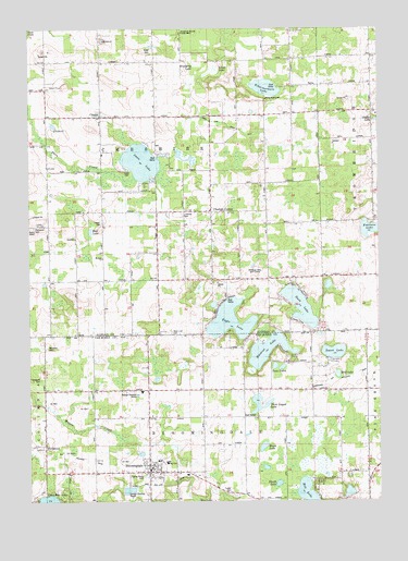
Bloomingdale, MI USGS Topographic Map
Click on map above to begin viewing in our Map Viewer.

This topographic map contains these locations and features:
Feature Name Type Latitude Longitude GNIS ID View Map
Base Line CemeteryCemeteryN42.4200°W85.9489°2109214View Map
Base Line SchoolSchoolN42.4200°W85.9522°620674View Map
BerlamontPopulated PlaceN42.3900°W85.9939°621159View Map
Berlamont Post Office (historical)Post OfficeN42.3900°W85.9939°2574494View Map
Berlamont Station (historical)LocaleN42.3892°W85.9944°2574411View Map
BloomingdalePopulated PlaceN42.3828°W85.9570°621621View Map
Bloomingdale Bible ChurchChurchN42.3842°W85.9564°2574985View Map
Bloomingdale Christian ChurchChurchN42.3844°W85.9550°2574987View Map
Bloomingdale Depot Historical MuseumParkN42.3829°W85.9574°2570902View Map
Bloomingdale Elementary SchoolSchoolN42.3858°W85.9533°2574984View Map
Bloomingdale High SchoolSchoolN42.3853°W85.9508°2574983View Map
Bloomingdale Methodist ChurchChurchN42.3850°W85.9558°2574988View Map
Bloomingdale MuseumBuildingN42.3822°W85.9578°2574980View Map
Bloomingdale Police DepartmentBuildingN42.3831°W85.9567°2574979View Map
Bloomingdale Post OfficePost OfficeN42.3833°W85.9558°2574981View Map
Bloomingdale Public LibraryBuildingN42.3828°W85.9564°2574982View Map
Bloomingdale Station (historical)LocaleN42.3828°W85.9581°2574978View Map
Bloomingdale Township Fire DepartmentBuildingN42.3826°W85.9469°2636135View Map
Blueberry LakeLakeN42.4931°W85.9431°1617062View Map
Brown SchoolSchoolN42.4328°W85.9914°622094View Map
Camp KaskitowaLocaleN42.4814°W85.9153°2109215View Map
Carpenter and Extension DrainCanalN42.4125°W85.8756°2112787View Map
Cheshire CenterPopulated PlaceN42.4517°W85.9345°623170View Map
Cheshire Hills Golf CourseLocaleN42.4361°W85.9167°2109213View Map
Chesire Hills Baptist ChurchChurchN42.4333°W85.9494°2574156View Map
Chesire Post Office (historical)Post OfficeN42.4517°W85.9344°2573932View Map
ChicoraPopulated PlaceN42.4767°W85.9736°623184View Map
Chicora Country ChapelChurchN42.4769°W85.9744°2574149View Map
Chicora FieldAirportN42.4665°W85.9757°2650895View Map
Chicora PitMineN42.4850°W85.9886°2726063View Map
Chicora Post Office (historical)Post OfficeN42.4767°W85.9736°2573931View Map
Congregational Church of GodChurchN42.3908°W85.9939°2574986View Map
Duck LakeLakeN42.4266°W85.9031°624927View Map
Eagle LakeLakeN42.4228°W85.9281°625085View Map
Emerson LakeLakeN42.4471°W85.8777°625564View Map
Ferris SchoolSchoolN42.4639°W85.9936°625920View Map
Finley Faith Tabernacle ChurchChurchN42.3778°W85.8792°2574924View Map
Giles Swanlake CampgroundLocaleN42.4689°W85.9658°2574276View Map
Healy SchoolSchoolN42.4050°W85.9372°1623735View Map
Indian CemeteryCemeteryN42.4483°W85.9742°2109216View Map
Kal-Haven Trail State ParkParkN42.3825°W85.9575°2574639View Map
Kalamazoo and South Haven Railroad Historical MarkerParkN42.3829°W85.9574°2570903View Map
Lindsley CemeteryCemeteryN42.4511°W85.9447°2574055View Map
Lindsley SchoolSchoolN42.4523°W85.9434°630508View Map
Marble SchoolSchoolN42.4767°W85.9150°631535View Map
Messiah ChurchChurchN42.4395°W85.9739°632159View Map
Mill LakeLakeN42.3761°W85.9003°632330View Map
Moon SchoolSchoolN42.4339°W85.9147°632632View Map
Mud LakeLakeN42.4089°W85.8897°2112780View Map
Mud LakeLakeN42.4465°W85.9780°632922View Map
Munn LakeLakeN42.3895°W85.9166°633125View Map
Munn SchoolSchoolN42.3903°W85.9236°633126View Map
Muskrat LakeLakeN42.4151°W85.9149°633173View Map
Noble SchoolSchoolN42.4909°W85.9928°633443View Map
Pecktown CemeteryCemeteryN42.4156°W85.9936°634554View Map
Pierceson CemeteryCemeteryN42.4475°W85.9978°634838View Map
Rowe CemeteryCemeteryN42.4942°W85.9556°636339View Map
Rowe SchoolSchoolN42.4884°W85.9553°636345View Map
Schermerhorn LakeLakeN42.4843°W85.9150°637334View Map
Silver LakeLakeN42.4892°W85.9339°637941View Map
Skunk LakeLakeN42.3797°W85.9113°638077View Map
Spring Grove CemeteryCemeteryN42.3817°W85.9589°2112781View Map
Swan LakeLakeN42.4649°W85.9597°639154View Map
Swan Lake Mobile EstatesPopulated PlaceN42.4597°W85.9397°2574154View Map
Swan Lake Store and CampgroundLocaleN42.4697°W85.9556°2574155View Map
Sweet LakeLakeN42.4144°W85.8911°1614492View Map
Thompson CemeteryCemeteryN42.4075°W85.9956°1614760View Map
Three Legged LakeLakeN42.3997°W85.9170°1614820View Map
Township of BloomingdaleCivilN42.3759°W85.9373°1625954View Map
Township of CheshireCivilN42.4628°W85.9542°1626070View Map
Tucker CemeteryCemeteryN42.3778°W85.9272°1615148View Map
Twin LakesLakeN42.4104°W85.9097°1615253View Map
Village of BloomingdaleCivilN42.3833°W85.9590°2398139View Map
Wager SchoolSchoolN42.4036°W85.8978°1615659View Map

Note: Coordinates in the location and feature list above are referenced to NAD83 datum.


Copyright (C) 2008-2025 Ryan Niemi / Sunset Dynamics ... All Rights Reserved