TopoQuest Logo
Do you find TopoQuest useful?
Help keep TopoQuest running and adding new maps/features by donating!
Bitcoin:  19c7KJd3qBynnjoSw5npx9KScwjBe4ifkT
Litecoin:  LXs6TkuXGGXo1vDsWCkWVdjQX94eUKd6ui
Home View Maps Find Maps Find Places Resources & Links


Knox, Pennsylvania Topographic Map

USGS Map Title: Knox, PA
USGS Map MRC: 41079B5
DRG (GeoTIFF) Download: o41079b5.tif


Neighboring USGS Topographic Map Quads:


  Cranberry, PA  
41079C6
 

  Kossuth, PA  
41079C5
 

  Fryburg, PA  
41079C4
 

  Emlenton, PA  
41079B6
 

  Knox, PA  
41079B5
 

  Clarion, PA  
41079B4
 

  Parker, PA  
41079A6
 

  Rimersburg, PA  
41079A5
 

  Sligo, PA  
41079A4


Map MRC Location:

N42°
W80°
N42°
W79°
H8 H7 H6 H5 H4 H3 H2 H1
G8 G7 G6 G5 G4 G3 G2 G1
F8 F7 F6 F5 F4 F3 F2 F1
E8 E7 E6 E5 E4 E3 E2 E1
D8 D7 D6 D5 D4 D3 D2 D1
C8 C7 C6 C5 C4 C3 C2 C1
B8 B7 B6 B5 B4 B3 B2 B1
A8 A7 A6 A5 A4 A3 A2 A1
N41°
W80°
N41°
W79°

Knox, PA USGS 1:24K Topographic Map Preview:
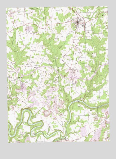
Knox, PA USGS Topographic Map
Click on map above to begin viewing in our Map Viewer.

This topographic map contains these locations and features:
Feature Name Type Latitude Longitude GNIS ID View Map
Alum RockPopulated PlaceN41.1673°W79.6212°1168238View Map
Alum Rock Post Office (historical)Post OfficeN41.1673°W79.6212°1214243View Map
Beaver CityPopulated PlaceN41.2237°W79.5556°1202121View Map
Beaver CreekStreamN41.1603°W79.5473°1217339View Map
Blairs CornersPopulated PlaceN41.1831°W79.5639°1169797View Map
Borough of CallensburgCivilN41.1257°W79.5577°1215081View Map
Borough of KnoxCivilN41.2346°W79.5360°1215086View Map
CallensburgPopulated PlaceN41.1259°W79.5584°1170898View Map
Callensburg - Licking Township Volunteer Fire Department Station 510BuildingN41.1262°W79.5577°2645661View Map
Callensburg Post OfficePost OfficeN41.1258°W79.5577°2779871View Map
Canoe CreekStreamN41.1623°W79.5328°1171169View Map
Canoe FurnacePopulated PlaceN41.1890°W79.5178°1203219View Map
Canoe RippleRapidsN41.1645°W79.5306°1171175View Map
Chestnut Ridge CemeteryCemeteryN41.1854°W79.6243°1171748View Map
EastonPopulated PlaceN41.1273°W79.5409°1173925View Map
Elk CityPopulated PlaceN41.2442°W79.5017°1174106View Map
JeffersonPopulated PlaceN41.2031°W79.5550°1178009View Map
Jefferson StationLocaleN41.2026°W79.5631°1212180View Map
Keystone Elementary SchoolSchoolN41.2378°W79.5403°1211510View Map
Keystone Junior-Senior High SchoolSchoolN41.2323°W79.5306°1211509View Map
KnoxPopulated PlaceN41.2345°W79.5373°1178620View Map
Knox Area Volunteer Ambulance CompanyBuildingN41.2365°W79.5370°2719550View Map
Knox Borough Police DepartmentBuildingN41.2340°W79.5370°2781070View Map
Knox Post OfficePost OfficeN41.2362°W79.5365°2779869View Map
Knox Volunteer Fire Company Station 570BuildingN41.2366°W79.5364°2644817View Map
Kropps CornersLocaleN41.2098°W79.5948°1178692View Map
Licking CreekStreamN41.1290°W79.5598°1179319View Map
Martins MillLocaleN41.1359°W79.6225°1205208View Map
MongtownPopulated PlaceN41.2445°W79.5384°1202122View Map
MonroePopulated PlaceN41.1942°W79.5906°1181432View Map
Mount Joy ChurchChurchN41.1781°W79.5423°1181731View Map
PilgrimhamPopulated PlaceN41.2337°W79.6028°1183746View Map
Providence ChurchChurchN41.2092°W79.5000°1184474View Map
RittsLocaleN41.1734°W79.5884°1205207View Map
Saint Marks ChurchChurchN41.1962°W79.5903°1186339View Map
Saint Pauls ChurchChurchN41.2051°W79.5537°1186628View Map
Snively CornersPopulated PlaceN41.2470°W79.6203°1187943View Map
Stovers MillPopulated PlaceN41.1326°W79.5950°1204754View Map
Township of BeaverCivilN41.1996°W79.5276°1216201View Map
Township of LickingCivilN41.1348°W79.5556°1216208View Map
Township of SalemCivilN41.2253°W79.6150°1216219View Map
TriangleLocaleN41.2084°W79.5764°1206973View Map
Turkey CityPopulated PlaceN41.1853°W79.6134°1189932View Map
Turkey City Post OfficePost OfficeN41.1838°W79.6145°2779868View Map
Turnip HolePopulated PlaceN41.1526°W79.5892°1189966View Map
Wentlings CornersPopulated PlaceN41.1923°W79.5456°1190834View Map
Zion HillPopulated PlaceN41.1395°W79.5053°1205018View Map

Note: Coordinates in the location and feature list above are referenced to NAD83 datum.


Copyright (C) 2008-2025 Ryan Niemi / Sunset Dynamics ... All Rights Reserved