TopoQuest Logo
Do you find TopoQuest useful?
Help keep TopoQuest running and adding new maps/features by donating!
Bitcoin:  19c7KJd3qBynnjoSw5npx9KScwjBe4ifkT
Litecoin:  LXs6TkuXGGXo1vDsWCkWVdjQX94eUKd6ui
Home View Maps Find Maps Find Places Resources & Links


Kossuth, Pennsylvania Topographic Map

USGS Map Title: Kossuth, PA
USGS Map MRC: 41079C5
DRG (GeoTIFF) Download: o41079c5.tif


Neighboring USGS Topographic Map Quads:


  Oil City, PA  
41079D6
 

  President, PA  
41079D5
 

  Tionesta, PA  
41079D4
 

  Cranberry, PA  
41079C6
 

  Kossuth, PA  
41079C5
 

  Fryburg, PA  
41079C4
 

  Emlenton, PA  
41079B6
 

  Knox, PA  
41079B5
 

  Clarion, PA  
41079B4


Map MRC Location:

N42°
W80°
N42°
W79°
H8 H7 H6 H5 H4 H3 H2 H1
G8 G7 G6 G5 G4 G3 G2 G1
F8 F7 F6 F5 F4 F3 F2 F1
E8 E7 E6 E5 E4 E3 E2 E1
D8 D7 D6 D5 D4 D3 D2 D1
C8 C7 C6 C5 C4 C3 C2 C1
B8 B7 B6 B5 B4 B3 B2 B1
A8 A7 A6 A5 A4 A3 A2 A1
N41°
W80°
N41°
W79°

Kossuth, PA USGS 1:24K Topographic Map Preview:
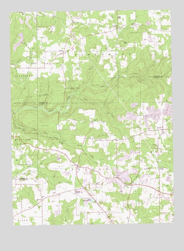
Kossuth, PA USGS Topographic Map
Click on map above to begin viewing in our Map Viewer.

This topographic map contains these locations and features:
Feature Name Type Latitude Longitude GNIS ID View Map
Altmans CornersLocaleN41.2681°W79.5762°1168231View Map
Ashland ChurchChurchN41.3103°W79.5603°1168455View Map
Ashland SchoolSchoolN41.2839°W79.5734°1168460View Map
BillingPopulated PlaceN41.2826°W79.5112°1203094View Map
Billings StationLocaleN41.2826°W79.5089°1212181View Map
Black SchoolSchoolN41.2728°W79.5109°1200614View Map
Blauser SchoolSchoolN41.3539°W79.5981°1200610View Map
Carnes SchoolSchoolN41.3420°W79.6109°1200611View Map
Coffman CampLocaleN41.3192°W79.5820°1172134View Map
Cogley RunStreamN41.3262°W79.5750°1172138View Map
Craig CemeteryCemeteryN41.3726°W79.5889°1172597View Map
Cream HillSummitN41.3695°W79.5892°1172662View Map
ElmoPopulated PlaceN41.2737°W79.5375°1203514View Map
FernPopulated PlaceN41.2992°W79.5425°1174694View Map
FertigsPopulated PlaceN41.3506°W79.5831°1174714View Map
Fertigs Gospel TabernacleChurchN41.3445°W79.6092°1174715View Map
Fertigs Post Office (historical)Post OfficeN41.3512°W79.5831°1214189View Map
Goodmans CornersLocaleN41.3645°W79.5403°1175812View Map
Grace ChurchChurchN41.2662°W79.6020°1175906View Map
Hi Level Golf CourseLocaleN41.2973°W79.5559°1205604View Map
Hickman CemeteryCemeteryN41.3448°W79.5945°1176943View Map
Kapp SchoolSchoolN41.3634°W79.5023°1200634View Map
KlinePopulated PlaceN41.2984°W79.5848°1203952View Map
KossuthPopulated PlaceN41.2848°W79.5739°1178657View Map
Kossuth Post OfficePost OfficeN41.2854°W79.5747°2779870View Map
Little East Sandy CreekStreamN41.3164°W79.6225°1179531View Map
Marie-Eileen LakeLakeN41.2640°W79.5627°1180409View Map
NinevehPopulated PlaceN41.2648°W79.6017°1182472View Map
O B Perry CornersLocaleN41.3417°W79.5987°1212150View Map
Old Dutch CemeteryCemeteryN41.3004°W79.5332°1182910View Map
Perry Chapel CemeteryCemeteryN41.2945°W79.5121°1183595View Map
Phipps CemeteryCemeteryN41.2788°W79.5434°1183683View Map
Pine CityPopulated PlaceN41.3051°W79.5075°1183765View Map
Pine HillSummitN41.3559°W79.5362°1183830View Map
Pine Hill CemeteryCemeteryN41.3656°W79.5370°1183837View Map
Pine Hill SchoolSchoolN41.3567°W79.5414°1200612View Map
Pine SchoolSchoolN41.3715°W79.5395°1183907View Map
Powell CornersLocaleN41.3662°W79.5267°1184367View Map
Prairie RunStreamN41.3317°W79.5634°1184381View Map
Saint Marks ChurchChurchN41.2740°W79.5600°1186340View Map
SawtownPopulated PlaceN41.3692°W79.5748°1187041View Map
Schreffler CemeteryCemeteryN41.2973°W79.6187°1187126View Map
Starr CemeteryCemeteryN41.2676°W79.5896°1188420View Map
Township of AshlandCivilN41.2859°W79.5673°1216200View Map
Township of PinegroveCivilN41.3693°W79.5432°1217150View Map
Trinity ChurchChurchN41.2995°W79.5548°1189807View Map
Valley CemeteryCemeteryN41.2864°W79.6125°1190286View Map
Wise School (historical)SchoolN41.3109°W79.5714°1200613View Map

Note: Coordinates in the location and feature list above are referenced to NAD83 datum.


Copyright (C) 2008-2025 Ryan Niemi / Sunset Dynamics ... All Rights Reserved