TopoQuest Logo
Do you find TopoQuest useful?
Help keep TopoQuest running and adding new maps/features by donating!
Bitcoin:  19c7KJd3qBynnjoSw5npx9KScwjBe4ifkT
Litecoin:  LXs6TkuXGGXo1vDsWCkWVdjQX94eUKd6ui
Home View Maps Find Maps Find Places Resources & Links


Rimersburg, Pennsylvania Topographic Map

USGS Map Title: Rimersburg, PA
USGS Map MRC: 41079A5
DRG (GeoTIFF) Download: o41079a5.tif


Neighboring USGS Topographic Map Quads:


  Emlenton, PA  
41079B6
 

  Knox, PA  
41079B5
 

  Clarion, PA  
41079B4
 

  Parker, PA  
41079A6
 

  Rimersburg, PA  
41079A5
 

  Sligo, PA  
41079A4
 

  Chicora, PA  
40079H6
 

  East Brady, PA  
40079H5
 

  Templeton, PA  
40079H4


Map MRC Location:

N42°
W80°
N42°
W79°
H8 H7 H6 H5 H4 H3 H2 H1
G8 G7 G6 G5 G4 G3 G2 G1
F8 F7 F6 F5 F4 F3 F2 F1
E8 E7 E6 E5 E4 E3 E2 E1
D8 D7 D6 D5 D4 D3 D2 D1
C8 C7 C6 C5 C4 C3 C2 C1
B8 B7 B6 B5 B4 B3 B2 B1
A8 A7 A6 A5 A4 A3 A2 A1
N41°
W80°
N41°
W79°

Rimersburg, PA USGS 1:24K Topographic Map Preview:
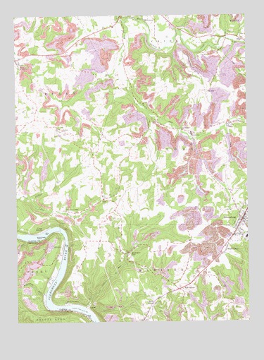
Rimersburg, PA USGS Topographic Map
Click on map above to begin viewing in our Map Viewer.

This topographic map contains these locations and features:
Feature Name Type Latitude Longitude GNIS ID View Map
Anderson RunStreamN41.1142°W79.5056°1168288View Map
Armstrong RunStreamN41.0120°W79.6092°1168403View Map
Bald Eagle IslandIslandN41.0348°W79.6145°1168628View Map
BelaPopulated PlaceN41.0501°W79.5775°1203054View Map
Birch RunStreamN41.0334°W79.6192°1169647View Map
Blue Goose MineLocaleN41.0456°W79.5975°1169873View Map
Borough of RimersburgCivilN41.0408°W79.5024°1215088View Map
CatfishPopulated PlaceN41.0065°W79.5867°1203234View Map
Catfish RunStreamN41.0053°W79.5881°1171334View Map
Cherry RunStreamN41.1223°W79.5653°1171669View Map
Cherry Run CampgroundLocaleN41.0767°W79.5295°1171672View Map
Cherry Run ChurchChurchN41.0781°W79.5348°1171674View Map
Concord ChurchChurchN41.0784°W79.5992°1172287View Map
Cross Roads GrangeBuildingN41.0153°W79.5153°1214740View Map
Eagle MineLocaleN41.0445°W79.5928°1201513View Map
Fiddlers RunStreamN41.0503°W79.6170°1174735View Map
Fredell Post Office (historical)Post OfficeN41.0373°W79.6112°1214244View Map
HillvillePopulated PlaceN41.0306°W79.6000°1198286View Map
HueyPopulated PlaceN41.0809°W79.5081°1177555View Map
Kissingers MillPopulated PlaceN41.0284°W79.5645°1178559View Map
Lower HillvillePopulated PlaceN41.0245°W79.5898°1201514View Map
Maple GrovePopulated PlaceN41.0301°W79.5114°1198291View Map
Mount AiryPopulated PlaceN41.0942°W79.5220°1204221View Map
New AthensPopulated PlaceN41.0137°W79.5367°1182284View Map
Perry Township Volunteer Ambulance ServiceBuildingN41.1052°W79.6236°2719549View Map
Perry Township Volunteer Fire Department Station 610BuildingN41.1089°W79.6223°2645641View Map
RimersburgPopulated PlaceN41.0415°W79.5031°1193191View Map
Rimersburg Elementary SchoolSchoolN41.0390°W79.5025°1211512View Map
Rimersburg Hose Company Station 620BuildingN41.0409°W79.5033°2645657View Map
Rimersburg Post OfficePost OfficeN41.0436°W79.5018°2768361View Map
Robinson CemeteryCemeteryN41.0348°W79.5998°1185224View Map
Sandy HollowPopulated PlaceN41.0081°W79.5506°1186947View Map
Sarah FurnacePopulated PlaceN41.0081°W79.5975°1186980View Map
TobyPopulated PlaceN41.0817°W79.5475°1204816View Map
Township of MadisonCivilN41.0125°W79.5261°1216210View Map
Township of TobyCivilN41.0667°W79.5252°1216220View Map
Union High SchoolSchoolN41.0342°W79.5006°1211511View Map
Upper HillvillePopulated PlaceN41.0373°W79.6112°1190234View Map
West FreedomPopulated PlaceN41.1073°W79.6242°1191030View Map

Note: Coordinates in the location and feature list above are referenced to NAD83 datum.


Copyright (C) 2008-2025 Ryan Niemi / Sunset Dynamics ... All Rights Reserved