TopoQuest Logo
Do you find TopoQuest useful?
Help keep TopoQuest running and adding new maps/features by donating!
Bitcoin:  19c7KJd3qBynnjoSw5npx9KScwjBe4ifkT
Litecoin:  LXs6TkuXGGXo1vDsWCkWVdjQX94eUKd6ui
Home View Maps Find Maps Find Places Resources & Links


Clarion, Pennsylvania Topographic Map

USGS Map Title: Clarion, PA
USGS Map MRC: 41079B4
DRG (GeoTIFF) Download: o41079b4.tif


Neighboring USGS Topographic Map Quads:


  Kossuth, PA  
41079C5
 

  Fryburg, PA  
41079C4
 

  Lucinda, PA  
41079C3
 

  Knox, PA  
41079B5
 

  Clarion, PA  
41079B4
 

  Strattanville, PA  
41079B3
 

  Rimersburg, PA  
41079A5
 

  Sligo, PA  
41079A4
 

  New Bethlehem, PA  
41079A3


Map MRC Location:

N42°
W80°
N42°
W79°
H8 H7 H6 H5 H4 H3 H2 H1
G8 G7 G6 G5 G4 G3 G2 G1
F8 F7 F6 F5 F4 F3 F2 F1
E8 E7 E6 E5 E4 E3 E2 E1
D8 D7 D6 D5 D4 D3 D2 D1
C8 C7 C6 C5 C4 C3 C2 C1
B8 B7 B6 B5 B4 B3 B2 B1
A8 A7 A6 A5 A4 A3 A2 A1
N41°
W80°
N41°
W79°

Clarion, PA USGS 1:24K Topographic Map Preview:
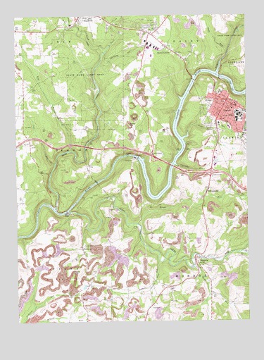
Clarion, PA USGS Topographic Map
Click on map above to begin viewing in our Map Viewer.

This topographic map contains these locations and features:
Feature Name Type Latitude Longitude GNIS ID View Map
Alumni and Development Center BuildingBuildingN41.2050°W79.3797°2114227View Map
Alumni House - Clarion University of PennsylvaniaBuildingN41.2097°W79.3778°2114228View Map
Anabel Lee Ralston HallBuildingN41.2083°W79.3781°2114229View Map
Bertha Nair HallBuildingN41.2108°W79.3767°2114231View Map
Borough of ClarionCivilN41.2107°W79.3803°1215082View Map
Boyd RunStreamN41.1948°W79.4695°1170081View Map
Brush RunStreamN41.1651°W79.4339°1198047View Map
Bryners StationLocaleN41.2376°W79.4517°1212175View Map
Buckhorn SchoolSchoolN41.2262°W79.4784°1200603View Map
Carrier Administration BuildingBuildingN41.2114°W79.3789°2114233View Map
Ceramics Laboratory BuildingBuildingN41.2114°W79.3797°2114234View Map
Chandler Dining HallBuildingN41.2097°W79.3786°2114235View Map
ClarionPopulated PlaceN41.2148°W79.3853°1171901View Map
Clarion CemeteryCemeteryN41.2143°W79.3949°2777558View Map
Clarion CountyCivilN41.1924°W79.4210°1210234View Map
Clarion County AirportAirportN41.2247°W79.4399°1194198View Map
Clarion County Sheriff's OfficeBuildingN41.2152°W79.3859°2781060View Map
Clarion Fire and Hose Company Station 520BuildingN41.2135°W79.3854°2644776View Map
Clarion HospitalHospitalN41.1920°W79.3977°2718083View Map
Clarion Hospital Emergency Medical ServicesBuildingN41.1925°W79.3979°2781027View Map
Clarion JunctionPopulated PlaceN41.2370°W79.4170°1198573View Map
Clarion Post OfficePost OfficeN41.2134°W79.3831°2779672View Map
Clarion Psychiatric CenterHospitalN41.1934°W79.3975°2718061View Map
Clarion University of PennsylvaniaSchoolN41.2098°W79.3784°1210541View Map
Coal RunStreamN41.1898°W79.4784°1172069View Map
Concord ChurchChurchN41.2417°W79.4270°1200602View Map
Courtleys RunStreamN41.1890°W79.4120°1172515View Map
Deer CreekStreamN41.1717°W79.4789°1173083View Map
Department of Conservation and Natural Resources Kittanning Forest District 8BuildingN41.2123°W79.3945°2645586View Map
Egbert HallBuildingN41.2100°W79.3797°2114237View Map
Frank M Campbell HallBuildingN41.2072°W79.3775°2114239View Map
Gathers RunStreamN41.1501°W79.4231°1175489View Map
Gemmell ParkParkN41.2108°W79.3794°2114240View Map
Gemmell Student CenterBuildingN41.2078°W79.3778°2114241View Map
Gretchen StationLocaleN41.2090°W79.4556°1212177View Map
Groce HillSummitN41.2053°W79.4378°1176257View Map
Hart Chapel TheatreBuildingN41.2114°W79.3803°2114242View Map
Haskett HouseBuildingN41.2097°W79.3775°2113956View Map
J George Becht HallBuildingN41.2106°W79.3794°2113957View Map
J W F Wilkinson HallBuildingN41.2106°W79.3761°2113958View Map
John Ballentine HallBuildingN41.2100°W79.3783°2113959View Map
Keeling Health CenterHospitalN41.2092°W79.3767°2113960View Map
Knox Spur StationLocaleN41.2359°W79.4556°1212176View Map
Larimer School (historical)SchoolN41.1448°W79.4323°1200604View Map
Lorena M Givan HallBuildingN41.2089°W79.3772°2113961View Map
Madison SchoolSchoolN41.2095°W79.4981°1200605View Map
Manor ChurchChurchN41.2195°W79.4364°1180291View Map
Manor ChurchChurchN41.2106°W79.4281°1200606View Map
MariannePopulated PlaceN41.2465°W79.4289°1212174View Map
Marianne Census Designated PlaceCensusN41.2441°W79.4310°2634245View Map
Marwick - Boyd Fine Arts CenterBuildingN41.2069°W79.3803°2113962View Map
Mayfield Golf CourseLocaleN41.1937°W79.3803°1205606View Map
Paint CreekStreamN41.2356°W79.4503°1183198View Map
Peirce Science CenterBuildingN41.2089°W79.3800°2113964View Map
Pennsylvania State Police Troop C Clarion StationBuildingN41.1833°W79.3965°2777326View Map
Pine Grove ChurchChurchN41.1565°W79.4625°1183813View Map
Piney CreekStreamN41.1695°W79.4734°1193135View Map
Piney DamDamN41.1921°W79.4335°1195332View Map
Piney ReservoirReservoirN41.1917°W79.4348°1195331View Map
Rapp RunStreamN41.2362°W79.3839°1184659View Map
Reids RunStreamN41.1476°W79.4037°1184874View Map
ReidsburgPopulated PlaceN41.1506°W79.4031°1184875View Map
ShamburgPopulated PlaceN41.1556°W79.4650°1204620View Map
Special Projects CenterBuildingN41.2083°W79.3808°2113966View Map
State Game Lands Number 63ParkN41.2256°W79.4556°1188522View Map
State Game Lands Number 72ParkN41.2403°W79.3764°1188529View Map
Still Hall Business Administration and Computer CenterBuildingN41.2122°W79.3778°2113968View Map
Tippin GymnasiumBuildingN41.2078°W79.3803°2113970View Map
Tippin NatatoriumBuildingN41.2078°W79.3806°2113971View Map
Toby CreekStreamN41.2265°W79.3900°1210047View Map
Township of MonroeCivilN41.1365°W79.4057°1216212View Map
Township of PaintCivilN41.2481°W79.4088°1216213View Map
Township of PineyCivilN41.1389°W79.4708°1216214View Map
Trout RunStreamN41.2023°W79.4062°1189871View Map
University GalleryBuildingN41.2106°W79.3803°2113972View Map
WCUC-FM (Clarion)TowerN41.2092°W79.3784°1200293View Map
WilliamsburgPopulated PlaceN41.1795°W79.3953°1191480View Map
Wilson Mill (historical)LocaleN41.2359°W79.4523°1200601View Map

Note: Coordinates in the location and feature list above are referenced to NAD83 datum.


Copyright (C) 2008-2025 Ryan Niemi / Sunset Dynamics ... All Rights Reserved