TopoQuest Logo
Do you find TopoQuest useful?
Help keep TopoQuest running and adding new maps/features by donating!
Bitcoin:  19c7KJd3qBynnjoSw5npx9KScwjBe4ifkT
Litecoin:  LXs6TkuXGGXo1vDsWCkWVdjQX94eUKd6ui
Home View Maps Find Maps Find Places Resources & Links


Sligo, Pennsylvania Topographic Map

USGS Map Title: Sligo, PA
USGS Map MRC: 41079A4
DRG (GeoTIFF) Download: o41079a4.tif


Neighboring USGS Topographic Map Quads:


  Knox, PA  
41079B5
 

  Clarion, PA  
41079B4
 

  Strattanville, PA  
41079B3
 

  Rimersburg, PA  
41079A5
 

  Sligo, PA  
41079A4
 

  New Bethlehem, PA  
41079A3
 

  East Brady, PA  
40079H5
 

  Templeton, PA  
40079H4
 

  Distant, PA  
40079H3


Map MRC Location:

N42°
W80°
N42°
W79°
H8 H7 H6 H5 H4 H3 H2 H1
G8 G7 G6 G5 G4 G3 G2 G1
F8 F7 F6 F5 F4 F3 F2 F1
E8 E7 E6 E5 E4 E3 E2 E1
D8 D7 D6 D5 D4 D3 D2 D1
C8 C7 C6 C5 C4 C3 C2 C1
B8 B7 B6 B5 B4 B3 B2 B1
A8 A7 A6 A5 A4 A3 A2 A1
N41°
W80°
N41°
W79°

Sligo, PA USGS 1:24K Topographic Map Preview:
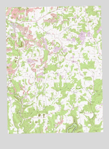
Sligo, PA USGS Topographic Map
Click on map above to begin viewing in our Map Viewer.

This topographic map contains these locations and features:
Feature Name Type Latitude Longitude GNIS ID View Map
Acme Mines (historical)MineN41.0362°W79.4834°1201076View Map
Blair School (historical)SchoolN41.0065°W79.4314°1201074View Map
Borough of SligoCivilN41.1081°W79.4964°1215091View Map
Browns School (historical)SchoolN41.0337°W79.4387°1201072View Map
Cherry Run ChurchChurchN41.0709°W79.4728°1171673View Map
Chestnut RidgeRidgeN41.0248°W79.4342°1192257View Map
ChurchvillePopulated PlaceN41.1034°W79.4198°1203277View Map
Craggs RunStreamN41.1090°W79.4614°1172594View Map
CurllsvillePopulated PlaceN41.0987°W79.4467°1172841View Map
Curllsville Post OfficePost OfficeN41.0986°W79.4464°2779879View Map
DiamondPopulated PlaceN41.0212°W79.4828°1203412View Map
Fiddlers RunStreamN41.0137°W79.4792°1174734View Map
Five PointsPopulated PlaceN41.1217°W79.4328°1203587View Map
Five Points SchoolSchoolN41.1217°W79.4325°1201067View Map
FrostburgPopulated PlaceN41.0556°W79.3864°1201958View Map
Independence SchoolSchoolN41.0876°W79.3817°1201068View Map
Jack RunStreamN41.0384°W79.3834°1192678View Map
Jocelyn Mine (historical)MineN41.0828°W79.4789°1201079View Map
Keystone Mine (historical)MineN41.0062°W79.4764°1201075View Map
LeatherwoodPopulated PlaceN41.0301°W79.3912°1179093View Map
Leatherwood StationLocaleN41.0026°W79.4106°1201070View Map
Licking ChurchChurchN41.1017°W79.4231°1179314View Map
Little Licking CreekStreamN41.1087°W79.4962°1179587View Map
Males SchoolSchoolN41.0715°W79.4142°1201069View Map
McClays PeakSummitN41.1242°W79.4548°1212172View Map
Middle RunStreamN41.0092°W79.4114°1181055View Map
Mineral RunStreamN41.1137°W79.4992°1181317View Map
Myers HillSummitN41.0773°W79.4759°1182133View Map
Oak Grove ChurchChurchN41.0401°W79.4128°1182749View Map
Oak Grove Church (historical)ChurchN41.0270°W79.4300°1201073View Map
PiolettPopulated PlaceN41.0567°W79.4025°1204409View Map
Reigle SchoolSchoolN41.0565°W79.4695°1201077View Map
Rimersburg StationLocaleN41.0526°W79.4942°1212173View Map
RockvillePopulated PlaceN41.0406°W79.3842°1185334View Map
Saint Charles FurnacePopulated PlaceN41.0195°W79.3878°1201959View Map
Scrub Ridge School (historical)SchoolN41.0676°W79.4387°1201071View Map
Sharpsburg ChurchChurchN41.1167°W79.3928°1201065View Map
SligoPopulated PlaceN41.1092°W79.4900°1193376View Map
Sligo Post OfficePost OfficeN41.1079°W79.4915°2779618View Map
Sligo Volunteer Fire Department Station 640BuildingN41.1076°W79.4899°2645087View Map
SmithlandPopulated PlaceN41.0203°W79.4056°1187900View Map
Southern Clarion County Ambulance ServiceBuildingN41.0706°W79.4847°2719548View Map
Squirrel HillPopulated PlaceN41.0387°W79.4117°1204716View Map
Township of PorterCivilN41.0408°W79.3874°1216215View Map
Watson School (historical)SchoolN41.0792°W79.4973°1201078View Map
West Fork Leatherwood CreekStreamN41.0470°W79.3831°1191026View Map
WildcatPopulated PlaceN41.0253°W79.4798°1191399View Map
Wildcat Run East ForkStreamN41.0270°W79.4800°1191423View Map

Note: Coordinates in the location and feature list above are referenced to NAD83 datum.


Copyright (C) 2008-2025 Ryan Niemi / Sunset Dynamics ... All Rights Reserved